Gsteig
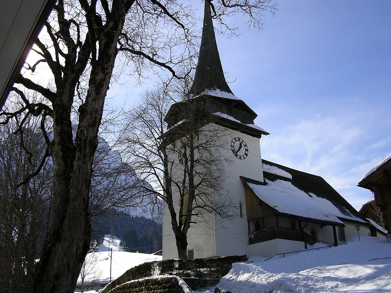
About Gsteig
A quiet Bernese hamlet where traditional wood architecture and rustic dairy farming endure just minutes from the glitz of Gstaad.
Highlights
- Authentic wood chalets
- Gothic church spire
- Rural farming heritage
- Sanctuary from crowds
Key Facts
- Altitude: 1189m
- Top lift: 1370m
- Ski pistes: 1km
- Ski lifts: 1
- Population: 1,028
- Lakes nearby: 15
- MTB trails: 81km
- Mountain huts: 20
Ski Area
Inbegrepen in deze seizoenpassen
Weather and 10-day forecast for Gsteig
- Today: 8 to 19 °C, clear sky, 12 h of sunshine
- Freezing level today: about 4304 m (4110 to 4430 m)
| Day | Min / max | Sky | Precipitation | Sunshine |
|---|---|---|---|---|
| di 22 sep | 8 / 19 °C | clear sky | dry | 12 h sun |
| wo 23 sep | 8 / 20 °C | clear sky | dry | 12 h sun |
| do 24 sep | 8 / 19 °C | overcast | dry | 2 h sun |
| vr 25 sep | 5 / 17 °C | clear sky | dry | 9 h sun |
| za 26 sep | 6 / 19 °C | clear sky | dry | 10 h sun |
| zo 27 sep | 7 / 21 °C | overcast | dry | 2 h sun |
| ma 28 sep | 9 / 22 °C | clear sky | dry | 12 h sun |
| di 29 sep | 10 / 22 °C | clear sky | dry | 12 h sun |
| wo 30 sep | 10 / 22 °C | overcast | dry | 1 h sun |
| do 1 okt | 11 / 21 °C | drizzle | dry | 1 h sun |
Things to do in Gsteig
Hikes nearby — Gsteig (20)
20+ curated hiking trails around Gsteig, sourced from OpenStreetMap and enriched with distance, elevation gain and difficulty.
-
Höhi-Wispile-Lauenensee-Weg
From the Wispile mountain station — reachable by cable car from Gstaad — the path traces a mountain ridge down to the Lauenensee, a natural lake sitting at 1,379 metres above sea level. The lake and its surrounding moor are a protected region, making this a descent from a ski mountain into genuine wilderness.
-
Tour des Alpes Vaudoises Étape 5
-
Sanetsch-Muveran-Weg
From the glacier-scoured limestone pavements of Tsanfleuron, the route drops steeply past the rocky shoulder of Sex Rouge into the protected valley of Derborence, home to one of Switzerland's last primeval mountain forests and a lake born from historic rockslides.
-
Via Alpina Red R103
Lauenen - Gsteig
-
Via Alpina Red R104
The Via Alpina is a network of five long-distance hiking trails across the alpine regions of Slovenia, Austria, Germany, Liechtenstein, Switzerland, Italy, France, and Monaco. The longest of the trails is the Red Trail, whose termini are in Trieste and Monaco.
-
Tour du Wildhorn
The route crosses the high-altitude Rottal Pass through the heart of the Gelten-Iffigen Nature Reserve, threading between waterfall-rich valleys and the rugged limestone terrain of the Tungel Glacier region. The trail passes the tranquil Stieretungel Alm and the picturesque Tungel Pass before dropping into the Iffig Valley.
-
Via Alpina Stage 76: Auberge du Godey - Anzeinde
-
Via Alpina
-
Via Alpina
-
Via Alpina Stage 73: Lenk - Lauenen
-
Le Grand Tour des Vanils
-
Tour des Alpes Vaudoises Étape 4
-
Tour Tête de la Minaude
-
Gryden - Leiterli
-
Seitengraben - Obere Lochberg
-
Sanetsch-Muveran-Weg: Gsteig - 120494
-
Tour des Alpes Vaudoises: L'Etivaz - Les Diablerets
-
Tour de la Palette
-
Via Alpina: Gstaad - L'Etivaz
-
Sanetsch-Muveran-Weg: 120494 - Derborence
Mountain biking near Gsteig
- Isenau Bike
Getting to Gsteig
Door-to-door travel times as used by the MR. ALPS ranking.
- Nearest airport: Bern Airport (BRN), 62 km away, about 1h33 by road
- Lausanne: 1h10 by car, 77 km
- Bern: 1h38 by car, 98 km
- Genève: 1h49 by car, 139 km
- Biel/Bienne: 2h01 by car, 133 km
- Annecy: 2h22 by car, 181 km
- Luzern: 2h30 by car, 149 km
Where to stay in Gsteig
40 places to stay for a night on 2026-09-25, from 210 EUR per night, median 293 EUR. Prices are direct with hotels and destinations, compared live on the Gsteig page.