Gspon (Staldenried)
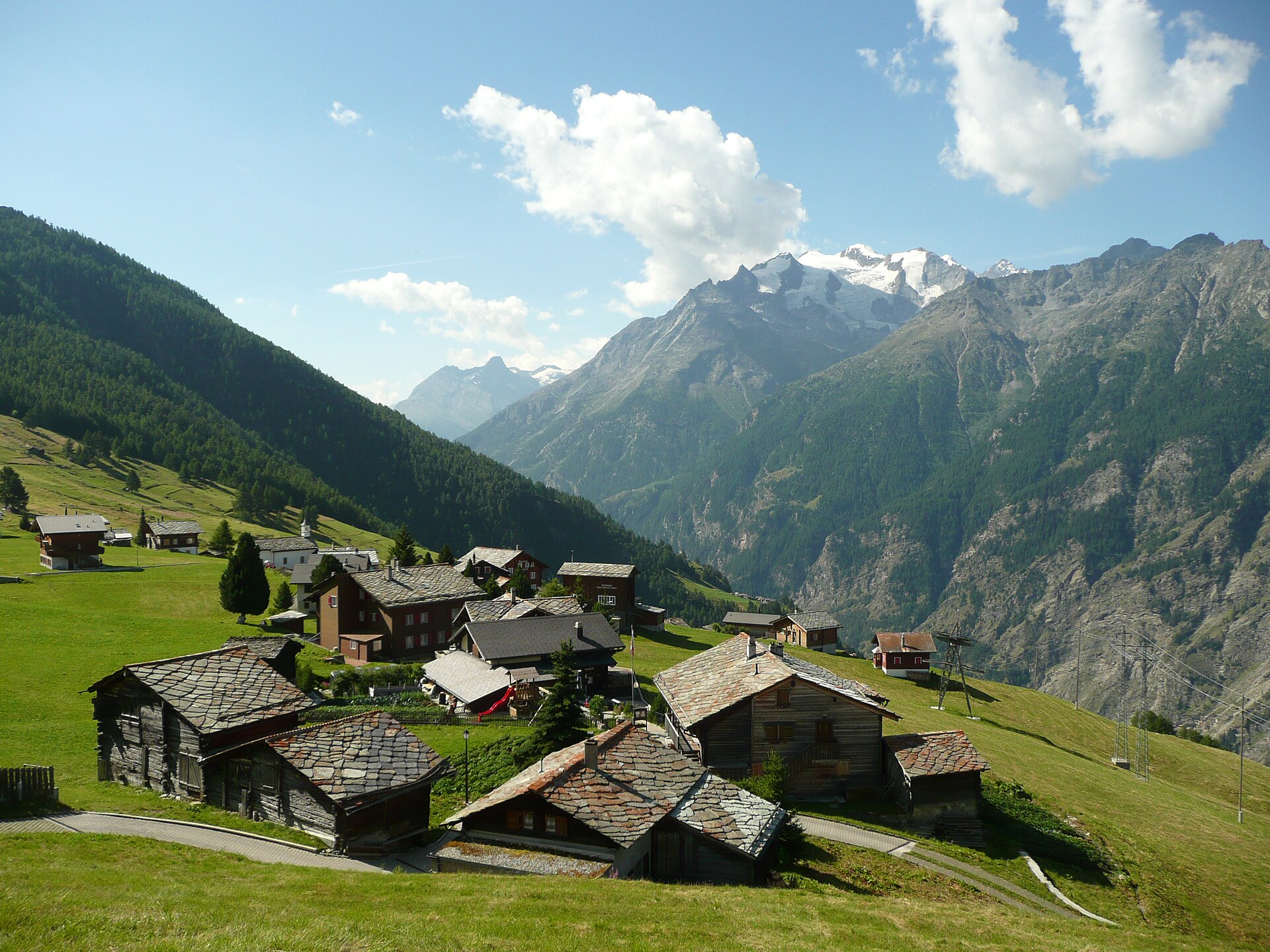
Live webcam


Open liften: 0%
Sneeuwbericht
- Laatste 24 uur: 0 cm
- Laatste 72 uur: 0 cm
- Laatste 7 dagen: 0 cm
- Laatste 7 dagen: Dal 0cm · Middenstation 0cm · Top 0cm
- Seizoenstotaal: 0 cm
Skigebieden nu open · Sneeuwbericht
About Gspon (Staldenried)
A secluded car-free hamlet reachable only by cable car, celebrated for its sky-high football pitch and slow-paced Valaisan charm.
Highlights
- Highest football pitch
- Car-free isolation
- Ancient water channels
- Sun-drenched larch forests
Key Facts
- Altitude: 1872m
- Top lift: 2193m
- Ski pistes: 5km
- Ski lifts: 4
- Population: 5
- 4000m+ peaks nearby: 13
- Lakes nearby: 11
- MTB trails: 146.4km
- Mountain huts: 12
Ski Area
Inbegrepen in deze seizoenpassen
Weather and 10-day forecast for Gspon (Staldenried)
- Today: 9 to 16 °C, partly cloudy, 8 h of sunshine
- Freezing level today: about 4174 m (3950 to 4300 m)
| Day | Min / max | Sky | Precipitation | Sunshine |
|---|---|---|---|---|
| zo 20 sep | 9 / 16 °C | partly cloudy | dry | 8 h sun |
| ma 21 sep | 9 / 16 °C | overcast | dry | 1 h sun |
| di 22 sep | 8 / 16 °C | clear sky | dry | 12 h sun |
| wo 23 sep | 7 / 16 °C | clear sky | dry | 12 h sun |
| do 24 sep | 7 / 16 °C | clear sky | dry | 10 h sun |
| vr 25 sep | 3 / 16 °C | clear sky | dry | 10 h sun |
| za 26 sep | 3 / 18 °C | clear sky | dry | 12 h sun |
| zo 27 sep | 6 / 19 °C | clear sky | dry | 12 h sun |
| ma 28 sep | 3 / 19 °C | clear sky | dry | 12 h sun |
| di 29 sep | 5 / 18 °C | clear sky | dry | 12 h sun |
Things to do in Gspon (Staldenried)
Hikes nearby — Gspon (Staldenried) (20)
20+ curated hiking trails around Gspon (Staldenried), sourced from OpenStreetMap and enriched with distance, elevation gain and difficulty.
-
Kapellenweg - Suone Bodmeri
A procession of ten historic rosary chapels lines the ascending path to the pilgrimage site of "Maria Heimsuchung," a forest chapel above Visperterminen, where the route then joins the Suone Bodmeri — an ancient irrigation channel that carries water from early April through mid-September — before descending through forest back to the village.
-
Panoramaweg Gebidem
-
19-Alpenpässe-Weg
-
20-Alpenpässse-Weg
The route traverses the steep western flank of the Saas Valley along an exposed high-altitude path — some sections secured with wire cables — delivering constant panoramas of the Mischabel group, the Fletschhorn, the Weissmies, and the Matterhorn, with vertiginous views straight down into the valley below. The terrain shifts from open larch forest through boulder fields and across several avalanche chutes before arriving at the sunny terrace of Grächen.
-
Swiss Tour Monte Rosa
A high-altitude panoramic traverse linking Saas-Fee to Zermatt, the route strings together views of 13 four-thousanders visible from Saas-Fee alone, threading the steep flanks of the Mischabel group along the Europaweg before crossing the 500 m Charles Kuonen suspension bridge — the world's longest pedestrian suspension bridge — with the Matterhorn waiting at the far end.
-
Hannigalp-Saas-Fee
-
18-Alpenpässe-Weg
-
Tour Monte Rosa tappa 7
around the Monte Rosa group
-
21-Alpenpässe-Weg
-
Tour Monte Rosa tappa 8
around the Monte Rosa group
-
ViaStockalper
-
Staldenried - Gspon
-
Gspon - Eisten
-
Gspon - Obere Schwarze Wald
-
Stalden - Eisten
-
Alpenpässe-Weg: Simplonpass - Gspon
-
Zauberwasser-Weg Grächen
-
Alpenpässe-Weg: Saas-Fee - Grächen
-
Swiss Tour Monte Rosa: Saas-Fee - Grächen
-
Moosalp Panoramaweg
Mountain biking near Gspon (Staldenried)
- Gsponer Höhenweg
- Bargjitrail
- Stockalperweg
Getting to Gspon (Staldenried)
Door-to-door travel times as used by the MR. ALPS ranking.
- Nearest airport: Milan Malpensa International Airport (MXP), 92 km away, about 2h47 by road
- Lausanne: 2h07 by car, 156 km
- Bern: 2h16 by train, 107 km
- Biel/Bienne: 2h31 by train, 140 km
- Genève: 2h45 by car, 218 km
- Zürich: 2h54 by train, 223 km
- Luzern: 2h58 by car, 176 km
Where to stay in Gspon (Staldenried)
164 places to stay for a night on 2026-09-25, from 132 EUR per night, median 249 EUR. Prices are direct with hotels and destinations, compared live on the Gspon (Staldenried) page.