Glarus
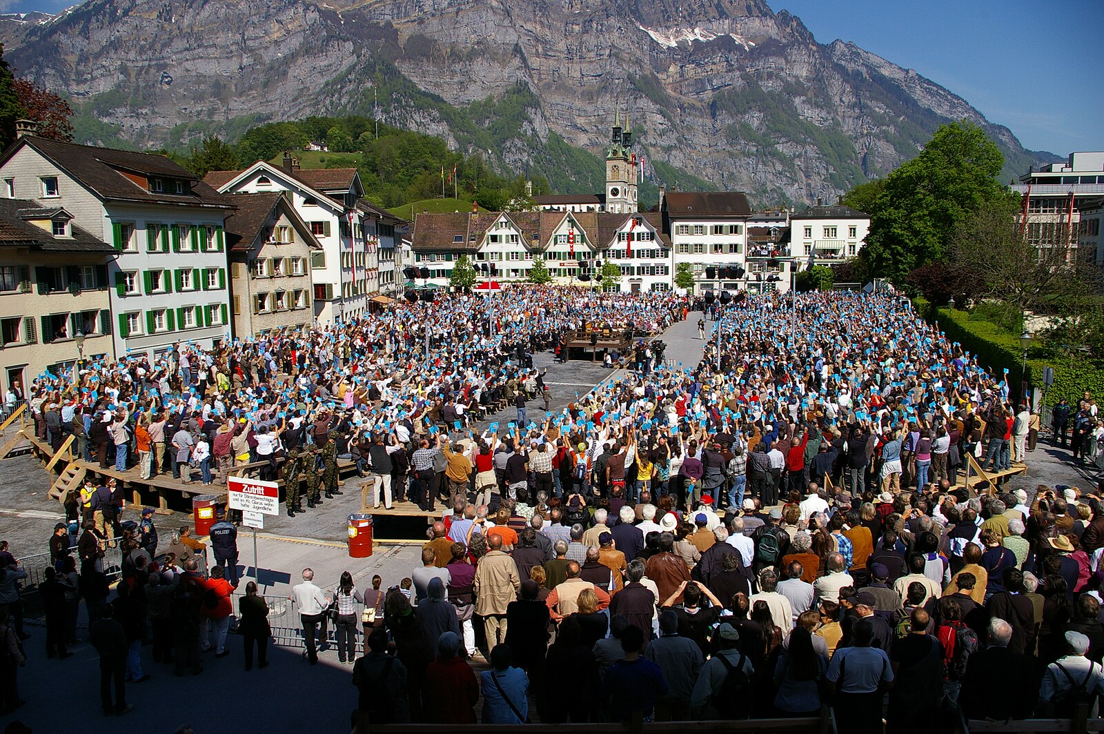
About Glarus
A deep-valley gem where industrial heritage meets jagged peaks, known for its distinct neo-classical layout and Schabziger cheese.
Highlights
- Industrial-chic architecture
- Dramatic mountain backdrop
- Artisan cheese heritage
- Steep valley hiking
Key Facts
- Altitude: 478m
- Top lift: 682m
- Ski pistes: 1km
- Ski lifts: 1
- Population: 12,539
- Lakes nearby: 28
- MTB trails: 159.3km
- Mountain huts: 28
Ski Area
Weather and 10-day forecast for Glarus
- Today: 12 to 20 °C, overcast, 2 h of sunshine
- Freezing level today: about 3715 m (3420 to 3930 m)
| Day | Min / max | Sky | Precipitation | Sunshine |
|---|---|---|---|---|
| ma 21 sep | 12 / 20 °C | overcast | dry | 2 h sun |
| di 22 sep | 9 / 19 °C | clear sky | dry | 12 h sun |
| wo 23 sep | 9 / 21 °C | clear sky | dry | 12 h sun |
| do 24 sep | 10 / 17 °C | partly cloudy | dry | 4 h sun |
| vr 25 sep | 8 / 21 °C | clear sky | dry | 12 h sun |
| za 26 sep | 13 / 24 °C | partly cloudy | dry | 7 h sun |
| zo 27 sep | 15 / 25 °C | mainly clear | dry | 5 h sun |
| ma 28 sep | 16 / 27 °C | partly cloudy | dry | 12 h sun |
| di 29 sep | 12 / 29 °C | overcast | dry | 12 h sun |
| wo 30 sep | 14 / 27 °C | mainly clear | dry | 12 h sun |
Things to do in Glarus
Hikes nearby — Glarus (20)
20+ curated hiking trails around Glarus, sourced from OpenStreetMap and enriched with distance, elevation gain and difficulty.
-
Via Glaralpina
-
ViaSuworow
-
Via Glaralpina
-
ViaSuworow
-
Via Glaralpina
-
Via Glaralpina
-
Glarus-Rundweg
A loop through the countryside surrounding Glarus — the smallest canton capital in Switzerland — this trail winds across large grassy meadows, through forests and cow pastures, and along quiet country lanes, with mountain views throughout.
-
Linth-Uferweg
The Linth-Uferweg follows a broad, comfortable path along the river through an open valley, its banks thick with wild plants and punctuated by shady woodland stretches. Between the villages of Mitlödi and Ennenda the route climbs slightly above the Linth, opening up wide views across the valley to the massive mountains beyond, before passing a woodland rest stop with a fireplace.
-
Holzflue-Rundweg
This loop above Ennenda passes through the Tektonikarena Sardona, a landscape shaped by primordial geology, while opening views down into the Linth valley below. Panoramas sweep southwest, west, northwest, and north across the Glarner Alps.
-
Schabziger Höhenweg
The Schabziger Höhenweg runs partially along the famous Glarner Ziger Highway, beginning in Filzbach in the canton of Glarus and passing through points including Habergschwänd before finishing at Mollis, Oberruestel. The route traverses the Kerenzerberg ridge above the Walensee, with the Fronalp area offering panoramic views across the Glarnerland.
-
Seerundweg Klöntal
-
Alpenpanorama-Weg
-
Sardona-Welterbe-Weg Etappe 1
-
Via Glaralpina
-
Via Glaralpina
-
Glarus Rundweg
-
ViaSuworow: Plätz Klöntal - Glarus
-
Pragelpass-Weg: Plätz Klöntal - Glarus
-
Murgseen Rundweg
-
ViaSuworow: Glarus - Elm Station
Mountain biking near Glarus
- Längenegg Bike
- Fronalp Bike
- Fryberg Bike
- Flowtrail Glarus
Getting to Glarus
Door-to-door travel times as used by the MR. ALPS ranking.
- Nearest airport: Zürich Airport (ZRH), 61 km away, about 1h12 by road
- Zürich: 56 min by car, 71 km
- Luzern: 1h15 by car, 93 km
- Basel: 1h53 by car, 154 km
- Biel/Bienne: 2h19 by car, 191 km
- Bern: 2h20 by car, 193 km
- Innsbruck: 3h09 by car, 236 km
Where to stay in Glarus
29 places to stay for a night on 2026-09-25, from 146 EUR per night, median 270 EUR. Prices are direct with hotels and destinations, compared live on the Glarus page.