Engelberg
Live webcam

Open liften: 0/43
Sneeuwbericht
- Laatste 24 uur: 0 cm
- Laatste 72 uur: 0 cm
- Laatste 7 dagen: 0 cm
- Laatste 7 dagen: Dal 0cm · Middenstation 0cm · Top 0cm
- Seizoenstotaal: 10.7 cm
Skigebieden nu open · Sneeuwbericht
About Engelberg
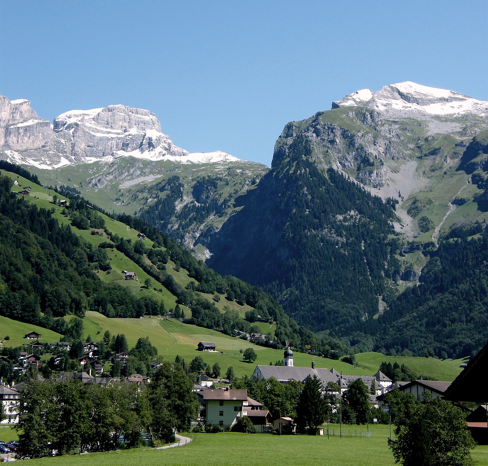
A rugged freeride mecca dominated by a historic Benedictine monastery and the high-altitude thrills of the Titlis glacier.
Highlights
- Monastic heritage
- Big mountain freeriding
- Year-round glacier access
- Steep vertical drops
Key Facts
- Altitude: 1000m
- Top lift: 3040m
- Ski pistes: 92km
- Ski lifts: 29
- Population: 4,100
- Lakes nearby: 13
- MTB trails: 273.1km
- Mountain huts: 20
Ski Area
Inbegrepen in deze seizoenpassen
Weather and 10-day forecast for Engelberg
- Today: 8 to 15 °C, clear sky, 8 h of sunshine
- Freezing level today: about 4080 m (3790 to 4230 m)
| Day | Min / max | Sky | Precipitation | Sunshine |
|---|---|---|---|---|
| zo 20 sep | 8 / 15 °C | clear sky | dry | 8 h sun |
| ma 21 sep | 6 / 11 °C | overcast | dry | 4 h sun |
| di 22 sep | 6 / 11 °C | clear sky | dry | 12 h sun |
| wo 23 sep | 6 / 12 °C | clear sky | dry | 12 h sun |
| do 24 sep | 6 / 12 °C | clear sky | dry | 12 h sun |
| vr 25 sep | 8 / 15 °C | overcast | dry | 1 h sun |
| za 26 sep | 9 / 15 °C | clear sky | dry | 12 h sun |
| zo 27 sep | 10 / 16 °C | overcast | dry | 3 h sun |
| ma 28 sep | 5 / 13 °C | clear sky | dry | 12 h sun |
| di 29 sep | 4 / 13 °C | clear sky | dry | 11 h sun |
Things to do in Engelberg
Hikes nearby — Engelberg (20)
20+ curated hiking trails around Engelberg, sourced from OpenStreetMap and enriched with distance, elevation gain and difficulty.
-
Benediktusweg
Der Benediktusweg ist ein 22 Kilometer langer historischer Höhenwander- und Pilgerweg zwischen Engelberg im Schweizer Kanton Obwalden und Niederrickenbach in Nidwalden an den östlichen Hängen des Engelbergertals.
-
Via Alpina
Stage 65 of the Via Alpina links Engelberg in canton Obwalden to Engstlenalp, while the broader C8 stage continues onward to Meiringen — a crossing that carries walkers from the alpine heart of central Switzerland into the Bernese highlands. The route over Surenenpass, which connects canton Uri to canton Obwalden, is described as a high, quiet pass crossing through stormy, dramatic mountain terrain.
-
Via Alpina
The trail departs Altdorf across the Reuss plain, climbing through forested ascents and open alpine terrain past waypoints including Attinghausen, Cholplatz, Höchiberg, and Brüsti before reaching the Alp Grat Hut. It unfolds within the rugged Uri Alps, where dramatic peaks, expansive meadows, and the waters of Lake Uri define the landscape.
-
Nidwaldner Höhenweg
The Nidwaldner Höhenweg traces six stages around the Engelberg Valley, crossing flowering mountain meadows, through ancient forests, and past glittering alpine lakes, with views stretching to the glaciated 4,000-metre peaks of the Bernese Alps. Meals and nights in mountain huts punctuate the route, which reveals the region's flora and fauna alongside panoramas of countless lakes and surrounding mountains.
-
Eienwäldli - Herrenrütiboden
markierter Wanderweg
-
Engelberger Rundweg
-
Jochpass - Trübsee
The descent from Jochpass to Trübsee skirts the south shore of the lake with sweeping views of the Bernese and Uri Alps overhead, while marmots whistle from the surrounding slopes. The route crosses the cantonal border between Bern and Obwalden as it winds down through the Uri Alps.
-
Walenpfad
The Walenpfad threads through the Engelberg region from Brunni-Ristis to Bannalpsee, passing a notably exposed section near Walegg where the trail hugs the mountainside above a steep drop-off, secured by steel cables. The route ends at Bannalpsee, described as Nidwalden's jewel, with views of Titlis and the central Alps unfolding along the way.
-
Vier-Seen-Wanderung
-
Kapellenweg
-
Storeggpass - Gräfimatt
-
Dominikpfad
-
Wiesenberg - Stanglisbüel
-
Banalp / Chrüzhütte - Bannalper Schonegg
-
Bannalper Schonegg - Rot Grätli
-
ViaSbrinz: _VZ Bahnhof - Engstlenalp
-
Via Alpina: Engelberg - Engstlenalp
-
Nidwaldner Höhenweg: Engelberg - Oberrickenbach
-
Nidwaldner Höhenweg: Melchsee-Frutt Dörfli - Engelberg
-
Kapellenweg Engelbergertal
Mountain biking near Engelberg
- Isenthal Bike
- Dallenwil - Wirzweli - Arvigrat - St. Jakob - Alpnach
- Vier Seen Bike
- Sädelegg-Walenalp (Walenpfad)
- Jochpass-Trail
- Hells Bells Trail
- Bättlenrüti-Wellenberg
Getting to Engelberg
Door-to-door travel times as used by the MR. ALPS ranking.
- Nearest airport: Zürich Airport (ZRH), 72 km away, about 1h23 by road
- Luzern: 37 min by car, 36 km
- Zürich: 1h13 by car, 86 km
- Basel: 1h40 by car, 129 km
- Biel/Bienne: 1h50 by car, 143 km
- Bern: 1h51 by car, 144 km
- Lausanne: 2h59 by car, 247 km
Where to stay in Engelberg
59 places to stay for a night on 2026-09-25, from 166 EUR per night, median 291 EUR. Prices are direct with hotels and destinations, compared live on the Engelberg page.