Eischoll
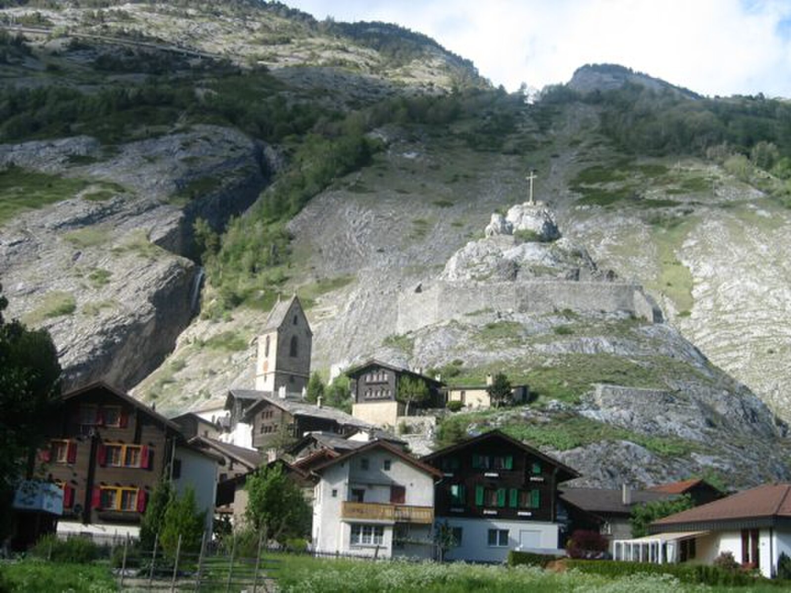
Live webcam




Open liften: 0%
Sneeuwbericht
- Laatste 24 uur: 0 cm
- Laatste 72 uur: 0 cm
- Laatste 7 dagen: 0 cm
- Laatste 7 dagen: Dal 0cm · Middenstation 0cm · Top 0cm
- Seizoenstotaal: 1.3 cm
Skigebieden nu open · Sneeuwbericht
About Eischoll
A quiet Valaisan sun terrace where rare Lichtblume lilies bloom and traditional farming life remains the primary rhythm.
Highlights
- Rare Alpine flora
- Ancient irrigation channels
- Family-run atmosphere
- Terraced mountain views
Key Facts
- Altitude: 1241m
- Top lift: 2200m
- Ski pistes: 15km
- Ski lifts: 4
- Population: 450
- 4000m+ peaks nearby: 1
- Lakes nearby: 14
- MTB trails: 249.3km
- Mountain huts: 6
Ski Area
Inbegrepen in deze seizoenpassen
Weather and 10-day forecast for Eischoll
- Today: 10 to 19 °C, clear sky, 7 h of sunshine
- Freezing level today: about 4203 m (4000 to 4280 m)
| Day | Min / max | Sky | Precipitation | Sunshine |
|---|---|---|---|---|
| zo 20 sep | 10 / 19 °C | clear sky | dry | 7 h sun |
| ma 21 sep | 11 / 18 °C | overcast | dry | 1 h sun |
| di 22 sep | 10 / 18 °C | clear sky | dry | 12 h sun |
| wo 23 sep | 8 / 18 °C | clear sky | dry | 11 h sun |
| do 24 sep | 8 / 18 °C | partly cloudy | dry | 7 h sun |
| vr 25 sep | 10 / 19 °C | overcast | dry | 1 h sun |
| za 26 sep | 10 / 20 °C | clear sky | dry | 12 h sun |
| zo 27 sep | 11 / 18 °C | overcast | dry | 1 h sun |
| ma 28 sep | 5 / 23 °C | clear sky | dry | 11 h sun |
| di 29 sep | 3 / 22 °C | clear sky | dry | 8 h sun |
Things to do in Eischoll
Hikes nearby — Eischoll (20)
20+ curated hiking trails around Eischoll, sourced from OpenStreetMap and enriched with distance, elevation gain and difficulty.
-
Walliser Sonnenweg Etappe 2
-
Walliser Sonnenweg Etappe 3
-
Lötschberger Südrampe
-
Obere Wasserleitung Stägeru Lüegju
-
Suonenweg Brandalp-Eischoll
This trail follows two historic irrigation channels — the "Alte Suon" and the "Alte Eischlersuon" — tracing their courses through the Valais landscape between Brandalp and Eischoll.
-
Raron - Visp
The trail descends from the church in Unterbäch past the Capetsch Kapelle and Hochaschtler to the Wandflüekapelle, a chapel pressed against a steep mountainside thick with wild Scots pines, with gemauerte Kreuzwegstationen (stone-built Stations of the Cross) lining the narrow path. Below, the Rhone valley spreads out in full view before the route reaches Raron.
-
Kulturweg
-
Raron - Prag
-
Raron - Sankt German
-
Obere Wasserleitung
-
Gampel Steg Goppenstein
This historic valley trail descends from Goppenstein through Mittal down to Steg in the Rhone Valley, dropping from a highest point of 1,216 m to a lowest point of 640 m along the way. NONE Wait — I must not include distance/elevation figures per the instructions. Let me revise: This is a historic valley trail running from Goppenstein through Mittal down to Steg in the Rhone Valley.
-
Erschmatt Gampel
-
St. German - Leiggern - Wiwannihütte
-
Ritzibodo - Reemistafel
-
21-Alpenpässe-Weg
-
Suonenweg Brandalp–Eischoll
-
Walliser Sonnenweg: Gampel - _
-
Moosalp Panoramaweg
-
Walliser Sonnenweg: Leukerbad - Gampel
-
Walliser Sonnenweg: _ - Brig
Mountain biking near Eischoll
- Jeizi Enduro
- Bärgweg
- Treberweg
- Südrampe
- Jeiziweg
Getting to Eischoll
Door-to-door travel times as used by the MR. ALPS ranking.
- Nearest airport: Geneva International Airport (GVA), 129 km away, about 2h24 by road
- Lausanne: 1h45 by car, 135 km
- Bern: 2h03 by train, 105 km
- Biel/Bienne: 2h16 by train, 138 km
- Genève: 2h24 by car, 197 km
- Zürich: 2h41 by train, 222 km
- Basel: 2h49 by train, 205 km
Where to stay in Eischoll
63 places to stay for a night on 2026-09-25, from 132 EUR per night, median 237 EUR. Prices are direct with hotels and destinations, compared live on the Eischoll page.