Breuil-Cervinia
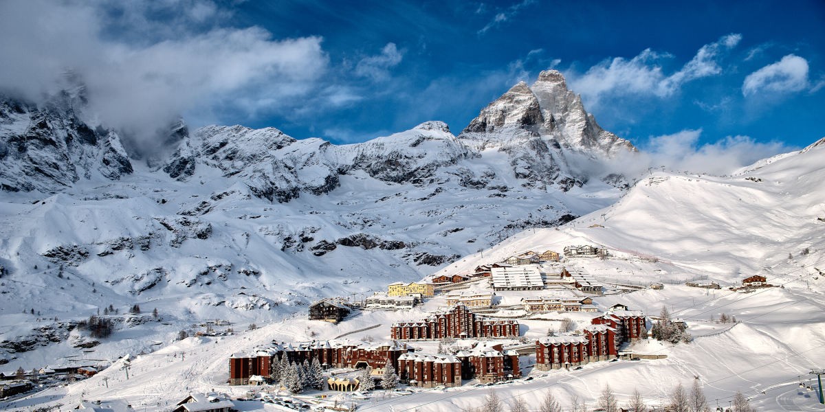
Live webcam

Open liften: 0/20
Sneeuwbericht
- Laatste 24 uur: 0 cm
- Laatste 72 uur: 0 cm
- Laatste 7 dagen: 0 cm
- Laatste 7 dagen: Dal 0cm · Middenstation 0cm · Top 0cm
- Seizoenstotaal: 8.9 cm
Skigebieden nu open · Sneeuwbericht
About Breuil-Cervinia
This historic high-altitude village sits at 2,003m in the Aosta Valley, providing direct access to 322km of pistes across the Matterhorn-Cervino Paradise. During the off-peak shoulder months, the expansive high-mountain terrain offers significant solitude and faster lift access for Ikon Pass holders.
Highlights
- Cross-border skiing
- Sun-drenched plateaus
- Laid-back Italian hospitality
- Iconic peak views
Key Facts
- Altitude: 2003m
- Top lift: 3469m
- Ski pistes: 322km
- Ski lifts: 51
- Population: 743
- 4000m+ peaks nearby: 24
- Lakes nearby: 26
- MTB trails: 28km
- Mountain huts: 35
Ski Area
Matterhorn-Cervino Paradise – Zermatt/Breuil-Cervinia/Valtournenche
Inbegrepen in deze seizoenpassen
Weather and 10-day forecast for Breuil-Cervinia
- Today: 7 to 13 °C, overcast, 2 h of sunshine
- Freezing level today: about 4323 m (4040 to 4610 m)
| Day | Min / max | Sky | Precipitation | Sunshine |
|---|---|---|---|---|
| ma 21 sep | 7 / 13 °C | overcast | dry | 2 h sun |
| di 22 sep | 5 / 14 °C | clear sky | dry | 12 h sun |
| wo 23 sep | 4 / 10 °C | clear sky | dry | 12 h sun |
| do 24 sep | 3 / 8 °C | clear sky | dry | 9 h sun |
| vr 25 sep | 4 / 10 °C | partly cloudy | dry | 5 h sun |
| za 26 sep | 6 / 12 °C | clear sky | dry | 12 h sun |
| zo 27 sep | 4 / 9 °C | overcast | dry | 1 h sun |
| ma 28 sep | -3 / 9 °C | clear sky | dry | 12 h sun |
| di 29 sep | -5 / 9 °C | partly cloudy | dry | 4 h sun |
| wo 30 sep | -3 / 8 °C | overcast | dry | 1 h sun |
Things to do in Breuil-Cervinia
Hikes nearby — Breuil-Cervinia (16)
16 curated hiking trails around Breuil-Cervinia, sourced from OpenStreetMap and enriched with distance, elevation gain and difficulty.
-
Gran Balconata del Cervino - Stage 3
-
Gran Balconata del Cervino - Stage 4
-
Sentier de l'Abbé Gorret
-
Sentier Jean Antoine Carrel
-
Tour Monte Rosa tappa 2
around the Monte Rosa group
-
Tour Monte Rosa tappa 1
around the Monte Rosa group
-
Alta Via n. 1 della Valle d'Aosta - Tappa 7
Tappa n. 7 - Rifugio Vieux Crest (1935 mt.) - Rifugio Gran Tournalin (2535 mt.)
-
Accesso Bivacco Manenti
-
Hörnliweg
-
Matterhorn glacier trail
Trockener Steg - Hirli - Schwarzsee
-
Grand Tournalin
-
Matternhorn-Trail
-
Edelweissweg
-
Lärchenweg
-
Anello di Tzere
-
Furi-Weg
Mountain biking near Breuil-Cervinia
- Moos-Trail
- Moos Trail
Getting to Breuil-Cervinia
Door-to-door travel times as used by the MR. ALPS ranking.
- Nearest airport: Turin Airport (TRN), 82 km away, about 1h42 by road
- Torino: 1h42 by car, 119 km
- Milano: 2h25 by car, 187 km
- Genève: 2h42 by car, 188 km
- Annecy: 2h51 by car, 200 km
- Genova: 2h58 by car, 246 km
- Lausanne: 3h08 by car, 200 km
Where to stay in Breuil-Cervinia
200 places to stay for a night on 2026-09-25, from 94 EUR per night, median 163 EUR. Prices are direct with hotels and destinations, compared live on the Breuil-Cervinia page.