Bödele – Schwarzenberg
Live webcam


Open liften: 0/12
Sneeuwbericht
- Laatste 24 uur: 0 cm
- Laatste 72 uur: 0 cm
- Laatste 7 dagen: 0 cm
- Laatste 7 dagen: Dal 0cm · Middenstation 0cm · Top 0cm
- Seizoenstotaal: 0 cm
Skigebieden nu open · Sneeuwbericht
About Bödele – Schwarzenberg
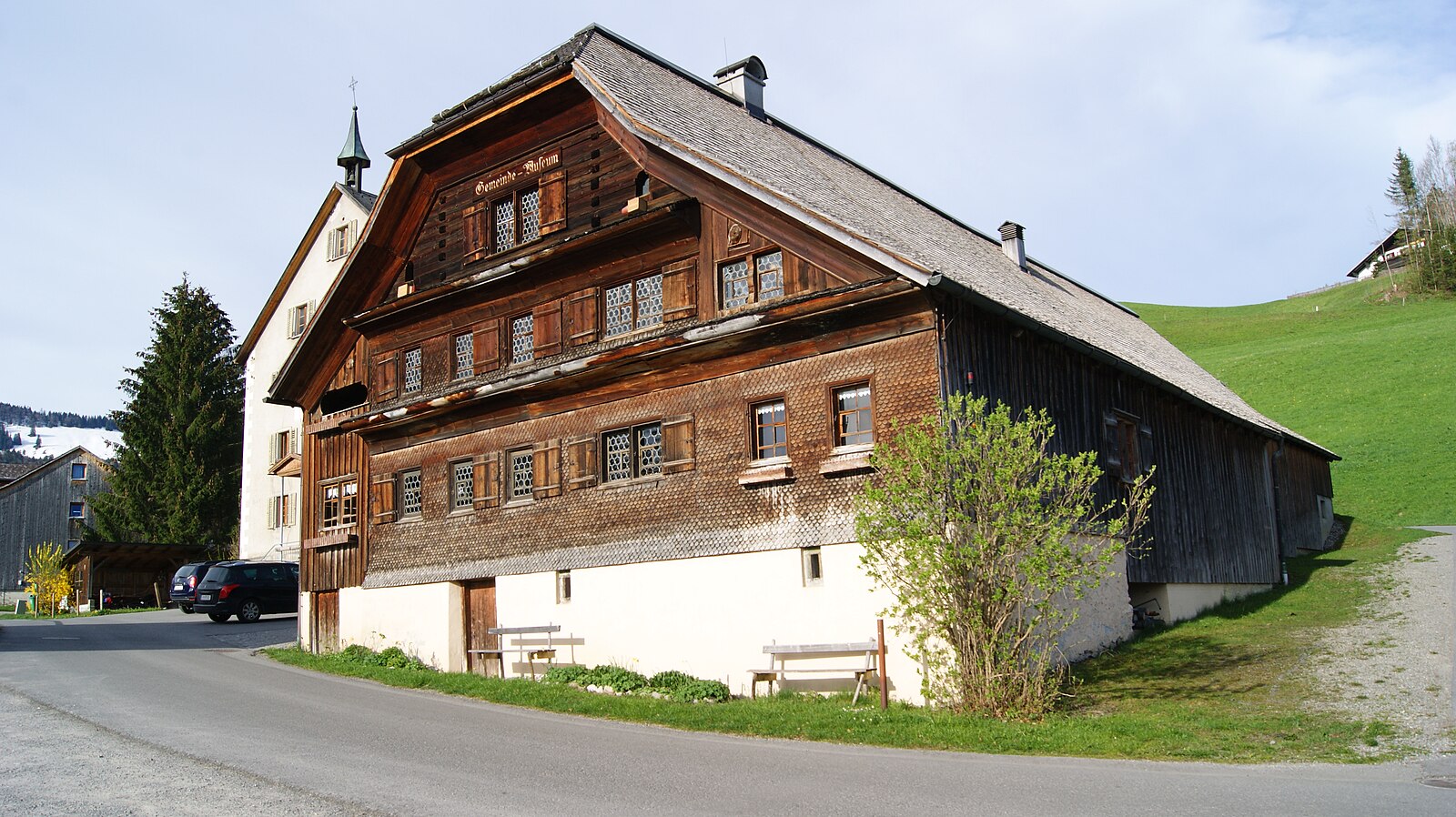
A nostalgic Vorarlberg hideaway where heritage farmhouses meet a low-key, local crowd seeking authentic charm over modern flash.
Highlights
- Rustic wooden chalets
- Bregenzerwald architecture
- Family-run guesthouses
- Gentle alpine meadows
Key Facts
- Altitude: 1088m
- Top lift: 1467m
- Ski pistes: 25km
- Ski lifts: 12
- Population: 1,850
- Lakes nearby: 25
- MTB trails: 55.9km
- Mountain huts: 10
Ski Area
Inbegrepen in deze seizoenpassen
Weather and 10-day forecast for Bödele – Schwarzenberg
- Today: 6 to 13 °C, clear sky, 11 h of sunshine
- Freezing level today: about 3334 m (3050 to 3790 m)
| Day | Min / max | Sky | Precipitation | Sunshine |
|---|---|---|---|---|
| di 22 sep | 6 / 13 °C | clear sky | dry | 11 h sun |
| wo 23 sep | 7 / 15 °C | clear sky | dry | 12 h sun |
| do 24 sep | 5 / 12 °C | overcast | dry | 4 h sun |
| vr 25 sep | 3 / 13 °C | clear sky | dry | 11 h sun |
| za 26 sep | 6 / 18 °C | clear sky | dry | 12 h sun |
| zo 27 sep | 9 / 20 °C | partly cloudy | dry | 6 h sun |
| ma 28 sep | 12 / 18 °C | clear sky | dry | 11 h sun |
| di 29 sep | 11 / 21 °C | clear sky | dry | 10 h sun |
| wo 30 sep | 13 / 21 °C | clear sky | dry | 10 h sun |
| do 1 okt | 11 / 18 °C | drizzle | dry | 0 h sun |
Things to do in Bödele – Schwarzenberg
Hikes nearby — Bödele – Schwarzenberg (10)
10 curated hiking trails around Bödele – Schwarzenberg, sourced from OpenStreetMap and enriched with distance, elevation gain and difficulty.
-
Musikwanderweg am Brüggelekopf
Der Musikwanderweg am Brüggelekopf ist eine Wanderroute, auf der zehn musikalisch gestaltete Stationen verteilt sind.
-
Achauen-Rundweg
The Achauen-Rundweg loops from Schwarzenberg's village square through the hamlet of Schwarzen along the Eschweg — an old ecclesiastical procession route still walked on Ascension Day — then continues through flat, agriculturally worked land past the Lourdes-Kapelle and wayside crosses. In spring, the meadows blaze with wildflowers before the first mowing, and the route traces the Bregenzerach river through the area known as Kräherau.
-
Jakobsweg Vorarlberg
-
Rheintalweg Vorarlberg
-
Familienweg
-
Schwarzenberg-Rundweg
-
Staufenrunde
-
Lausbubenweg
-
Klettersteig Känzele
-
Ebniter Rundweg
Mountain biking near Bödele – Schwarzenberg
- Bezau-Weissenfluhalpe
- Kehlegg-Weissenfluhalpe
- Kehlegg-Gschwendtalpe-Bödele
- MTB Alberschwende-Brüggelekopf (über Tannen)-Lorenapass
- MTB Lorenapass-Geißkopf-Bödele
Getting to Bödele – Schwarzenberg
Door-to-door travel times as used by the MR. ALPS ranking.
- Nearest airport: Bodensee Airport Friedrichshafen (FDH), 36 km away, about 1h by road
- Zürich: 1h43 by car, 130 km
- München: 2h19 by car, 204 km
- Luzern: 2h19 by car, 182 km
- Innsbruck: 2h29 by car, 190 km
- Basel: 2h37 by car, 210 km
- Stuttgart: 2h40 by car, 243 km
Where to stay in Bödele – Schwarzenberg
200 places to stay for a night on 2026-09-25, from 110 EUR per night, median 165 EUR. Prices are direct with hotels and destinations, compared live on the Bödele – Schwarzenberg page.