Val Formica – Cima Larici
ライブカメラ
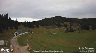
営業中のリフト: 0%
積雪情報
- 過去24時間: 0 cm
- 過去72時間: 0 cm
- 過去7日間: 0 cm
- 過去7日間: 山麓 0cm · 中腹 0cm · 山頂 0cm
- シーズン累計: 0 cm
About Val Formica – Cima Larici
A gentle sanctuary on the Asiago plateau, favored by families for its sun-drenched pastures and approachable, slow-paced winter charm.
Highlights
- Family-friendly slopes
- Sun-soaked plateau
- Traditional mountain refuges
- Silent snowshoe trails
Key Facts
- Altitude: 1649m
- Top lift: 1767m
- Ski pistes: 4km
- Ski lifts: 2
- Lakes nearby: 2
- Mountain huts: 24
Ski Area
Weather and 10-day forecast for Val Formica – Cima Larici
- Today: 8 to 18 °C, partly cloudy, 7 h of sunshine
- Freezing level today: about 4211 m (4040 to 4330 m)
| Day | Min / max | Sky | Precipitation | Sunshine |
|---|---|---|---|---|
| 9月20日(日) | 8 / 18 °C | partly cloudy | dry | 7 h sun |
| 9月21日(月) | 11 / 17 °C | overcast | dry | 2 h sun |
| 9月22日(火) | 6 / 14 °C | clear sky | dry | 10 h sun |
| 9月23日(水) | 6 / 12 °C | partly cloudy | dry | 5 h sun |
| 9月24日(木) | 6 / 14 °C | partly cloudy | dry | 7 h sun |
| 9月25日(金) | 6 / 13 °C | overcast | dry | 1 h sun |
| 9月26日(土) | 4 / 16 °C | partly cloudy | dry | 6 h sun |
| 9月27日(日) | 6 / 15 °C | overcast | dry | 1 h sun |
| 9月28日(月) | 8 / 17 °C | clear sky | dry | 12 h sun |
| 9月29日(火) | 8 / 18 °C | partly cloudy | dry | 6 h sun |
Things to do in Val Formica – Cima Larici
Hikes nearby — Val Formica – Cima Larici (15)
15 curated hiking trails around Val Formica – Cima Larici, sourced from OpenStreetMap and enriched with distance, elevation gain and difficulty.
-
Galmarara - Bivio Italia
Old military roads thread through the largely untouched heart of the Asiago Plateau's northern zone, passing war monuments and remnants of 1915–18 fortifications amid a glaciokarst landscape, with rest stops at malghe and baiti along the way.
-
Portule
-
Monte Verena
-
Troso di Manazzo
-
Via ferrata "Giuseppe Hippoliti"
-
Sentiero "Mario Magnago"
-
Sentiero Don Cesare
-
Malga Camporosà – Contrà Bisele di Sotto – Ponte Rossato – Malga Crojer
-
La Singela
-
Itinerario Ex Forte - San Valentino
-
Itinerario Part dei Boschi
-
Sentiero della Pace nell'Altopiano dei Sette Comuni
-
Casotto – Belfiore – Nore - Luserna
-
Casotto – Val Torra – Malga Crojer
-
Forte Campolongo
Mountain biking near Val Formica – Cima Larici
- Strada forestale Val Vis - Cera
- Erzherzog Eugen Straße
- Strada forestale Gomioselo
- Strada forestale Val Vis - Cera - Busa dei Groi
- Strada forestale Val dell'erba
- Strada forestale Puisle
Getting to Val Formica – Cima Larici
Door-to-door travel times as used by the MR. ALPS ranking.
- Nearest airport: Bolzano Airport (BZO), 54 km away, about 1h44 by road
- Trento: 1h13 by car, 58 km
- Padova: 1h39 by car, 105 km
- Bolzano - Bozen: 1h52 by car, 118 km
- Verona: 2h02 by car, 133 km
- Brescia: 2h35 by car, 170 km
- Bologna: 2h50 by car, 217 km
Where to stay in Val Formica – Cima Larici
55 places to stay for a night on 2026-09-25, from 138 EUR per night, median 189 EUR. Prices are direct with hotels and destinations, compared live on the Val Formica – Cima Larici page.