St. Antönien
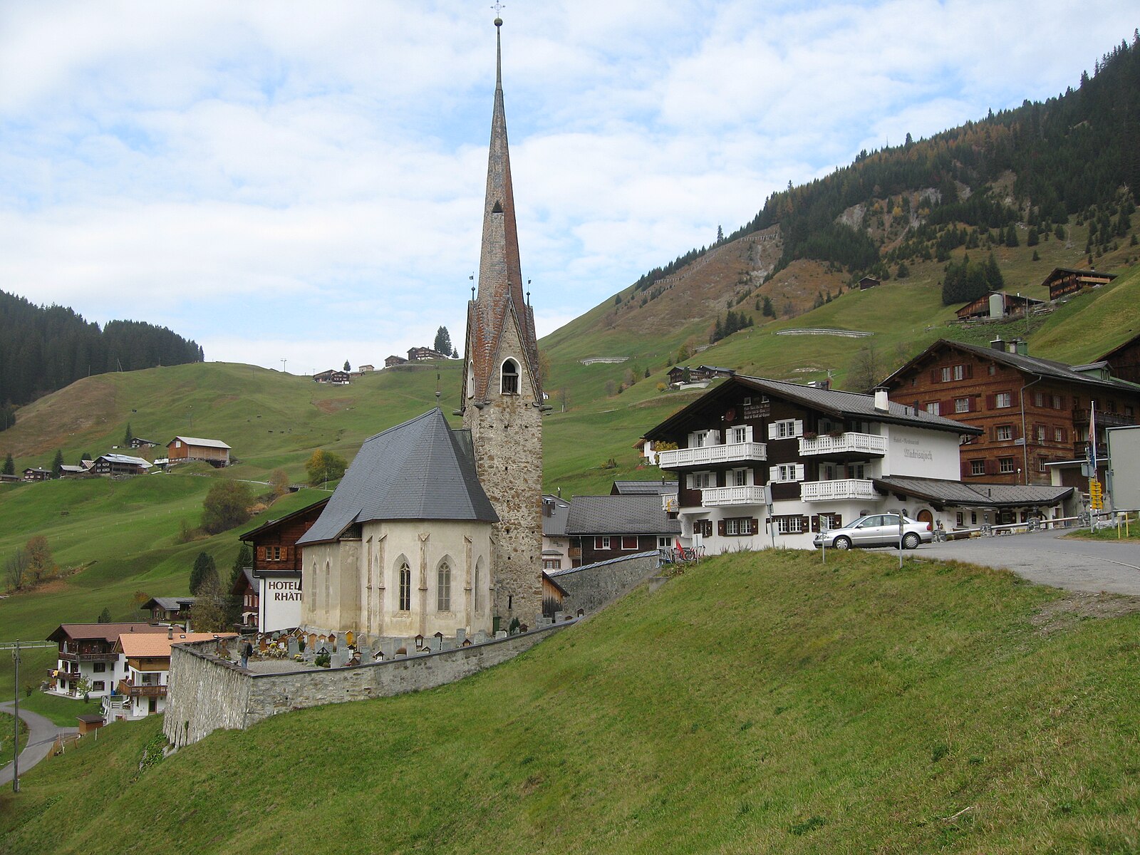
About St. Antönien
A quiet mountaineering sanctuary near the Austrian border, revered by purists for its untouched slopes and authentic Walser heritage.
Highlights
- Pristine ski touring
- Walser timber architecture
- Off-grid tranquility
- Steep limestone peaks
Key Facts
- Altitude: 1431m
- Top lift: 1656m
- Ski pistes: 3km
- Ski lifts: 2
- Population: 331
- Lakes nearby: 18
- MTB trails: 211.2km
- Mountain huts: 10
Ski Area
Weather and 10-day forecast for St. Antönien
- Today: 5 to 14 °C, clear sky, 12 h of sunshine
- Freezing level today: about 3268 m (3010 to 3690 m)
| Day | Min / max | Sky | Precipitation | Sunshine |
|---|---|---|---|---|
| 9月22日(火) | 5 / 14 °C | clear sky | dry | 12 h sun |
| 9月23日(水) | 6 / 17 °C | clear sky | dry | 11 h sun |
| 9月24日(木) | 5 / 13 °C | overcast | dry | 1 h sun |
| 9月25日(金) | 3 / 14 °C | clear sky | dry | 11 h sun |
| 9月26日(土) | 6 / 17 °C | clear sky | dry | 10 h sun |
| 9月27日(日) | 9 / 19 °C | partly cloudy | dry | 7 h sun |
| 9月28日(月) | 10 / 20 °C | overcast | dry | 5 h sun |
| 9月29日(火) | 11 / 21 °C | clear sky | dry | 12 h sun |
| 9月30日(水) | 5 / 21 °C | overcast | dry | 2 h sun |
| 10月1日(木) | 8 / 19 °C | drizzle | dry | 6 h sun |
Things to do in St. Antönien
Hikes nearby — St. Antönien (20)
20+ curated hiking trails around St. Antönien, sourced from OpenStreetMap and enriched with distance, elevation gain and difficulty.
-
Prättigauer Höhenweg - Etappe 3
-
Walserweg - Etappe 18
The route climbs steeply through the Schlappintobel and its forest into the Saas Alpine region, then crosses the Rätschenjoch — a karst landscape and former mining area — where views open wide to both north and south. Scattered Walser settlements cling to the hillsides of the Gafiatal, reminders that these people cultivated remote, inhospitable terrain in the late Middle Ages, before the trail descends to the compact village of St. Antönien Platz.
-
Prättigauer Höhenweg - Etappe 4
The route follows the Alpbach stream past scattered farmsteads up to the Jägglisch Horn at 2,257 m, where views open across the Rätikon and the full sweep of the Prättigauer Höhenweg. A long traverse of the hillside then passes the Erlebnispark Madrisa-Land and the Madrisabahn mountain station before descending through the Schlappintobel gorge to Klosters.
-
Walserweg - Etappe 19
-
Prättigauer Höhenweg - Etappe 2
-
Schijenfluh Umrundung
-
Salfsch-Schuders
-
Schiers - Überlandquart
-
Klosters Platz - Grossrüti
-
Latschätzer Weg
-
Golmer Höhenweg
-
Suggadinweg
-
Schuders-Bushalt Salginatobelbrücke
-
Saas Station - Küblis
-
Küblis -
-
Prättigauer Höhenweg: Carschinafurgga - St. Antönien Platz
-
Panyer Rundweg
-
Walserweg: Klosters Dorf Bahnhof - St. Antönien Platz
-
Walserweg: St. Antönien Platz - Brand (A)
-
Prättigauer Höhenweg: St. Antönien Platz - Klosters Bahnhof
Mountain biking near St. Antönien
- Tilisunaweg
- St. Antönier Jochweg
- Madrisa Normalweg
Getting to St. Antönien
Door-to-door travel times as used by the MR. ALPS ranking.
- Nearest airport: Sankt Gallen Altenrhein Airport (ACH), 60 km away, about 1h24 by road
- Zürich: 1h49 by car, 133 km
- Luzern: 2h09 by car, 155 km
- Basel: 2h47 by car, 216 km
- Innsbruck: 3h08 by car, 210 km
- Biel/Bienne: 3h12 by car, 253 km
- Bern: 3h13 by car, 255 km
Where to stay in St. Antönien
50 places to stay for a night on 2026-09-25, from 134 EUR per night, median 199 EUR. Prices are direct with hotels and destinations, compared live on the St. Antönien page.