Osterhofen, Bayrischzell
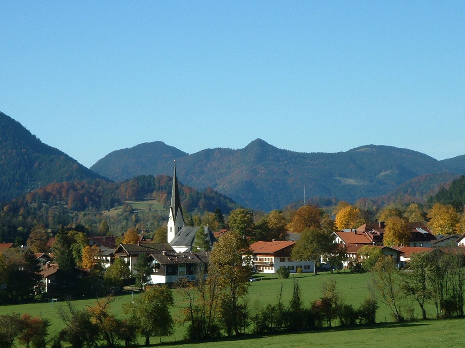
ライブカメラ


営業中のリフト: 0/4
積雪情報
- 過去24時間: 0 cm
- 過去72時間: 0 cm
- 過去7日間: 0 cm
- 過去7日間: 山麓 0cm · 中腹 0cm · 山頂 0cm
- シーズン累計: 0 cm
About Osterhofen, Bayrischzell
A quiet Bavarian hamlet where heritage farmhouses meet the cable car base for some of Germany's most nostalgic mountain terrain.
Highlights
- Traditional farmhouse architecture
- Sudelfeld lift access
- Rustic alpine meadows
- Authentic Bavarian charm
Key Facts
- Altitude: 537m
- Top lift: 1723m
- Ski pistes: 11km
- Ski lifts: 4
- Population: 1,691
- Lakes nearby: 17
- MTB trails: 333.2km
- Mountain huts: 16
Ski Area
Weather and 10-day forecast for Osterhofen, Bayrischzell
- Today: 4 to 11 °C, partly cloudy, 9 h of sunshine
- Freezing level today: about 2688 m (2480 to 2900 m)
| Day | Min / max | Sky | Precipitation | Sunshine |
|---|---|---|---|---|
| 9月22日(火) | 4 / 11 °C | partly cloudy | dry | 9 h sun |
| 9月23日(水) | 4 / 14 °C | clear sky | dry | 12 h sun |
| 9月24日(木) | 6 / 13 °C | thunderstorm | dry | 1 h sun |
| 9月25日(金) | 3 / 12 °C | partly cloudy | dry | 9 h sun |
| 9月26日(土) | 6 / 17 °C | clear sky | dry | 12 h sun |
| 9月27日(日) | 9 / 19 °C | clear sky | dry | 9 h sun |
| 9月28日(月) | 9 / 20 °C | partly cloudy | dry | 6 h sun |
| 9月29日(火) | 10 / 21 °C | clear sky | dry | 11 h sun |
| 9月30日(水) | 11 / 22 °C | overcast | dry | 3 h sun |
| 10月1日(木) | 11 / 20 °C | overcast | dry | 1 h sun |
Things to do in Osterhofen, Bayrischzell
Hikes nearby — Osterhofen, Bayrischzell (19)
19 curated hiking trails around Osterhofen, Bayrischzell, sourced from OpenStreetMap and enriched with distance, elevation gain and difficulty.
-
Via Alpina Purple A52
Brünnsteinhaus - Rotwandhaus
-
Weitwanderweg Ursprungweg
This nearly 55-kilometre long-distance trail winds from Wörnsmühl near Fischbachau over the Ursprungpass and on to Thiersee in Austria, passing through meadows, forest, and alongside running water with the mountain world always in view. Along the way, an audio walk — accessible via the free Livi AR app — brings the history of the Ursprungpass to life through two characters, Elli and Theo.
-
Wanderweg 596 - Bayrischzell
-
Wanderweg 645 - Spitzingsee
Von Spitzingsee/Geitau auf die Rotwand
-
Bayrischzeller Höhenweg
The trail winds in serpentines through forest above Bayrischzell before opening onto the sunny meadow hollow of the Neuhüttenalm, where the Ursprungtal drops nearly 500 metres below and the view stretches freely into the Tyrolean mountains. Cows still graze the remaining alms on the Seeberg's flanks, a landscape shaped by centuries of alpine farming — and, briefly, by Bavarian soldiers who kept watch here against Tyrolean Gebirgsschützen between 1806 and 1809.
-
Wanderweg 646a
-
Wanderweg 646 - Spitzingsee
-
Wanderweg 658 - Brünnstein
Tatzelwurm - Rosengasse - Traithenkessel - Feldalmsattel - Nesseltal
-
Wanderweg 652 - Brünnstein
Von Buchau, Wall oder Hocheck über das Brünnsteinhaus auf den Traithen und über Vogelsang nach Bayrischzell
-
Alpiner Premiumwanderweg Spitzing Panorama
-
BF4 - Hochgenuss
-
BF11 - Jetzad werds zach
-
BF9 - Kim glei wieda
-
BF10 - Des dauert a bisserl
-
BF14 - Panoramaweg
-
BF6 - Über Stock und Stein
-
BF12 - Fürs Herza'l
-
BF13 - Des baggsd!
Terrainkurweg "Wilhelm-Leibl"
-
BF1 - Auf der Spur der Wassernixe
Mountain biking near Osterhofen, Bayrischzell
- Zur Lacheralm und zurück
- Zur Niederhofer-Alm und zurück
Getting to Osterhofen, Bayrischzell
Door-to-door travel times as used by the MR. ALPS ranking.
- Nearest airport: Salzburg Airport (SZG), 77 km away, about 1h18 by road
- München: 1h04 by car, 76 km
- Innsbruck: 1h29 by car, 104 km
- Nürnberg: 2h32 by car, 244 km
- Bolzano - Bozen: 2h55 by car, 220 km
- Stuttgart: 3h16 by car, 309 km
- Trento: 3h25 by car, 275 km
Where to stay in Osterhofen, Bayrischzell
133 places to stay for a night on 2026-09-25, from 135 EUR per night, median 358 EUR. Prices are direct with hotels and destinations, compared live on the Osterhofen, Bayrischzell page.