Mürren
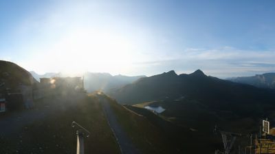
ライブカメラ

営業中のリフト: 0/49
積雪情報
- 過去24時間: 0 cm
- 過去72時間: 0 cm
- 過去7日間: 0 cm
- 過去7日間: 山麓 0cm · 中腹 0cm · 山頂 0.4cm
- シーズン累計: 19.5 cm
About Mürren
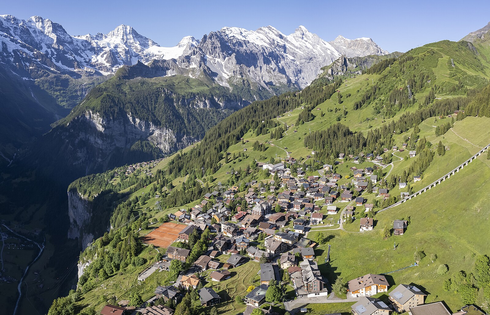
A car-free village perched on a cliff, famous as a James Bond filming location with stunning views.
Highlights
- Car-free
- James Bond location
- Schilthorn panorama
- Authentic village
Key Facts
- Altitude: 1650m
- Top lift: 2970m
- Ski pistes: 205km
- Ski lifts: 49
- Population: 2,558
- 4000m+ peaks nearby: 6
- Lakes nearby: 5
- MTB trails: 66.4km
- Mountain huts: 26
Ski Area
この目的地が含まれるシーズンパス
Weather and 10-day forecast for Mürren
- Today: 11 to 18 °C, partly cloudy, 8 h of sunshine
- Freezing level today: about 4138 m (3870 to 4280 m)
| Day | Min / max | Sky | Precipitation | Sunshine |
|---|---|---|---|---|
| 9月20日(日) | 11 / 18 °C | partly cloudy | dry | 8 h sun |
| 9月21日(月) | 10 / 15 °C | overcast | dry | 2 h sun |
| 9月22日(火) | 9 / 16 °C | clear sky | dry | 12 h sun |
| 9月23日(水) | 10 / 17 °C | clear sky | dry | 11 h sun |
| 9月24日(木) | 10 / 17 °C | clear sky | dry | 9 h sun |
| 9月25日(金) | 10 / 18 °C | overcast | dry | 2 h sun |
| 9月26日(土) | 11 / 18 °C | clear sky | dry | 12 h sun |
| 9月27日(日) | 12 / 18 °C | overcast | dry | 11 h sun |
| 9月28日(月) | 11 / 20 °C | overcast | dry | 12 h sun |
| 9月29日(火) | 10 / 19 °C | mainly clear | dry | 12 h sun |
Things to do in Mürren
Hikes nearby — Mürren (20)
20+ curated hiking trails around Mürren, sourced from OpenStreetMap and enriched with distance, elevation gain and difficulty.
-
Via Alpina
Walking in the shadow of the Eiger and Jungfrau, this stage of the long-distance Via Alpina threads through the quintessential car-free village of Wengen on its point-to-point traverse of the Bernese Oberland. The route crosses Alpine pastures filled with the sound of cowbells, connecting Grindelwald to Lauterbrunnen across demanding mountain terrain.
-
Wasserbrücke - Untere Busenalp
markierter Wanderweg
-
Wasserbrücke - fixme
markierter Wanderweg
-
Stechelberg / Rütti - Schilthornbahn
markierter Wanderweg
-
Mountain View Trail
A point-to-point route running from Grütschalp to Allmendhubel, this trail delivers first-class panoramic views of the Bernese Alps' 4000m peaks — the Eiger, and its neighbours — in one sustained sweep.
-
Trachsellauenen - Im Boden
markierter Wanderweg
-
Lauterbrunnen - Schilthornbahn
markierter Wanderweg
-
Obersteinberg - fixme
markierter Wanderweg
-
Obersteinberg - Oberhornsee
The trail climbs from Stechelberg through the upper Lauterbrunnen Valley — a protected alpine area since 1960 — passing through Trachsellauenen and Obersteinberg's rustic mountain hotel before reaching the Oberhornsee at 2065m. The route is noted for its scenery and botany, with no asphalt underfoot throughout.
-
Sousegg - Sattel
-
Sattel - Glütschnessli
-
Zustieg Rottalhütte
The route climbs through the Lauterbrunnen valley to the 2,755 m Rottalhütte — built in 1907 and last renovated in 2013 — passing through Sichellauenen and Stuefestein before reaching the foot of the Rottalgrat, with the Ebnefluh, Gletscherhorn, Rottalhorn, and Jungfrau looming above. The hut itself is described as a "very sympathetic old-style" refuge, complete with a winter room, perched at the edge of the Rottalgletscher.
-
Floschwald/Sausmatten - Grütschalp
-
Zustieg Silberhornhütte
-
Via Alpina
-
Via Alpina: Lauterbrunnen - Griesalp
-
Lauberhorn Trail
-
Via Alpina: Grindelwald Bhf. - Lauterbrunnen
-
ViaBerna: Saxeten - Isenfluh
-
Eiger Trail
Mountain biking near Mürren
- Alpine Bike - Etappe 12
- Mürren Bike
- Grütsch-Trail
- Eigertrail
Getting to Mürren
Door-to-door travel times as used by the MR. ALPS ranking.
- Nearest airport: Bern Airport (BRN), 48 km away, about 1h08 by road
- Bern: 1h17 by car, 74 km
- Luzern: 1h34 by car, 85 km
- Biel/Bienne: 1h40 by car, 109 km
- Zürich: 2h10 by car, 136 km
- Basel: 2h16 by car, 165 km
- Lausanne: 2h28 by car, 180 km
Where to stay in Mürren
200 places to stay for a night on 2026-09-25, from 279 EUR per night, median 525 EUR. Prices are direct with hotels and destinations, compared live on the Mürren page.