Les Menuires
ライブカメラ



営業中のリフト: 0/159
積雪情報
- 過去24時間: 0 cm
- 過去72時間: 0 cm
- 過去7日間: 0 cm
- 過去7日間: 山麓 0cm · 中腹 0cm · 山頂 0cm
- シーズン累計: 8 cm
About Les Menuires
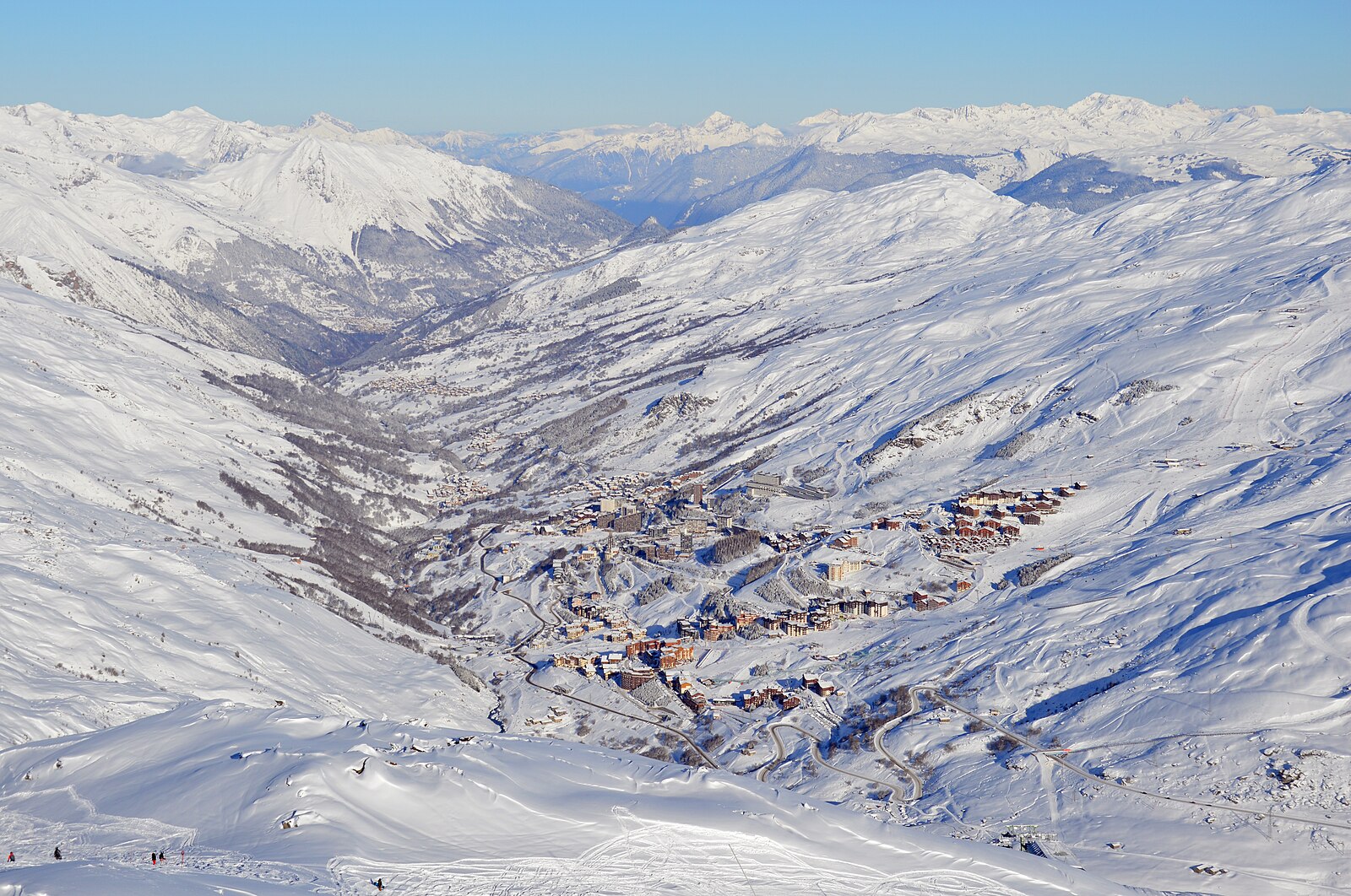
Situated at 1,850m within the Les 3 Vallées network, this historic Savoie destination provides direct access to 600km of pistes. During the shoulder season, the expansive lift system serves significantly quieter high-altitude terrain, offering better value for Epic Pass holders exploring the Vanoise National Park border.
Highlights
- Direct slope access
- Modernist architecture
- Family-centric base
- Expansive terrain links
Key Facts
- Altitude: 1850m
- Top lift: 3230m
- Ski pistes: 600km
- Ski lifts: 156
- Population: 497
- Lakes nearby: 25
- MTB trails: 139.4km
- Mountain huts: 18
Ski Area
Les 3 Vallées – Val Thorens/Les Menuires/Méribel/Courchevel (Trois Vallees)
この目的地が含まれるシーズンパス
Weather and 10-day forecast for Les Menuires
- Today: 5 to 13 °C, partly cloudy, 7 h of sunshine
- Freezing level today: about 4309 m (4210 to 4450 m)
| Day | Min / max | Sky | Precipitation | Sunshine |
|---|---|---|---|---|
| 9月20日(日) | 5 / 13 °C | partly cloudy | dry | 7 h sun |
| 9月21日(月) | 6 / 12 °C | overcast | dry | 1 h sun |
| 9月22日(火) | 5 / 14 °C | clear sky | dry | 12 h sun |
| 9月23日(水) | 6 / 13 °C | clear sky | dry | 12 h sun |
| 9月24日(木) | 5 / 13 °C | clear sky | dry | 8 h sun |
| 9月25日(金) | 4 / 12 °C | clear sky | dry | 12 h sun |
| 9月26日(土) | 4 / 15 °C | clear sky | dry | 12 h sun |
| 9月27日(日) | 6 / 16 °C | clear sky | dry | 12 h sun |
| 9月28日(月) | 3 / 15 °C | clear sky | dry | 12 h sun |
| 9月29日(火) | 1 / 14 °C | clear sky | dry | 12 h sun |
Things to do in Les Menuires
Hikes nearby — Les Menuires (17)
17 curated hiking trails around Les Menuires, sourced from OpenStreetMap and enriched with distance, elevation gain and difficulty.
-
Le Sentier Balcon
-
Circuit des Lacs des Menuires
From the télécabine de La Masse, the route climbs in zigzags before detouring to Le Teurre, where a sweeping viewpoint opens over the Vallée des Belleville; the trail then drifts gently from one mountain lake to the next.
-
Boucle de Roche Jaille
-
Le Cochet
-
Sentier Balcon de la Masse
-
Val Thorens - Les Ménuires
This walking and cycling loop threads through three major French Alpine ski resorts — Méribel, Val Thorens, and Les Ménuires — within the Vanoise National Park, delivering sweeping views of the region's high peaks and glaciers along the way.
-
Tougnète 1
-
Mont de la Chambre au départ des Ménuires
This out-and-back route climbs from the Savoyard ski resort of Les Ménuires through the Tarentaise region to the summit of Mont de la Chambre, set within Vanoise National Park.
-
Mont de la Chambre au départ de Val Thorens
-
Lac de Montaulever
The trail passes the pretty Lac du Montaulever at 2560m, set among the high terrain of the Péclet-Polset massif and its glaciers, before opening onto sweeping views over the Belleville and Allues valleys.
-
Sentier Balcon du Lou
-
Lac du Lou
A well-marked trail climbs from the Plan de l'Eau parking area to a glacial lake sitting at 2,035 m, with views over the Masse massif. The route lies within Vanoise National Park and is popular in both summer and winter, when hikers share the path with snowshoers.
-
Col de la Vallée Étroite
-
Lac de la Montagnette
-
Circuit des Lacs de Val Thorens
-
Lac Blanc
-
Lac de la Portette
Mountain biking near Les Menuires
- Circuit des Bétachos
- Gyrophare
- Kiss Kool
- Single des Bétachos
- Bloody Mary
- La Coriace
- DH7 Bloody Mary
- E9 Single des Bétachos
Getting to Les Menuires
Door-to-door travel times as used by the MR. ALPS ranking.
- Nearest airport: Lyon Saint-Exupéry Airport (LYS), 121 km away, about 2h07 by road
- Chambéry: 1h22 by car, 104 km
- Annecy: 1h45 by car, 100 km
- Grenoble: 1h45 by car, 135 km
- Genève: 2h20 by car, 144 km
- Lyon: 2h32 by car, 201 km
- Lausanne: 3h by car, 206 km
Where to stay in Les Menuires
192 places to stay for a night on 2026-09-25, from 90 EUR per night, median 114 EUR. Prices are direct with hotels and destinations, compared live on the Les Menuires page.