Lenk
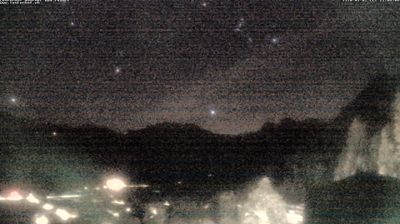
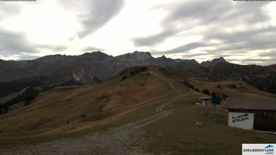
ライブカメラ
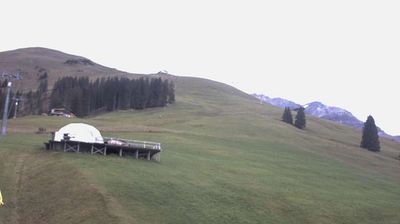
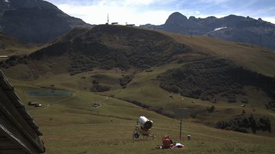
営業中のリフト: 0/22
積雪情報
- 過去24時間: 0 cm
- 過去72時間: 0 cm
- 過去7日間: 0 cm
- 過去7日間: 山麓 0cm · 中腹 0cm · 山頂 0cm
- シーズン累計: 0.5 cm
About Lenk
A family-oriented valley floor retreat where wide, gentle slopes meet the authentic charm of a working Bernese farming community.
Highlights
- Wide sunny plateaus
- Traditional wooden chalets
- Family-friendly terrain
- Bernese Oberland hospitality
Key Facts
- Altitude: 1067m
- Top lift: 2200m
- Ski pistes: 86km
- Ski lifts: 25
- Population: 2,322
- Lakes nearby: 18
- MTB trails: 31.1km
- Mountain huts: 18
Ski Area
この目的地が含まれるシーズンパス
Weather and 10-day forecast for Lenk
- Today: 9 to 18 °C, clear sky, 8 h of sunshine
- Freezing level today: about 4194 m (4040 to 4280 m)
| Day | Min / max | Sky | Precipitation | Sunshine |
|---|---|---|---|---|
| 9月20日(日) | 9 / 18 °C | clear sky | dry | 8 h sun |
| 9月21日(月) | 7 / 17 °C | overcast | dry | 2 h sun |
| 9月22日(火) | 7 / 16 °C | clear sky | dry | 12 h sun |
| 9月23日(水) | 7 / 17 °C | clear sky | dry | 12 h sun |
| 9月24日(木) | 8 / 16 °C | clear sky | dry | 12 h sun |
| 9月25日(金) | 6 / 14 °C | clear sky | dry | 12 h sun |
| 9月26日(土) | 7 / 17 °C | clear sky | dry | 12 h sun |
| 9月27日(日) | 9 / 22 °C | clear sky | dry | 12 h sun |
| 9月28日(月) | 8 / 21 °C | clear sky | dry | 12 h sun |
| 9月29日(火) | 7 / 20 °C | clear sky | dry | 12 h sun |
Things to do in Lenk
Hikes nearby — Lenk (20)
20+ curated hiking trails around Lenk, sourced from OpenStreetMap and enriched with distance, elevation gain and difficulty.
-
Siebenbrunnen-Weg
The route climbs through forest past the Simmenfälle, where masses of water cascade over rocks and envelop the surroundings in mist — close enough on the Barbara bridge to feel the spray on your skin. Deep gorges open along the way as the path winds up toward the Oberlaubhorn, with views over Lenk village and the surrounding mountain world.
-
Ritzdole-Iffigen Läger
-
Via Alpina Stage 73: Lenk - Lauenen
-
Via Alpina
The trail climbs nearly 1000 metres from Lenk im Simmental up to the Betelberg, a summit area that conceals one of Switzerland's most unusual geological features: the Gryden, a crater-like, bizarre rock landscape that fascinates and astonishes.
-
Via Alpina
-
Schwand - Laubbärgli
-
Gibel - Gütsch
The trail climbs through alpine pastures to the Stübleni limestone formation, where gypsum bedrock slowly dissolved by rainwater has collapsed into a field of sunken craters — dolinen — that give the Gryden its eerie, moonscape character. At the high point, clear days open a sweeping panorama stretching from the Simmental across the Saanenland to the Fribourg peaks.
-
Stoss - Betelberg / Leiterli
-
Seitengraben - Obere Lochberg
-
Lenk (Ritzdole) - Lenk (Sibe Brünne - Rezlibergli)
-
Gryden - Leiterli
The Gryden high-altitude circular trail on the Betelberg draws hikers into a striking crater landscape, with an alpine flower path (Alpenblumenweg) threading through the terrain. A stop at the Alpbeizli Steistoos mountain hut punctuates the route.
-
Tour du Wildhorn
-
Stalde - Ammertenhütte
-
Iffigenalp-Stierenläger
-
Eggweid Mittelstation - Oeschseite
-
Via Alpina: BE-12002 - Lenk
-
Via Alpina: Lenk - Gstaad
-
Höhenrundweg Gryden
-
Iffigsee-Rundweg
-
Horneggli-Panoramaweg
Mountain biking near Lenk
- Alpine Bike - Etappe 14
Getting to Lenk
Door-to-door travel times as used by the MR. ALPS ranking.
- Nearest airport: Geneva International Airport (GVA), 105 km away, about 2h31 by road
- Bern: 1h23 by car, 84 km
- Lausanne: 1h44 by car, 111 km
- Biel/Bienne: 1h47 by car, 120 km
- Luzern: 2h15 by car, 135 km
- Basel: 2h22 by car, 175 km
- Genève: 2h23 by car, 173 km
Where to stay in Lenk
53 places to stay for a night on 2026-09-25, from 141 EUR per night, median 455 EUR. Prices are direct with hotels and destinations, compared live on the Lenk page.