Lauchernalp – Lötschental
ライブカメラ
営業中のリフト: 0/6
積雪情報
- 過去24時間: 0 cm
- 過去72時間: 0 cm
- 過去7日間: 0 cm
- 過去7日間: 山麓 0cm · 中腹 0cm · 山頂 0cm
- シーズン累計: 11.4 cm
About Lauchernalp – Lötschental
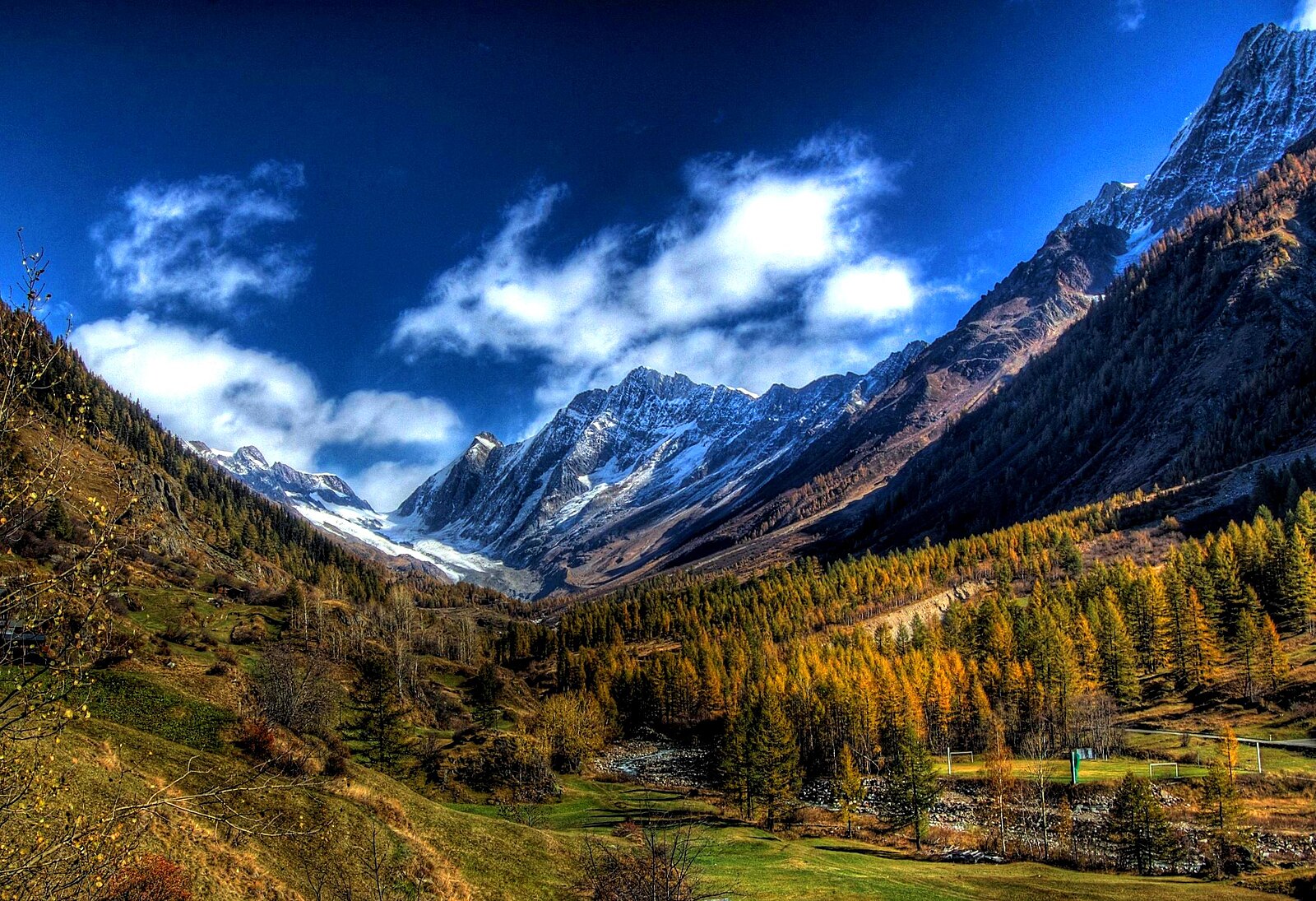
A secluded, sun-soaked terrace in the wild Lötschental valley, revered by locals for its deep powder and mystical Swiss folklore.
Highlights
- Deep freeride terrain
- Traditional wooden hamlets
- Ancient carnival masks
- High-altitude sun decks
Key Facts
- Altitude: 1968m
- Top lift: 3100m
- Ski pistes: 40km
- Ski lifts: 6
- Population: 1,500
- 4000m+ peaks nearby: 2
- Lakes nearby: 11
- MTB trails: 170.6km
- Mountain huts: 21
Ski Area
この目的地が含まれるシーズンパス
Weather and 10-day forecast for Lauchernalp – Lötschental
- Today: 8 to 15 °C, clear sky, 12 h of sunshine
- Freezing level today: about 4209 m (3870 to 4420 m)
| Day | Min / max | Sky | Precipitation | Sunshine |
|---|---|---|---|---|
| 9月22日(火) | 8 / 15 °C | clear sky | dry | 12 h sun |
| 9月23日(水) | 5 / 15 °C | clear sky | dry | 12 h sun |
| 9月24日(木) | 7 / 14 °C | partly cloudy | dry | 7 h sun |
| 9月25日(金) | 8 / 17 °C | partly cloudy | dry | 4 h sun |
| 9月26日(土) | 9 / 19 °C | clear sky | dry | 10 h sun |
| 9月27日(日) | 9 / 20 °C | clear sky | dry | 12 h sun |
| 9月28日(月) | 9 / 19 °C | clear sky | dry | 8 h sun |
| 9月29日(火) | 8 / 19 °C | clear sky | dry | 12 h sun |
| 9月30日(水) | 4 / 16 °C | overcast | dry | 11 h sun |
| 10月1日(木) | 2 / 16 °C | overcast | dry | 10 h sun |
Things to do in Lauchernalp – Lötschental
Hikes nearby — Lauchernalp – Lötschental (20)
20+ curated hiking trails around Lauchernalp – Lötschental, sourced from OpenStreetMap and enriched with distance, elevation gain and difficulty.
-
03-Lötschberg Panoramaweg
The route traverses fragrant forests and flower-rich alpine meadows, with the glaciated Petersgrat rising high above the path in stark contrast to the deep green of the woods and pastures below. Wild mountain streams tumble down from surrounding glaciers, while the still waters of the Schwarzsee offer a quieter counterpoint along the way.
-
04-Lötschberg Panoramaweg
-
Lötschentaler Höhenwanderweg
Der Weg im Talboden zurück Blatten ist gesperrt wegen dem Bergsturz
-
Ferden Restialp
-
Fardumalp Ferden
-
Fardumalp Restialp
-
Lötschenpass - Kummenalp
-
Harrischfuhre - Goppenstein
-
Kanderfirn - Heimritz
-
Heimritz - Kanderfirn
-
Gfelalp - Lötschenpass
-
Via Alpina
Etappe 13: Griesalp – Kandersteg
-
Walliser Sonnenweg Etappe 3
-
02-Lötschberg Panoramaweg
-
Walliser Sonnenweg Etappe 2
-
Lötschberg-Panoramaweg: Stafel - Fafleralp
-
Lötschberg-Panoramaweg: Selde - Stafel
-
Lötschberg-Panoramaweg: Kandersteg - Selde
-
Walliser Sonnenweg: Gampel - _
-
Via Alpina: Griesalp - Kandersteg
Mountain biking near Lauchernalp – Lötschental
- Flowtrail Loichi Trail
Getting to Lauchernalp – Lötschental
Door-to-door travel times as used by the MR. ALPS ranking.
- Nearest airport: Geneva International Airport (GVA), 130 km away, about 2h47 by road
- Lausanne: 2h06 by car, 150 km
- Bern: 2h32 by train, 98 km
- Genève: 2h45 by car, 213 km
- Biel/Bienne: 3h05 by train, 131 km
- Luzern: 3h13 by car, 194 km
- Annecy: 3h16 by car, 219 km