Kandersteg
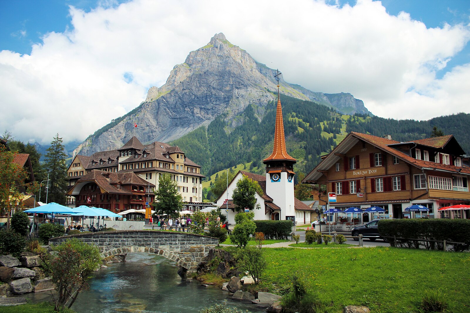
About Kandersteg
A secluded Bernese valley retreat where traditional wooden chalets meet frozen waterfalls and high-altitude lake adventures.
Highlights
- Frozen lake hiking
- Traditional wood architecture
- Ice climbing hub
- Quiet valley charm
Key Facts
- Altitude: 1574m
- Top lift: 1730m
- Ski pistes: 13km
- Ski lifts: 6
- Population: 1,299
- 4000m+ peaks nearby: 1
- Lakes nearby: 8
- MTB trails: 39.5km
- Mountain huts: 27
Ski Area
Weather and 10-day forecast for Kandersteg
- Today: 7 to 14 °C, clear sky, 12 h of sunshine
- Freezing level today: about 3956 m (3570 to 4280 m)
| Day | Min / max | Sky | Precipitation | Sunshine |
|---|---|---|---|---|
| 9月23日(水) | 7 / 14 °C | clear sky | dry | 12 h sun |
| 9月24日(木) | 8 / 15 °C | overcast | dry | 3 h sun |
| 9月25日(金) | 7 / 14 °C | partly cloudy | dry | 6 h sun |
| 9月26日(土) | 7 / 16 °C | clear sky | dry | 12 h sun |
| 9月27日(日) | 8 / 17 °C | clear sky | dry | 12 h sun |
| 9月28日(月) | 10 / 20 °C | clear sky | dry | 8 h sun |
| 9月29日(火) | 11 / 21 °C | clear sky | dry | 12 h sun |
| 9月30日(水) | 10 / 21 °C | clear sky | dry | 12 h sun |
| 10月1日(木) | 7 / 13 °C | rain showers | dry | 2 h sun |
| 10月2日(金) | 3 / 6 °C | snow showers | dry | 0 h sun |
Things to do in Kandersteg
Hikes nearby — Kandersteg (20)
20+ curated hiking trails around Kandersteg, sourced from OpenStreetMap and enriched with distance, elevation gain and difficulty.
-
01-Lötschberg Panoramaweg
-
02-Lötschberg Panoramaweg
-
Lötschberger Nordrampe
The trail traces the historic Lötschberg mountain railway line between Kandersteg and Frutigen, climbing high above the tracks to deliver views of viaducts and helical tunnels cut into the Kandertal valley below. Along the way, 34 information boards in four languages recount the engineering and history of this mountain railway.
-
Via Alpina
-
Via Alpina
Etappe 13: Griesalp – Kandersteg
-
Via Alpina
-
03-Lötschberg Panoramaweg
-
04-Lötschberg Panoramaweg
-
Fründenhütte
Nur bei absoluter Tritt- und Schwindelfreiheit zu begehen!
-
Oeschigässli-Kander-Rundweg
Rollstuhlwanderweg
-
Wageti-Rundweg
-
Heimritz - Kanderfirn
-
Kanderfirn - Heimritz
-
Wanderwege Griesalp
-
Waldhaus - Pletschenweidli
-
Via Alpina: Griesalp - Kandersteg
-
Lötschberg-Panoramaweg: Kandersteg - Selde
-
Via Alpina: Kandersteg - BE-12002
-
Lötschberg-Panoramaweg: Kiental - Kandersteg
-
Lötschberg-Panoramaweg: Selde - Stafel
Mountain biking near Kandersteg
- MTB Freeride Kandersteg
- MTB Freeridetrail
- Flowtrail Loichi Trail
- MTB Freeride Kandersteg Variante
Getting to Kandersteg
Door-to-door travel times as used by the MR. ALPS ranking.
- Nearest airport: Bern Airport (BRN), 49 km away, about 57 min by road
- Bern: 1h01 by car, 65 km
- Biel/Bienne: 1h25 by car, 100 km
- Luzern: 1h51 by car, 112 km
- Basel: 2h by car, 155 km
- Lausanne: 2h12 by car, 171 km
- Zürich: 2h21 by car, 182 km
Where to stay in Kandersteg
55 places to stay for a night on 2026-09-25, from 364 EUR per night, median 386 EUR. Prices are direct with hotels and destinations, compared live on the Kandersteg page.