St. Peter
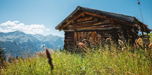
About St. Peter
A hidden Graubünden gem where local purists escape the crowds to enjoy expansive freeride terrain and a slow-paced sun terrace vibe.
Highlights
- Untracked powder runs
- Family-run hospitality
- Panoramic ridge trails
- Quiet mountain solitude
Key Facts
- Altitude: 1507m
- Top lift: 2300m
- Ski pistes: 20km
- Ski lifts: 2
- Population: 680
- Lakes nearby: 15
- MTB trails: 255.5km
- Mountain huts: 10
Ski Area
この目的地が含まれるシーズンパス
Weather and 10-day forecast for St. Peter
- Today: 5 to 13 °C, overcast, 3 h of sunshine
- Freezing level today: about 3592 m (3040 to 4010 m)
| Day | Min / max | Sky | Precipitation | Sunshine |
|---|---|---|---|---|
| 9月21日(月) | 5 / 13 °C | overcast | dry | 3 h sun |
| 9月22日(火) | 4 / 12 °C | clear sky | dry | 12 h sun |
| 9月23日(水) | 5 / 15 °C | clear sky | dry | 11 h sun |
| 9月24日(木) | 3 / 10 °C | partly cloudy | dry | 5 h sun |
| 9月25日(金) | 2 / 13 °C | clear sky | dry | 12 h sun |
| 9月26日(土) | 7 / 17 °C | clear sky | dry | 12 h sun |
| 9月27日(日) | 8 / 18 °C | clear sky | dry | 8 h sun |
| 9月28日(月) | 10 / 21 °C | clear sky | dry | 12 h sun |
| 9月29日(火) | 9 / 19 °C | clear sky | dry | 9 h sun |
| 9月30日(水) | 8 / 20 °C | clear sky | dry | 12 h sun |
Things to do in St. Peter
Hikes nearby — St. Peter (20)
20+ curated hiking trails around St. Peter, sourced from OpenStreetMap and enriched with distance, elevation gain and difficulty.
-
Via son Giachen
-
Schanfigger Höhenweg - Etappe 4
The fourth stage of the Schanfigger Höhenweg runs from St. Peter via the Skihaus Hochwang to Maladers and the alte Post. It traces the final stretch of this ancient mule-track route through the Schanfigg toward the Alpine city of Chur.
-
Via son Giachen
-
Arosa-Ochsenalp Rundtour
From the high point of the Hauptichopf, the route opens onto panoramic views over the Schanfigg valley and the Churer Rheintal, set within the rich natural landscapes surrounding Arosa.
-
BAW Bündner Wanderwege (um Praden)
-
Füxliweg
-
Wanderwege Graubünden (um Tschiertschen)
-
Aroser-Weisshorn-Weg
-
Dörferweg Schanfigg
The Dörferweg Schanfigg threads through the Schanfigg valley between Arosa and Chur — Switzerland's oldest city — passing through traditional Walser settlements, meadows, and atmospheric forests. The route connects quaint villages including Langwies, tracing the cultural heritage of the Walser people through this storied Alpine valley.
-
Schanfigger Höhenweg - Etappe 3
-
ViaSett
-
Untervaz Bahnhof - Haldenstein Station
-
Chur-Felsberg
-
Schanfigger Höhenweg - Etappe 1
-
Walserweg - Etappe 16
-
Jakobsweg Graubünden: Langwies Dorf - Tschiertschen
-
Schanfigger Höhenweg: Furgglis - Arosa Obersee
-
Schanfigger Höhenweg: Strassberg - Skihaus Hochwang
-
Schanfigger Höhenweg: Skihaus Hochwang - _VZ GR-M_1195_293
-
Schanfigger Höhenweg: _VZ GR-M_1195_293 - Furgglis
Mountain biking near St. Peter
- Hochwang–Peisteralp
- Ochsenalp–Tschiertschen
- Arosa–Ochsenalp
Getting to St. Peter
Door-to-door travel times as used by the MR. ALPS ranking.
- Nearest airport: Bodensee Airport Friedrichshafen (FDH), 93 km away, about 2h05 by road
- Zürich: 1h43 by car, 135 km
- Luzern: 2h02 by car, 157 km
- Basel: 2h40 by car, 218 km
- Innsbruck: 3h05 by car, 232 km
- Biel/Bienne: 3h06 by car, 255 km
- Bern: 3h07 by car, 257 km
Where to stay in St. Peter
200 places to stay for a night on 2026-09-25, from 129 EUR per night, median 377 EUR. Prices are direct with hotels and destinations, compared live on the St. Peter page.