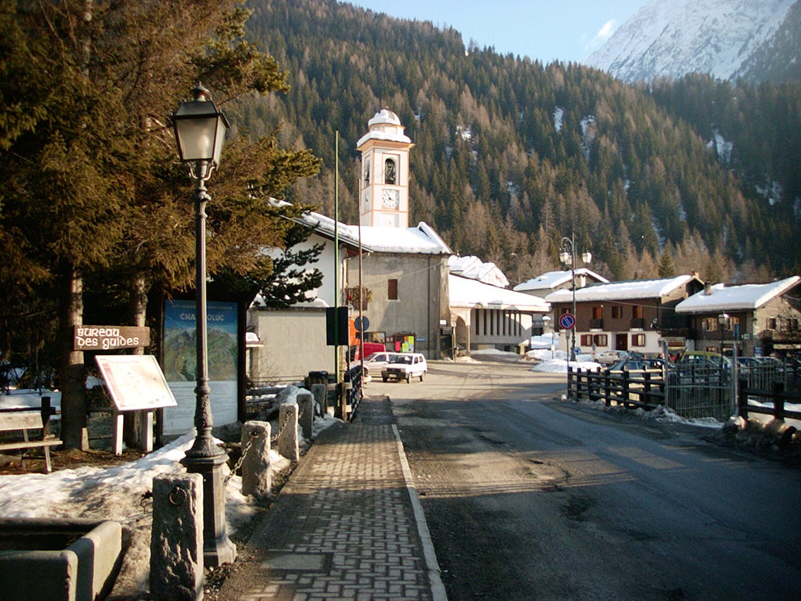
Champoluc
ライブカメラ


営業中のリフト: 0/21
積雪情報
- 過去24時間: 0 cm
- 過去72時間: 0 cm
- 過去7日間: 0 cm
- 過去7日間: 山麓 0cm · 中腹 0cm · 山頂 0cm
- シーズン累計: 0.1 cm
About Champoluc
Situated at 1,559m in the Aosta Valley, this historic village serves as a primary access point to the 132km Monterosa Ski circuit. During the shoulder season, the technical terrain empties, providing uncrowded access to a vertical drop of 1,716m and high-altitude lifts reaching 3,275m.
Highlights
- Vast off-piste terrain
- Laid-back atmosphere
- Traditional stone hamlets
- Hearty Aostan cuisine
Key Facts
- Altitude: 1559m
- Top lift: 3275m
- Ski pistes: 132km
- Ski lifts: 20
- Population: 500
- 4000m+ peaks nearby: 20
- Lakes nearby: 39
- MTB trails: 33.7km
- Mountain huts: 26
Ski Area
Monterosa Ski - Alagna Valsesia/Gressoney-La-Trinité/Champoluc
この目的地が含まれるシーズンパス
Weather and 10-day forecast for Champoluc
- Today: 5 to 15 °C, clear sky, 9 h of sunshine
- Freezing level today: about 4334 m (4110 to 4530 m)
| Day | Min / max | Sky | Precipitation | Sunshine |
|---|---|---|---|---|
| 9月20日(日) | 5 / 15 °C | clear sky | dry | 9 h sun |
| 9月21日(月) | 8 / 15 °C | overcast | dry | 1 h sun |
| 9月22日(火) | 6 / 12 °C | clear sky | dry | 10 h sun |
| 9月23日(水) | 5 / 11 °C | partly cloudy | dry | 5 h sun |
| 9月24日(木) | 6 / 13 °C | clear sky | dry | 10 h sun |
| 9月25日(金) | 6 / 13 °C | clear sky | dry | 12 h sun |
| 9月26日(土) | 5 / 13 °C | clear sky | dry | 12 h sun |
| 9月27日(日) | 5 / 15 °C | clear sky | dry | 11 h sun |
| 9月28日(月) | 2 / 14 °C | clear sky | dry | 12 h sun |
| 9月29日(火) | 2 / 14 °C | clear sky | dry | 12 h sun |
Things to do in Champoluc
Hikes nearby — Champoluc (15)
15 curated hiking trails around Champoluc, sourced from OpenStreetMap and enriched with distance, elevation gain and difficulty.
-
Anello di Tzere
-
Alta Via n. 1 della Valle d'Aosta - Tappa 8
L'Alta via della Valle d'Aosta n. 1, detta anche Alta via dei Giganti è un'alta via il cui tracciato parte e termina nel territorio della Valle d'Aosta, ma si sviluppa in parte anche nel Biellese, al cospetto dei massicci più elevati delle Alpi: Monte Rosa, Cervino e Monte Bianco.
-
Alta Via n. 1 della Valle d'Aosta - Tappa 7
Tappa n. 7 - Rifugio Vieux Crest (1935 mt.) - Rifugio Gran Tournalin (2535 mt.)
-
Alta Via n. 1 della Valle d'Aosta - Tappa 6
Tappa n. 6 - Gressoney-Saint-Jean (1405 mt.) - Rifugio Vieux Crest (1935 mt.)
-
Ru Courtod
The trail follows the Ru Courtod, an ancient open-air irrigation canal built in the 15th century by the "free men" of the Saint-Vincent hill, threading through alpine meadows and mountain pastures past the Chavannes and Granaz alpes. At Alpe di Nana Inferiore (2034 m), the route opens onto sweeping views of the Monte Rosa Group.
-
Ru Courtaud
The Ru Courtaud is an ancient watercourse that threads across the entire Ayas valley, carrying hikers through forest passages and open alpine pastures, past ski slopes marked by artificial snow cannons, and onward to mountain alpage settlements including Alpe Metzan and the Nana alpine pasture. The route descends eventually to the Évançon river, following a path alongside the stream all the way into Champoluc.
-
Tour Monte Rosa tappa 3
around the Monte Rosa group
-
Tour Monte Rosa tappa 2
around the Monte Rosa group
-
Gran Balconata del Cervino - Stage 4
-
Gran Balconata del Cervino - Stage 3
-
Grand Tournalin
-
Le sorgenti del Lys
-
Sentier de l'Abbé Gorret
-
Anello dei Villaggi di Antey ( Ruvère, Liesse,Fontaney, Villettaz)
-
Sentiero Walser
Mountain biking near Champoluc
- Ru Courtod
- Strada di Mascognaz
Getting to Champoluc
Door-to-door travel times as used by the MR. ALPS ranking.
- Nearest airport: Turin Airport (TRN), 70 km away, about 1h33 by road
- Torino: 1h32 by car, 107 km
- Milano: 2h15 by car, 175 km
- Genève: 2h45 by car, 198 km
- Genova: 2h48 by car, 234 km
- Annecy: 2h55 by car, 210 km
- Brescia: 3h05 by car, 261 km
Where to stay in Champoluc
200 places to stay for a night on 2026-09-25, from 84 EUR per night, median 137 EUR. Prices are direct with hotels and destinations, compared live on the Champoluc page.