Carezza

ライブカメラ
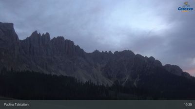
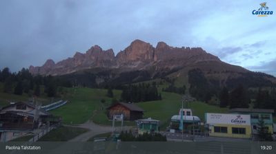
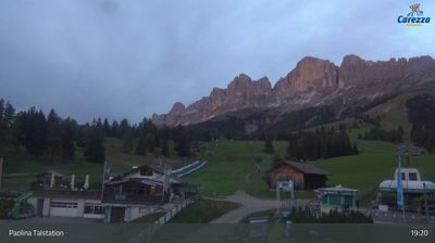
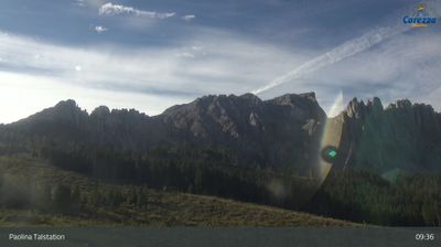
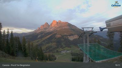
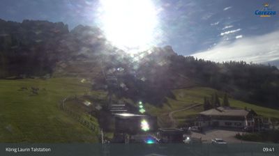
営業中のリフト: 0/13
積雪情報
- 過去24時間: 0 cm
- 過去72時間: 0 cm
- 過去7日間: 0 cm
- 過去7日間: 山麓 0cm · 中腹 0cm · 山頂 0cm
- シーズン累計: 0 cm
About Carezza
A family-oriented South Tyrolean gem where the Rosengarten massif glows pink above the legendary emerald waters of Lake Carezza.
Highlights
- Dolomite sunset glow
- Family-friendly slopes
- Lakeside alpine trails
- Ladin cultural heritage
Key Facts
- Altitude: 1652m
- Top lift: 2337m
- Ski pistes: 40km
- Ski lifts: 13
- Population: 125
- Lakes nearby: 11
- MTB trails: 100.6km
- Mountain huts: 41
Ski Area
この目的地が含まれるシーズンパス
Weather and 10-day forecast for Carezza
- Today: 6 to 16 °C, partly cloudy, 8 h of sunshine
- Freezing level today: about 4122 m (3880 to 4300 m)
| Day | Min / max | Sky | Precipitation | Sunshine |
|---|---|---|---|---|
| 9月20日(日) | 6 / 16 °C | partly cloudy | dry | 8 h sun |
| 9月21日(月) | 6 / 14 °C | overcast | dry | 2 h sun |
| 9月22日(火) | 3 / 11 °C | clear sky | dry | 12 h sun |
| 9月23日(水) | 4 / 12 °C | partly cloudy | dry | 8 h sun |
| 9月24日(木) | 6 / 14 °C | clear sky | dry | 12 h sun |
| 9月25日(金) | 7 / 14 °C | overcast | dry | 1 h sun |
| 9月26日(土) | 7 / 16 °C | clear sky | dry | 10 h sun |
| 9月27日(日) | 6 / 14 °C | partly cloudy | dry | 4 h sun |
| 9月28日(月) | 5 / 17 °C | clear sky | dry | 11 h sun |
| 9月29日(火) | 7 / 18 °C | partly cloudy | dry | 6 h sun |
Things to do in Carezza
Hikes nearby — Carezza (16)
16 curated hiking trails around Carezza, sourced from OpenStreetMap and enriched with distance, elevation gain and difficulty.
-
Dolomites World Heritage Geotrail 8
-
Dolomites World Heritage Geotrail 9
-
Langer Rundweg am Karer See
Der Rundweg umkreist den Karersee, der direkt am Fuße der Latemar-Spitzen liegt und für seine außergewöhnlichen Wasserfarben bekannt ist. Der barrierefreie Zugang zum Seeufer macht ihn auch für unerfahrene Wanderer zugänglich, während die eindrucksvollen Dolomitgestein-Bergketten im Hintergrund das Panorama prägen.
-
Mittlerer Rundweg am Karer See
-
Sagenweg
-
Sentiero del Masarè - Hirzelsteig
センティエロ・デル・マサレ|ヒルツェルシュタイクは、パオリナ・レフュージと周囲のドロミテの地形の間を走り、そのルート沿いに壮観な景色をもたらします。
-
N01
-
Nigertalweg
-
Alta via dei Fassani
The Alta Via dei Fassani serves as the return route through the Malga Vael alpine pasture back toward the Vigo di Fassa cable car, offering views across the Rosengarten massif on a quieter, less-crowded path through the Dolomites.
-
Vial de la Feide
-
Sagenweg
The Sagenweg follows signposts toward Gardeccia from Pian Pecei, tracing the legend of King Laurin and the Dolomites. It is a panoramic path that opens onto views of the Rosengarten (Catinaccio) group and its towers.
-
Samweg
-
1 - Kardaun => Nigerpass => Kölner Hütte
-
5 - Laives => Deutschnofen => Welschnofen => Tiers
-
Via Alpina Yellow B25
Rifugio Antermoia - Schlernhaus / Rifugio Bolzano
-
Führersteig
Mountain biking near Carezza
- MTB: Latemar Tour
- Karer See
- Carezza Biketrail
- Carezza Pumpline
- Perlenweg - Sentiero delle Perle
Getting to Carezza
Door-to-door travel times as used by the MR. ALPS ranking.
- Nearest airport: Innsbruck Airport (INN), 96 km away, about 2h18 by road
- Bolzano - Bozen: 37 min by car, 29 km
- Trento: 1h12 by car, 88 km
- Innsbruck: 2h04 by car, 143 km
- Verona: 2h10 by car, 183 km
- Brescia: 2h41 by car, 219 km
- Padova: 2h55 by car, 262 km
Where to stay in Carezza
200 places to stay for a night on 2026-09-25, from 131 EUR per night, median 289 EUR. Prices are direct with hotels and destinations, compared live on the Carezza page.