Bivio
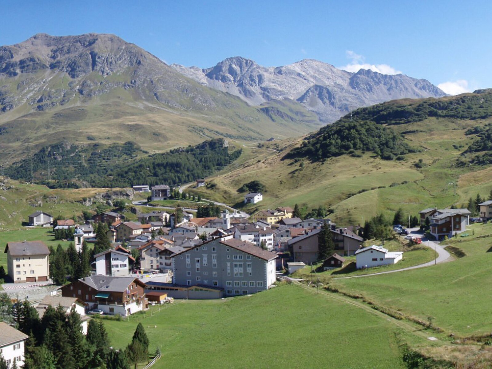
ライブカメラ


営業中のリフト: 0/4
積雪情報
- 過去24時間: 0 cm
- 過去72時間: 0 cm
- 過去7日間: 0 cm
- 過去7日間: 山麓 0cm · 中腹 0cm · 山頂 0cm
- シーズン累計: 18.3 cm
About Bivio
Known as the Pearl of the Julier Pass, this secluded outpost offers a raw, high-alpine escape for serious ski tourers.
Highlights
- Untracked powder fields
- Trilingual cultural heritage
- Vast backcountry terrain
- High-altitude isolation
Key Facts
- Altitude: 1769m
- Top lift: 2560m
- Ski pistes: 30km
- Ski lifts: 4
- Population: 189
- Lakes nearby: 25
- MTB trails: 97.5km
- Mountain huts: 13
Ski Area
この目的地が含まれるシーズンパス
Weather and 10-day forecast for Bivio
- Today: 5 to 14 °C, clear sky, 10 h of sunshine
- Freezing level today: about 4231 m (4130 to 4310 m)
| Day | Min / max | Sky | Precipitation | Sunshine |
|---|---|---|---|---|
| 9月20日(日) | 5 / 14 °C | clear sky | dry | 10 h sun |
| 9月21日(月) | 3 / 11 °C | overcast | dry | 2 h sun |
| 9月22日(火) | 2 / 11 °C | clear sky | dry | 9 h sun |
| 9月23日(水) | 3 / 13 °C | clear sky | dry | 9 h sun |
| 9月24日(木) | 0 / 9 °C | thunderstorm | dry | 7 h sun |
| 9月25日(金) | 0 / 12 °C | clear sky | dry | 12 h sun |
| 9月26日(土) | 4 / 14 °C | clear sky | dry | 11 h sun |
| 9月27日(日) | 5 / 17 °C | clear sky | dry | 11 h sun |
| 9月28日(月) | 4 / 18 °C | clear sky | dry | 12 h sun |
| 9月29日(火) | 2 / 17 °C | partly cloudy | dry | 7 h sun |
Things to do in Bivio
Hikes nearby — Bivio (20)
20+ curated hiking trails around Bivio, sourced from OpenStreetMap and enriched with distance, elevation gain and difficulty.
-
ViaSett
The trail climbs through the Lenzerheide region past Riom Castle — seat of the «Origen» Roman music theatre — before descending into Savognin, with the Albula and Gelgia rivers marking the historic starting point at Tiefencastel, a village that has sat at the crossroads of north-south and east-west Alpine routes since antiquity.
-
Senda Segantini - Etappe 1
The route departs from Savognin and climbs steadily above the Julier Pass road through scenic terrain, finishing at Bivio. It runs through Parc Ela and is rated hard.
-
ViaSett
-
Walserweg - Etappe 10
-
Senda Segantini - Etappe 2
From Bivio, the trail climbs steadily along a historic Roman trade route, forming the second stage of the Senda Segantini long-distance hiking trail through Parc Ela, ending at Maloja.
-
Stallerberg - Bivio
-
Senda Leg Columban
From Bivio — the only Italian-speaking village north of the Alpine watershed, threaded with trails dating to Roman times — this circular route climbs past the Leg Columban mountain lake to the high point of "Uf da Flüe," where the Averstal valley and Juf, the highest permanently inhabited settlement in Europe, spread out below. The descent follows the "Steinmännliweg" past a scatter of smaller lakes via Stallerberg back to the start.
-
02-Alpenpässe-Weg
-
01-Alpenpässe-Weg
-
Bernina Tour
-
Senda Segantini - Etappe 3
-
Walserweg - Etappe 9
-
Juf - Pass da Sett
-
Pass da Sett-Maroz Dora
-
Alte Averserstrasse
-
Alpenpässe-Weg: Chamanna Jenatsch - Tigias (Alp Flix)
-
Walserweg: Juf - Tigias (Alp Flix)
-
Senda Segantini: Bivio - Maloja Posta
-
Via Engiadina: Maloja Posta - Silvaplauna Ova dal Vallun
-
ViaSett: _VZ GR-M_1256_69_5 - Vicosoprano
Mountain biking near Bivio
- Alpine Bike - Etappe 4
- Alp Flix Bike
- Rona Bike
Getting to Bivio
Door-to-door travel times as used by the MR. ALPS ranking.
- Nearest airport: Milano Linate Airport (LIN), 117 km away, about 3h by road
- Zürich: 2h21 by car, 183 km
- Luzern: 2h40 by car, 205 km
- Milano: 3h01 by car, 178 km
- Innsbruck: 3h03 by car, 211 km
- Bolzano - Bozen: 3h11 by car, 188 km
- Basel: 3h19 by car, 265 km
Where to stay in Bivio
56 places to stay for a night on 2026-09-25, from 139 EUR per night, median 288 EUR. Prices are direct with hotels and destinations, compared live on the Bivio page.