Ausserschwand
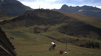
ライブカメラ
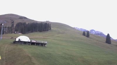
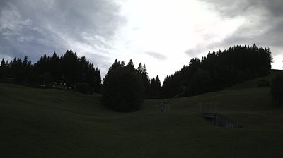

営業中のリフト: 0/22
積雪情報
- 過去24時間: 0 cm
- 過去72時間: 0 cm
- 過去7日間: 0 cm
- 過去7日間: 山麓 0cm · 中腹 0cm · 山頂 0cm
- シーズン累計: 0 cm
About Ausserschwand
A quiet, residential satellite of Adelboden where traditional farmhouses meet a slow-paced, sun-soaked life on the valley floor.
Highlights
- Traditional Bernese chalets
- Quiet pastoral setting
- Family-run guesthouses
- Sun-drenched plateau
Key Facts
- Altitude: 1329m
- Top lift: 1392m
- Ski lifts: 1
- Population: 265
- Lakes nearby: 11
- MTB trails: 44.2km
- Mountain huts: 25
Ski Area
この目的地が含まれるシーズンパス
Weather and 10-day forecast for Ausserschwand
- Today: 8 to 17 °C, overcast, 5 h of sunshine
- Freezing level today: about 3951 m (3780 to 4530 m)
| Day | Min / max | Sky | Precipitation | Sunshine |
|---|---|---|---|---|
| 9月21日(月) | 8 / 17 °C | overcast | dry | 5 h sun |
| 9月22日(火) | 6 / 16 °C | clear sky | dry | 12 h sun |
| 9月23日(水) | 7 / 17 °C | clear sky | dry | 12 h sun |
| 9月24日(木) | 9 / 16 °C | overcast | dry | 2 h sun |
| 9月25日(金) | 8 / 18 °C | clear sky | dry | 11 h sun |
| 9月26日(土) | 11 / 21 °C | partly cloudy | dry | 8 h sun |
| 9月27日(日) | 12 / 22 °C | clear sky | dry | 12 h sun |
| 9月28日(月) | 11 / 20 °C | partly cloudy | dry | 5 h sun |
| 9月29日(火) | 13 / 22 °C | clear sky | dry | 11 h sun |
| 9月30日(水) | 12 / 23 °C | clear sky | dry | 12 h sun |
Things to do in Ausserschwand
Hikes nearby — Ausserschwand (20)
20+ curated hiking trails around Ausserschwand, sourced from OpenStreetMap and enriched with distance, elevation gain and difficulty.
-
Via Alpina
-
Via Alpina
The trail climbs nearly 1000 metres from Lenk im Simmental up to the Betelberg, a summit area that conceals one of Switzerland's most unusual geological features: the Gryden, a crater-like, bizarre rock landscape that fascinates and astonishes.
-
Cholerenschlucht Rundweg
-
Flueweid - Schwandfeldspitze
-
Bonderalp - Elsigensee
From the Elsigenalp, the route passes the Brandsee and traverses lush alpine meadows via Alp Metsch and Bonderalp, with sweeping views across the entire Engstligtal toward Adelboden and the surrounding peaks. Beyond the Berghaus Bonderalp, the path joins the Via Alpina, the well-marked trail threading through some of the Bernese Oberland's most storied high-mountain terrain.
-
Rinderwald - Otterealp
-
Lohnerfälle - Bonderalp
-
Furggi - Schwandfeldspitze
-
Schärmtanne - Uelisgraben
-
Schärmtanne - Tschentenalp
From the gondola station at Tschentenalp — Adelboden's "Berg der Aussichten" at 1950 m — the trail descends through dense forest to the Schärmtanne, with panoramic views opening across the valley's mountain backdrop along the way.
-
Adelboden - Unter dem Birg
This car-free path follows a mountain stream from the quiet village of Adelboden through Oey and Raufmatte to the foot of the Engstligenalp, where foaming waters carve their dramatic way down into the valley. The return journey is made by bus.
-
Hohliebe - Unter dem Birg
The route climbs steeply from Unter dem Birg (1399 m) through pastures and forests to the high point at Laueli (1660 m), a beautiful ridge walk above Adelboden. From there the path descends through the Hohliebe, passing several ravines before dropping toward the valley.
-
Höchst - Elsigenalp
-
Bonderalp - Bunderchrinde
-
Elsigenalp - Elsigsee
-
Gempelen - Rinderwald
-
Elsigbach - Elsigenalp
-
Lohnerhütte SAC
The route climbs from Bonderalp through the Leiternweg, a chain-secured ascent demanding sure-footedness and a head for heights, with sensational views over the village of Adelboden and its five valleys. Beyond the chains, the terrain opens into a partly rocky, exposed landscape — the famous Zürchertritt, named after the hut's first guard — leading to the Lohnerhütte SAC.
-
Oberberg - Männliflue
From Oberberg at 1,926m, this hard out-and-back route threads through consistently open terrain at the foot of mountain passes, offering a quieter way into the Diemtigtal Nature Park with the Männliflue always drawing the eye ahead.
-
Höhenweg Elsigenalp-Adelboden
Mountain biking near Ausserschwand
- Alpine Bike - Etappe 14
- MTB Freeride Kandersteg
- Weryhorny
- MTB Freeride Kandersteg Variante
- MTB Freeridetrail
Getting to Ausserschwand
Door-to-door travel times as used by the MR. ALPS ranking.
- Nearest airport: Bern Airport (BRN), 46 km away, about 1h01 by road
- Bern: 1h06 by car, 67 km
- Biel/Bienne: 1h29 by car, 103 km
- Luzern: 1h55 by car, 115 km
- Basel: 2h05 by car, 158 km
- Lausanne: 2h16 by car, 174 km
- Zürich: 2h25 by car, 185 km
Where to stay in Ausserschwand
146 places to stay for a night on 2026-09-25, from 206 EUR per night, median 639 EUR. Prices are direct with hotels and destinations, compared live on the Ausserschwand page.