Astenberg – Wiesing
ライブカメラ
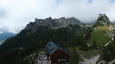
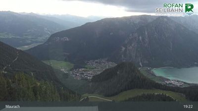

営業中のリフト: 0%
積雪情報
- 過去24時間: 0 cm
- 過去72時間: 0 cm
- 過去7日間: 0 cm
- 過去7日間: 山麓 0cm · 中腹 0cm · 山頂 0cm
- シーズン累計: 0 cm
About Astenberg – Wiesing
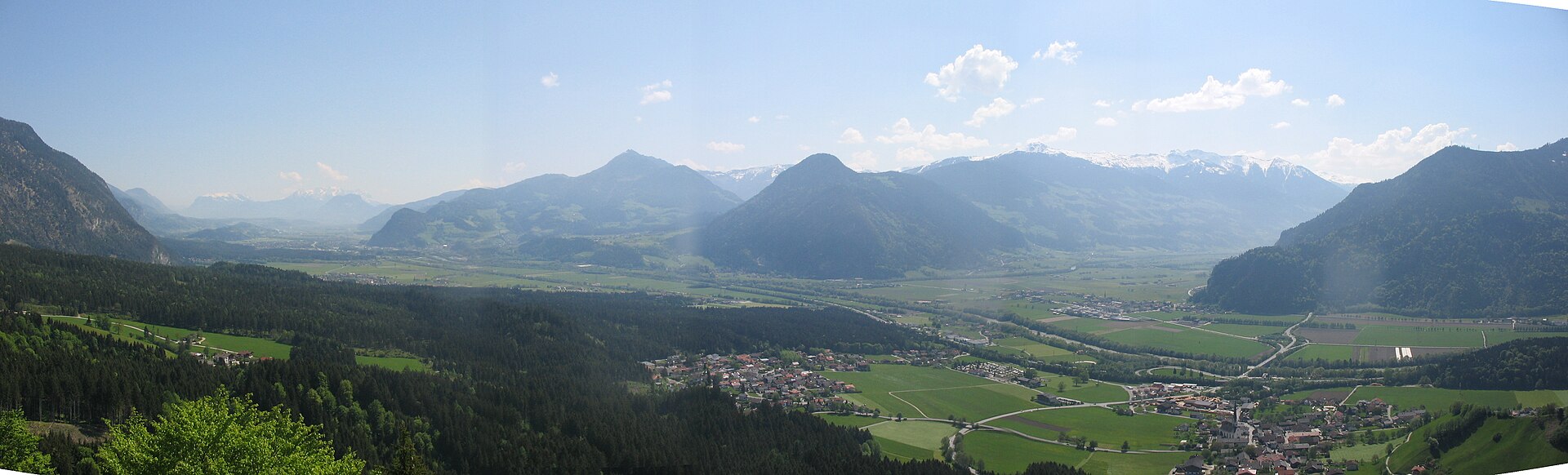
A quiet gateway to the Achensee region, known for its slow-paced Tirolean charm and panoramic views over the Inn Valley.
Highlights
- Traditional farmhouse architecture
- Panoramic valley vistas
- Rural Austrian tranquility
- Alpine hiking trails
Key Facts
- Altitude: 754m
- Top lift: 745m
- Ski pistes: 1km
- Ski lifts: 1
- Population: 29
- Lakes nearby: 11
- MTB trails: 501.9km
- Mountain huts: 14
Ski Area
Weather and 10-day forecast for Astenberg – Wiesing
- Today: 5 to 18 °C, clear sky, 12 h of sunshine
- Freezing level today: about 3415 m (2670 to 3630 m)
| Day | Min / max | Sky | Precipitation | Sunshine |
|---|---|---|---|---|
| 9月23日(水) | 5 / 18 °C | clear sky | dry | 12 h sun |
| 9月24日(木) | 9 / 19 °C | rain showers | dry | 1 h sun |
| 9月25日(金) | 5 / 16 °C | clear sky | dry | 12 h sun |
| 9月26日(土) | 8 / 20 °C | clear sky | dry | 12 h sun |
| 9月27日(日) | 11 / 22 °C | clear sky | dry | 12 h sun |
| 9月28日(月) | 13 / 26 °C | clear sky | dry | 11 h sun |
| 9月29日(火) | 14 / 26 °C | clear sky | dry | 11 h sun |
| 9月30日(水) | 13 / 25 °C | clear sky | dry | 10 h sun |
| 10月1日(木) | 10 / 24 °C | drizzle | dry | 2 h sun |
| 10月2日(金) | 11 / 14 °C | drizzle | dry | 0 h sun |
Things to do in Astenberg – Wiesing
Hikes nearby — Astenberg – Wiesing (20)
20+ curated hiking trails around Astenberg – Wiesing, sourced from OpenStreetMap and enriched with distance, elevation gain and difficulty.
-
Wanderweg 413
-
Wanderweg 401
Maurach - Grubascharte
-
Adlerweg Etappe 8
From the gondola descent of the Rofanseilbahn to Maurach, the route traces the southern shore of the Achensee to Pertisau before pushing deep into the Falzthurntal, passing the Falzthurnalm and the idyllic Gramaialm on its way to the valley's steep head. The final push screws upward in serpentines through loose scree and shattered slopes, arriving at the Lamsenjochhütte at 1,953 m beneath the spectacular rock walls of the Lamsenspitze.
-
Stanser Joch Kamm
-
Europäischer Fernwanderweg E4, Österreich, Rofan
Der Europäische Fernwanderweg E4 ist Teil des europäischen Wanderwegnetzes und soll den südwestlichsten Punkt des europäischen Kontinents in einem großen Bogen durch das westliche Mitteleuropa mit der im Südosten liegenden Insel Zypern verbinden. Der E4 ist mit einer Gesamtlänge von ungefähr 12.090 Kilometern bei weitem der längste aller Europäischen Fernwanderwege.
-
AV Weg 412
-
Adlerweg Etappe 7
Steinberg am Rofan - Erfurter Hütte
-
AV Weg 411
-
Wanderweg 12
-
Wanderweg 21
-
Wanderweg 15
Haidachstellwand
-
Wanderweg 19
-
Kienberg
-
9
-
4
-
Alpentiere Rundwanderweg
-
Brandenbergvariante - Alternative zum Nordalpenweg 01 in den Brandenberger Alpen
-
Burgenweg
-
Kapellenrundweg
-
Heilwasserweg
Mountain biking near Astenberg – Wiesing
- Bike Trail Tirol Etappe 16: Zell - Achensee
- Fügen - Hart - Bruck
- Rundweg Pletzachalm
- Bayreuther Hütte - Bergalm
- Panoramaweg
- Inntalradweg - Reith i. A.
Getting to Astenberg – Wiesing
Door-to-door travel times as used by the MR. ALPS ranking.
- Nearest airport: Innsbruck Airport (INN), 39 km away, about 40 min by road
- Innsbruck: 37 min by car, 41 km
- München: 1h36 by car, 131 km
- Bolzano - Bozen: 2h03 by car, 156 km
- Trento: 2h34 by car, 212 km
- Nürnberg: 3h05 by car, 300 km
- Verona: 3h32 by car, 307 km
Where to stay in Astenberg – Wiesing
200 places to stay for a night on 2026-09-25, from 191 EUR per night, median 474 EUR. Prices are direct with hotels and destinations, compared live on the Astenberg – Wiesing page.