Antagnod
ライブカメラ




営業中のリフト: 0/97
積雪情報
- 過去24時間: 0 cm
- 過去72時間: 0 cm
- 過去7日間: 0 cm
- 過去7日間: 山麓 0cm · 中腹 0cm · 山頂 0cm
- シーズン累計: 0 cm
About Antagnod
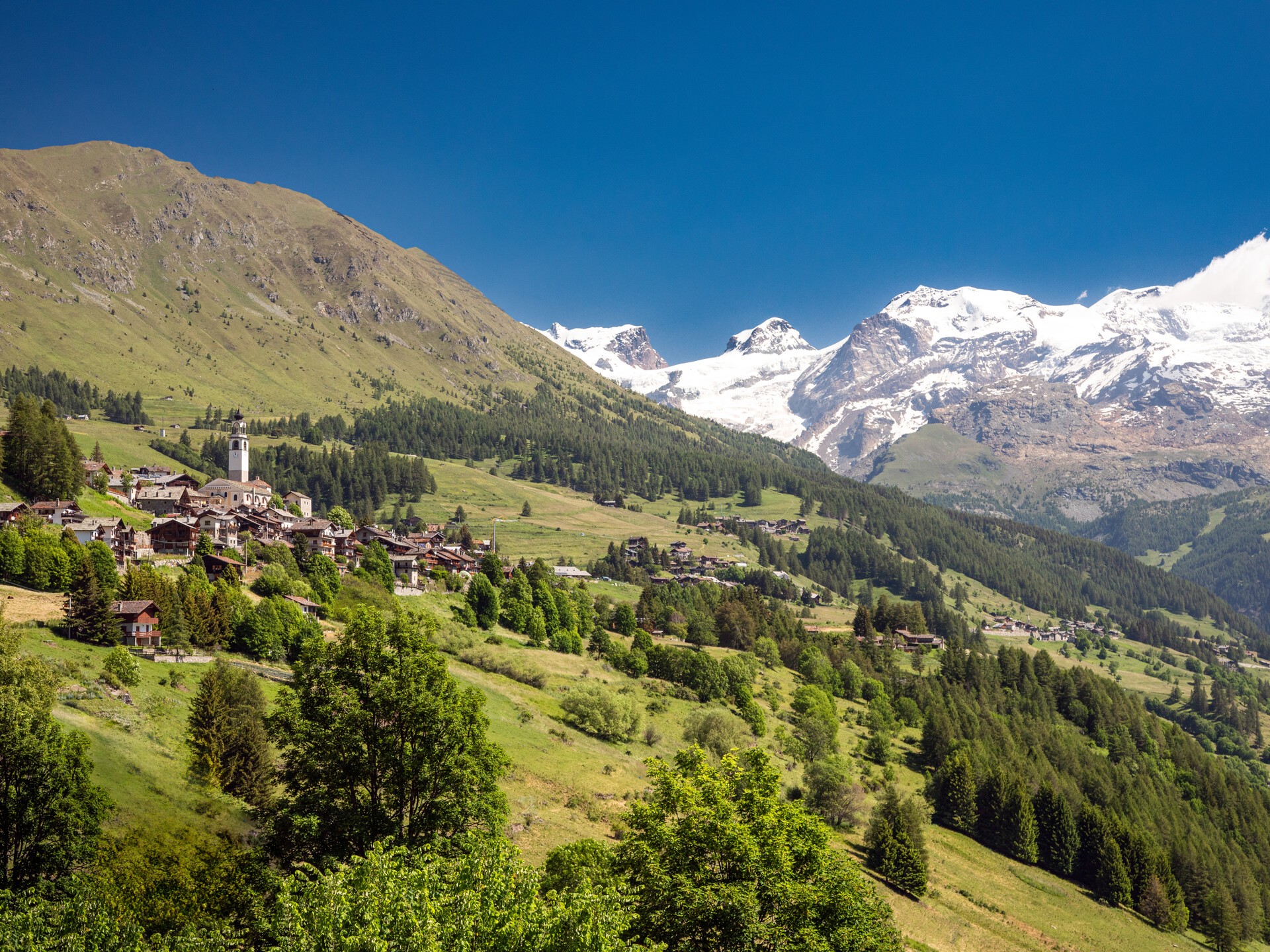
A sunny balcony over the Ayas Valley, where traditional Walser architecture meets a quiet, slow-paced Italian charm.
Highlights
- Walser wooden chalets
- Family-friendly slopes
- South-facing sun
- Panoramic valley views
Key Facts
- Altitude: 1730m
- Top lift: 2307m
- Ski pistes: 15km
- Ski lifts: 2
- Population: 242
- 4000m+ peaks nearby: 20
- Lakes nearby: 38
- MTB trails: 33.7km
- Mountain huts: 23
Ski Area
この目的地が含まれるシーズンパス
Weather and 10-day forecast for Antagnod
- Today: 11 to 18 °C, overcast, 2 h of sunshine
- Freezing level today: about 4328 m (3970 to 4650 m)
| Day | Min / max | Sky | Precipitation | Sunshine |
|---|---|---|---|---|
| 9月21日(月) | 11 / 18 °C | overcast | dry | 2 h sun |
| 9月22日(火) | 8 / 15 °C | clear sky | dry | 12 h sun |
| 9月23日(水) | 7 / 15 °C | partly cloudy | dry | 7 h sun |
| 9月24日(木) | 9 / 18 °C | clear sky | dry | 9 h sun |
| 9月25日(金) | 7 / 15 °C | overcast | dry | 3 h sun |
| 9月26日(土) | 8 / 17 °C | clear sky | dry | 12 h sun |
| 9月27日(日) | 6 / 13 °C | overcast | dry | 2 h sun |
| 9月28日(月) | 4 / 17 °C | clear sky | dry | 12 h sun |
| 9月29日(火) | 3 / 18 °C | clear sky | dry | 12 h sun |
| 9月30日(水) | 5 / 16 °C | overcast | dry | 2 h sun |
Things to do in Antagnod
Hikes nearby — Antagnod (17)
17 curated hiking trails around Antagnod, sourced from OpenStreetMap and enriched with distance, elevation gain and difficulty.
-
Alta Via n. 1 della Valle d'Aosta - Tappa 8
L'Alta via della Valle d'Aosta n. 1, detta anche Alta via dei Giganti è un'alta via il cui tracciato parte e termina nel territorio della Valle d'Aosta, ma si sviluppa in parte anche nel Biellese, al cospetto dei massicci più elevati delle Alpi: Monte Rosa, Cervino e Monte Bianco.
-
Gran Balconata del Cervino - Stage 6
-
Itinerario 6 Ru des Novalles
The Ru des Novalles is a still-active irrigation channel traced along a panoramic route that looks down over the village of Chamois and the surrounding landscape. Along the way, illustrated panels recount the history and nature of these *rus* — small masterworks of hydraulic engineering unique to the Aosta Valley.
-
Tour Monte Rosa tappa 3
around the Monte Rosa group
-
Tour Monte Rosa tappa 2
around the Monte Rosa group
-
Alta Via n. 1 della Valle d'Aosta - Tappa 7
Tappa n. 7 - Rifugio Vieux Crest (1935 mt.) - Rifugio Gran Tournalin (2535 mt.)
-
Gran Balconata del Cervino - Stage 4
-
Gran Balconata del Cervino - Stage 3
-
Ru Courtod
-
Grand Tournalin
-
Anello di Tzere
-
Le sorgenti del Lys
-
Sentier de l'Abbé Gorret
-
Ru de Verdetta
-
Ru de Chandianaz
-
Anello dei Villaggi di Antey ( Ruvère, Liesse,Fontaney, Villettaz)
-
Sentiero Walser
Mountain biking near Antagnod
- Ru Courtod
- Strada di Mascognaz
Getting to Antagnod
Door-to-door travel times as used by the MR. ALPS ranking.
- Nearest airport: Turin Airport (TRN), 69 km away, about 1h32 by road
- Torino: 1h30 by car, 106 km
- Milano: 2h13 by car, 173 km
- Genève: 2h44 by car, 197 km
- Genova: 2h46 by car, 233 km
- Annecy: 2h53 by car, 209 km
- Brescia: 3h04 by car, 259 km
Where to stay in Antagnod
200 places to stay for a night on 2026-09-25, from 92 EUR per night, median 181 EUR. Prices are direct with hotels and destinations, compared live on the Antagnod page.