Unterwasser
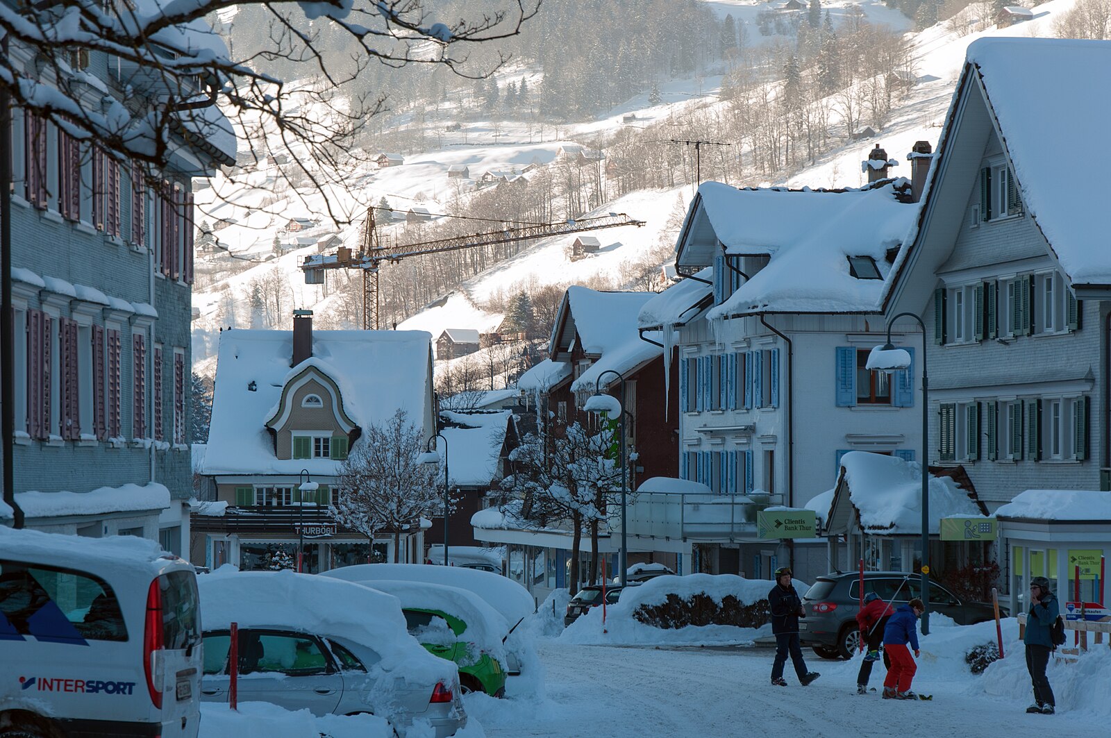
Webcam in diretta
Impianti aperti: 0/12
Bollettino neve
- Ultime 24h: 0 cm
- Ultime 72h: 0 cm
- Ultimi 7 giorni: 0 cm
- Ultimi 7 giorni: Valle 0cm · Mezza montagna 0cm · Cima 0cm
- Totale stagionale: 0 cm
Comprensori sciistici aperti ora · Bollettino neve
About Unterwasser
A low-key Toggenburg retreat where acoustic festivals and family-run inns offer a grounded alternative to Swiss glitz.
Highlights
- Traditional wooden architecture
- Ancient musical heritage
- Family-oriented slopes
- Authentic Toggenburg culture
Key Facts
- Altitude: 900m
- Top lift: 2262m
- Ski pistes: 50km
- Ski lifts: 12
- Population: 685
- Lakes nearby: 15
- MTB trails: 308.1km
- Mountain huts: 27
Ski Area
Weather and 10-day forecast for Unterwasser
- Today: 4 to 13 °C, clear sky, 11 h of sunshine
- Freezing level today: about 3738 m (3480 to 3900 m)
| Day | Min / max | Sky | Precipitation | Sunshine |
|---|---|---|---|---|
| mer 23 set | 4 / 13 °C | clear sky | dry | 11 h sun |
| gio 24 set | 6 / 11 °C | overcast | dry | 1 h sun |
| ven 25 set | 5 / 14 °C | clear sky | dry | 9 h sun |
| sab 26 set | 9 / 17 °C | partly cloudy | dry | 6 h sun |
| dom 27 set | 9 / 19 °C | clear sky | dry | 11 h sun |
| lun 28 set | 8 / 18 °C | partly cloudy | dry | 7 h sun |
| mar 29 set | 8 / 18 °C | clear sky | dry | 12 h sun |
| mer 30 set | 9 / 18 °C | overcast | dry | 1 h sun |
| gio 1 ott | 9 / 18 °C | partly cloudy | dry | 6 h sun |
| ven 2 ott | 9 / 19 °C | drizzle | dry | 5 h sun |
Things to do in Unterwasser
Hikes nearby — Unterwasser (20)
20+ curated hiking trails around Unterwasser, sourced from OpenStreetMap and enriched with distance, elevation gain and difficulty.
-
Thurweg
From the Gamplüt gondola station, the trail descends through flowering meadows and Toggenburg villages alongside the Säntisthur — a river whose source lies some 1,200 metres higher on Chalbersäntis — before plunging through the forested Chammerlitobel to reach the thundering Thur Falls. The route then passes through ravines and drops past the three Giessen Falls just before Nesslau.
-
Tschingla Chäserugg
-
Hochrugg - Bergwald
-
Hochrugg - Tschingla
-
Tschingla Sennis
-
Hochrugg - Tschingla
-
Voralp - Niederipass - Höchst - Voralp
-
Quinten Seeweg
-
rote Raute
-
Schwaldis - Hochrugg
-
Walenstadt - Pluder
-
Unterterzen-Walenstadt
The route climbs from the shores of the Walensee up into a varied mountain world, crossing the Maschgenkamm ridge where the panorama opens on one side to the Spitzmeilen massif and on the other to the jagged Churfirsten and Alviergruppe chains looming above the lake. The trail also takes in the celebrated 7-Gipfel-Tour, one of the region's signature highlights.
-
Margelchopf-Gipfelweg
The route climbs from the Malbun mountain restaurant through forest and alpine pastures, passing clusters of small mountain lakes where the Alpstein and Rhine Valley reflect in still water, before a hands-and-feet scramble up a stony peak with a pronounced north-facing rock face. From the grassy high plateau of Margelchopf — Grabs' local mountain — the view stretches across the St. Gallen Rhine Valley as far as Lake Constance, with Lake Voralp waiting at the trail's end.
-
Walenstadtberg - Quinten
The trail combines shady forest sections with sweeping views of mountain and lake, descending in a zigzag course through the woods before reaching the shoreline of the Walensee. The picturesque village of Quinten waits at the end of the route as a reward for the effort.
-
Voralpsee Ost rot
The route circles through alpine meadows and past highland bogs (Hochmoore), with views stretching across the Toggenburg and down into the Rhine Valley. At its heart lies the Voralpsee, an idyllic mountain lake ringed by gentle pastures and forest, with swimming spots and fire-grill huts on its shores.
-
Thurweg: Bergstation Gamplüt - Nesslau
-
Toggenburger Höhenweg: Wildhaus - Vordere Selunalp
-
Alpenpanorama-Weg: Schwägalp - Stein
-
Churfirsten-Weg
-
Gamplüt-Säntis-Weg
Mountain biking near Unterwasser
- Hörnli Bike - Etappe 3
- Panorama Bike - Etappe 3
- ex. Lüsis Bike
- Tesel-Gruebe-Zwinglipass
Getting to Unterwasser
Door-to-door travel times as used by the MR. ALPS ranking.
- Nearest airport: Bodensee Airport Friedrichshafen (FDH), 59 km away, about 1h40 by road
- Zürich: 1h24 by car, 93 km
- Luzern: 1h43 by car, 116 km
- Basel: 2h21 by car, 176 km
- Innsbruck: 2h36 by car, 187 km
- München: 2h44 by car, 242 km
- Biel/Bienne: 2h47 by car, 214 km
Where to stay in Unterwasser
107 places to stay for a night on 2026-09-25, from 137 EUR per night, median 295 EUR. Prices are direct with hotels and destinations, compared live on the Unterwasser page.