Megève
Alpi › Alpi Graie › Alpi del Beaufortain
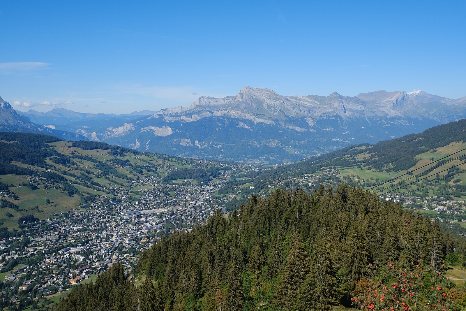
Webcam in diretta
Impianti aperti: 0/60
Bollettino neve
- Ultime 24h (1728 m): 13 cm
- Ultime 72h (1728 m): 75 cm
- Ultimi 7 giorni: Cima (2353 m) 93cm · Mezza montagna (1728 m) 81cm · Valle (1102 m) 0cm
- Totale stagionale (1728 m): 0 cm
Comprensori sciistici aperti ora · Bollettino neve
About Megève
The epitome of Savoyard soul, where horse-drawn carriages traverse cobblestone streets lined with Michelin stars and designer boutiques.
Highlights
- Old-world elegance
- Gourmet dining scene
- Medieval town center
- Discreet luxury
Key Facts
- Altitude: 1102m
- Top lift: 2353m
- Ski pistes: 235km
- Ski lifts: 81
- Population: 2,927
- 4000m+ peaks nearby: 7
- Lakes nearby: 14
- MTB trails: 379.8km
- Mountain huts: 30
Ski Area
Incluso in questi abbonamenti stagionali
Weather and 10-day forecast for Megève
- Today: 1 to 5 °C, rain, 0 h of sunshine
- Freezing level today: about 1909 m (1590 to 2710 m)
| Day | Min / max | Sky | Precipitation | Sunshine |
|---|---|---|---|---|
| dom 22 nov | 1 / 5 °C | rain | 95 mm rain | 0 h sun |
| lun 23 nov | 1 / 2 °C | rain | 33 mm rain | 0 h sun |
| mar 24 nov | -1 / 3 °C | overcast | 1 mm rain | 1 h sun |
| mer 25 nov | 1 / 4 °C | rain | 0 cm snow | 0 h sun |
| gio 26 nov | 0 / 3 °C | snow | 4 cm snow | 0 h sun |
| ven 27 nov | -3 / 3 °C | clear sky | dry | 8 h sun |
| sab 28 nov | 0 / 9 °C | mainly clear | dry | 6 h sun |
| dom 29 nov | -7 / 6 °C | rain | 0 mm rain | 5 h sun |
| lun 30 nov | -10 / 4 °C | overcast | dry | 9 h sun |
| mar 1 dic | -10 / 6 °C | overcast | dry | 8 h sun |
Things to do in Megève
Hikes nearby - Megève (10)
10 curated hiking trails around Megève, sourced from OpenStreetMap and enriched with distance, elevation gain and difficulty.
-
La Croix des Salles
A loop through the heart of Haute-Savoie, this route passes through varied landscapes of alpine pastures and dense forests, with views stretching across the Aravis and Mont Blanc ranges.
-
Le Petit Bois
-
Balade panoramique du Haut-Combloux
-
Rochebrune - Mègeve
-
Le Mont d'Arbois - Mont Joux
The route passes one of the last working alpine farms surrounded by meadow wildflowers — gentians, cowslips, and buttercups — before climbing to the Mont Joux orientation table, where an unobstructed panorama of the Mont Blanc massif opens up. Along the way, the path also looks out over a golf course spread across the high plateau below.
-
Col de Véry
A sporty route for confirmed walkers that climbs through steep forest before opening onto alpine pastures, with views over Mont Blanc and the Beaufortain — and the chance to spot marmots near Butte. The high pasture farms along the way offer abundant flora and cheese for sale.
-
Le Bettex - Arbois
This moderate loop from Le Bettex weaves through forest trails and gentle alpine scenery, with the gondola link between Le Bettex and Mont d'Arbois offering a panoramic reward — a sweeping view of Mont Blanc from the summit.
-
Aiguille Croche
Un itinerario di alta montagna nelle Alpi Settentrionali che sale fino alla vetta di 2.500 m dell'Aiguille Croche, una cima emblematica dell'Alta Savoia che offre viste panoramiche a 360°. Una tavola di orientamento in cima aiuta gli escursionisti a identificare le vette circostanti, mentre il sentiero percorre i versanti del Mont Joly con viste sulla valle verso il Mont Blanc.
-
Boucle des Bénés
-
Boucle de Miage
Mountain bike vicino a Megève
- Les Belvédères de Megève
- Mont d'Arbois
- Rochebrune
- La Panoramique
- Plan des dames
- Wizz Descente
- Les Montagnes d'Arbois
- Javen
Girato qui
- Downhill Racer (1969)
- Charade (1963)
Getting to Megève
Door-to-door travel times as used by the MR. ALPS ranking.
- Nearest airport: Geneva International Airport (GVA), 58 km away, about 1h24 by road
- Genève: 1h02 by car, 71 km
- Chambéry: 1h10 by car, 85 km
- Annecy: 1h11 by car, 83 km
- Grenoble: 1h34 by car, 116 km
- Lausanne: 1h47 by car, 132 km
- Lyon: 2h20 by car, 182 km
Where to stay in Megève
202 places to stay for a night on 2026-11-27, from 67 EUR per night, median 180 EUR. Prices are direct with hotels and destinations, compared live on the Megève page.