Marebbe / Enneberg
Alpi › Dolomiti › Northeastern Dolomites

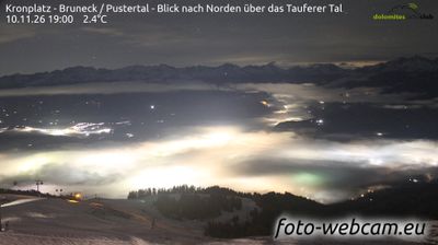
Webcam in diretta


Impianti aperti: 0/32
Bollettino neve
- Ultime 24h (1624 m): 2 cm
- Ultime 72h (1624 m): 3 cm
- Ultimi 7 giorni: Cima (2275 m) 9cm · Mezza montagna (1624 m) 9cm · Valle (973 m) 0cm
- Totale stagionale (1624 m): 0 cm
Comprensori sciistici aperti ora · Bollettino neve
About Marebbe / Enneberg
A Ladin stronghold where South Tyrolean tradition meets the rugged, pale peaks of the Fanes-Sennes-Prags nature park.
Highlights
- Ladin cultural heritage
- Dolomite gateway
- Rustic mountain farmsteads
- Quiet alpine elegance
Key Facts
- Altitude: 973m
- Top lift: 2275m
- Ski pistes: 91.2km
- Ski lifts: 31
- Population: 3,196
- Lakes nearby: 12
- MTB trails: 248.4km
- Mountain huts: 13
Ski Area
Incluso in questi abbonamenti stagionali
Weather and 10-day forecast for Marebbe / Enneberg
- Today: -2 to -1 °C, snow, 0 h of sunshine
- Freezing level today: about 1536 m (1430 to 1790 m)
- Snowfall in the last 7 days: 9 cm
| Day | Min / max | Sky | Precipitation | Sunshine |
|---|---|---|---|---|
| dom 22 nov | -2 / -1 °C | snow | dry | 0 h sun |
| lun 23 nov | -5 / 0 °C | partly cloudy | dry | 3 h sun |
| mar 24 nov | -6 / -1 °C | partly cloudy | dry | 5 h sun |
| mer 25 nov | -4 / 0 °C | snow | dry | 0 h sun |
| gio 26 nov | -2 / 0 °C | snow | dry | 1 h sun |
| ven 27 nov | -7 / -2 °C | snow | dry | 4 h sun |
| sab 28 nov | -9 / 0 °C | clear sky | dry | 9 h sun |
| dom 29 nov | -11 / 2 °C | overcast | dry | 3 h sun |
| lun 30 nov | -13 / 1 °C | partly cloudy | dry | 5 h sun |
| mar 1 dic | -13 / -1 °C | clear sky | dry | 6 h sun |
Things to do in Marebbe / Enneberg
Hikes nearby - Marebbe / Enneberg (20)
20+ curated hiking trails around Marebbe / Enneberg, sourced from OpenStreetMap and enriched with distance, elevation gain and difficulty.
-
Abteier Höhenweg
-
Über die Pragser Hochalm2
-
Tru di Pra
-
Tres la Val
-
A Soredl
-
Weilerweg A
-
Weilerweg B
-
1 - Al Plan de Mareo => Kronplatz
-
Rundweg Corones - Sentiero Corones
-
Val dl'Ert
-
Roda dles Viles
La vila è un insediamento rurale montano costituito da alcune case e fabbricati privati, con i servizi rustici essenziali in comune tipico della regione ladina nelle aree un tempo appartenenti alla Contea del Tirolo, in particolare in Val Badia dove ne esistono più di centoventi.
-
Panoramaweg
This trail climbs from Castelbadia up to the Sonnenburger Köpfl hill, where information panels reveal the history of the ancient Roman station Mansio Sebatum, with panoramic viewpoints opening over San Lorenzo di Sebato along the way.
-
Roda de Armentara
Soleggiate praterie alpine ai piedi del Sas dla Crusc si dispiegano lungo questo circuito con le ciaspole prevalentemente pianeggiante, passando per il rifugio Ranch de Anrdé e la conca di Valgiarëi prima di tornare in loop attraverso Arciara. A fine primavera, i Prati dell'Armentara esplodono di fiori di croco e di una grande varietà di fiori alpini all'interno del Parco Naturale Fanes-Senes-Braies.
-
Via Crucis d'La Val - Kreuzweg
-
Tru dles Viles
Questo facile anello si snoda tra boschi e prati tra La Villa e Badia, passando davanti a tradizionali masi ladini. Lungo il percorso visita Oies, dove la casa natale di san Josef Freinademetz si erge come punto di riferimento del patrimonio culturale locale.
-
Ferata dla Crusc - Heiligkreuzkofelsteig - Ferrata Monte Cavallo
-
Tru di Lëc
-
11 - Ehrenburg
-
2 - Lüsen => Montal
-
1 - Brixen => Natz => Rodeneck => Lüsen => AV2
Bressanone - Elvas - Naz - Luson
Mountain bike vicino a Marebbe / Enneberg
- MTB Gran Jú-Tour
- MTB Val-Costa-Tour
- Piz de Plaies
Getting to Marebbe / Enneberg
Door-to-door travel times as used by the MR. ALPS ranking.
- Nearest airport: Innsbruck Airport (INN), 77 km away, about 1h53 by road
- Bolzano - Bozen: 1h14 by car, 82 km
- Innsbruck: 1h43 by car, 115 km
- Trento: 1h45 by car, 138 km
- Verona: 2h43 by car, 233 km
- Padova: 3h04 by car, 235 km
- Brescia: 3h14 by car, 269 km