Dippoldiswalde
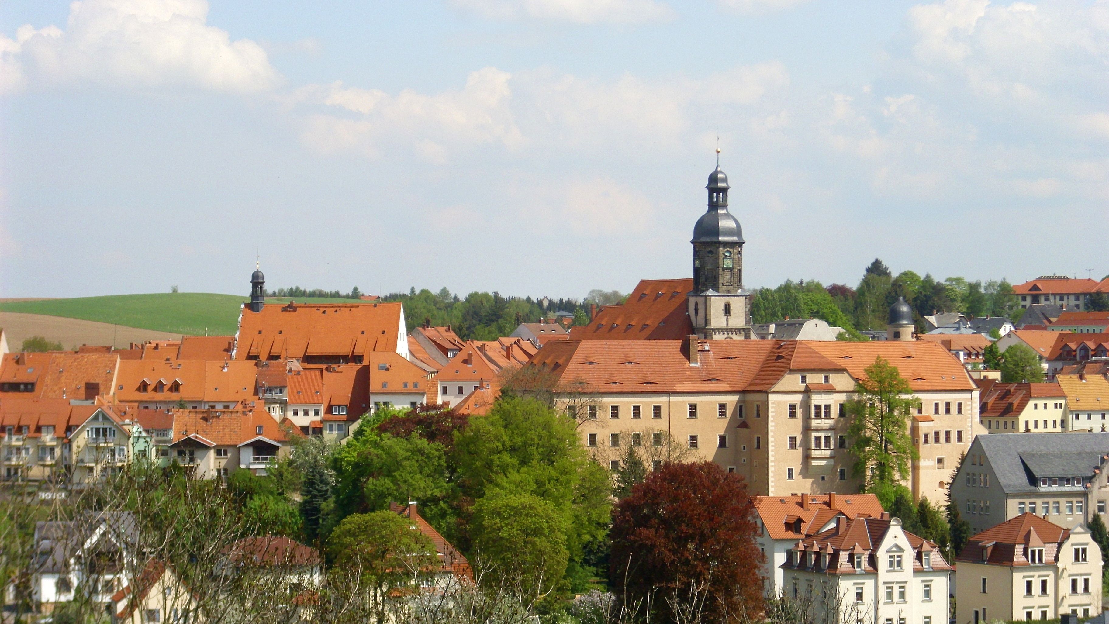
About Dippoldiswalde
A gateway to the Ore Mountains defined by its historic steam railway, red-roofed architecture, and tranquil reservoir lifestyle.
Highlights
- Vintage steam train
- Lakeside summer recreation
- Traditional Saxon crafts
- Gothic market square
Key Facts
- Altitude: 413m
- Top lift: 470m
- Ski pistes: 0.4km
- Ski lifts: 1
- Lakes nearby: 18
- MTB trails: 118.3km
Ski Area
Weather and 10-day forecast for Dippoldiswalde
- Today: 7 to 9 °C, rain, 0 h of sunshine
- Freezing level today: about 1658 m (1530 to 1840 m)
| Day | Min / max | Sky | Precipitation | Sunshine |
|---|---|---|---|---|
| jeu. 19 nov. | 7 / 9 °C | rain | dry | 0 h sun |
| ven. 20 nov. | 2 / 8 °C | rain showers | dry | 0 h sun |
| sam. 21 nov. | 1 / 4 °C | partly cloudy | dry | 3 h sun |
| dim. 22 nov. | 0 / 3 °C | partly cloudy | dry | 3 h sun |
| lun. 23 nov. | -2 / 0 °C | snow showers | dry | 3 h sun |
| mar. 24 nov. | -4 / 0 °C | clear sky | dry | 7 h sun |
| mer. 25 nov. | -4 / 1 °C | clear sky | dry | 9 h sun |
| jeu. 26 nov. | -3 / 3 °C | clear sky | dry | 7 h sun |
| ven. 27 nov. | 0 / 5 °C | clear sky | dry | 6 h sun |
| sam. 28 nov. | 0 / 4 °C | drizzle | dry | 5 h sun |
Things to do in Dippoldiswalde
Hikes nearby - Dippoldiswalde (20)
20+ curated hiking trails around Dippoldiswalde, sourced from OpenStreetMap and enriched with distance, elevation gain and difficulty.
-
Wanderung von Bärenfels durch das romantische Pöbeltal
-
Vom Eisernen Kreuz über die Rabenauer Alberthöhe
-
Hike around Liebstadt
-
Von Freital an der Roten Weißeritz entlang durch den Rabenauer Grund
-
Energie Erlebnispfad der SachsenEnergie AG
-
Liebstadt: Rundwanderung mit Schloss Kuckuckstein
-
Historischer Rundwanderweg Berreuth
-
Trinkwasserlehrpfad Lehnmühle - Klingenberg
-
Fernwanderweg Görlitz – Greiz (Teil: Glashütte – Frauenstein)
-
Grüner Punkt
-
Grüner Punkt
-
Gelber Punkt
-
Rundwanderweg um die Uhrenstadt Glashütte
-
Rundweg Hirschbachheide
-
Gelber Balken
-
Gelber Balken
-
Rundweg A Kreischa
Kreischa - Lungkwitz –Teufelsmühle - Wilisch - Kreischa
-
Rundweg B Kreischa
Kreischa - Hermsdorf - Quohrener Kipse - Karsdorf - Quohren - Kreischa
-
Grüner Punkt
-
Gelber Balken Dittersdorf
VTT près de Dippoldiswalde
- BLOCKLINE Gesamtstrecke an zwei Tagen: 1. Tag Holzhau - Mulda (Kombination Freiberger Eisenbahn)
- Blockline Etappe 05: Altenberg » Bärenfels
- Blockline Etappe 06: Bärenfels » Hermsdorf
- Firstenweg
- Oberer Denkmalsweg
- Denkmalsweg
- Ottertellenweg
Getting to Dippoldiswalde
Door-to-door travel times as used by the MR. ALPS ranking.
- Nearest airport: Dresden Airport (DRS), 31 km away, about 1h04 by road
- Berlin: 2h47 by car, 228 km
- Nürnberg: 3h34 by car, 331 km
- München: 4h59 by car, 480 km
- Frankfurt am Main: 5h04 by car, 487 km
- Wien: 5h26 by car, 461 km
- Stuttgart: 5h33 by car, 527 km
Where to stay in Dippoldiswalde
67 places to stay for a night on 2026-11-27, from 108 EUR per night, median 131 EUR. Prices are direct with hotels and destinations, compared live on the Dippoldiswalde page.