Lauterbrunnen
Alpes › Préalpes Suisses › Préalpes Bernoises
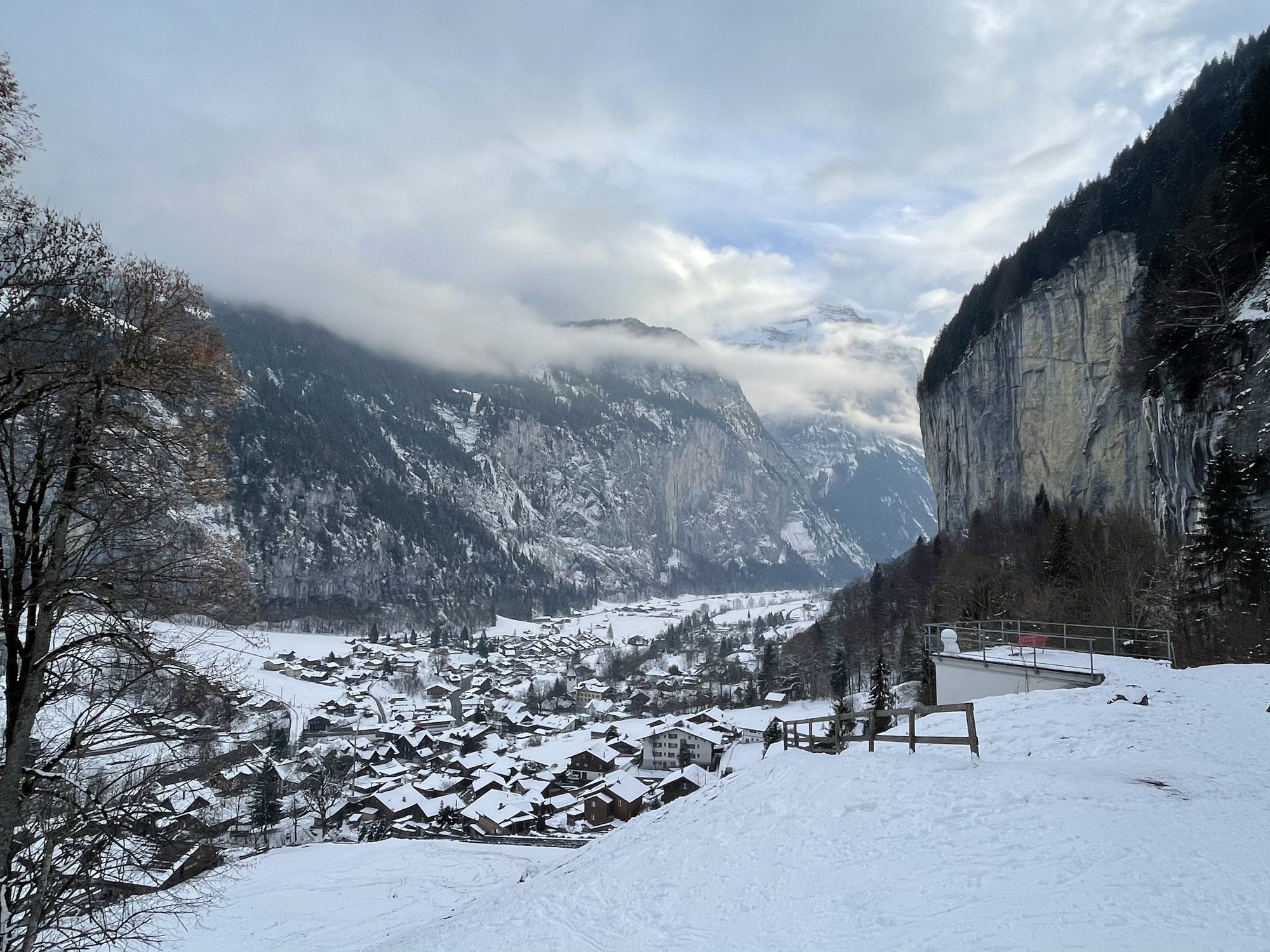
Webcam en direct



Remontées ouvertes: 0/49
Bulletin d'enneigement
- Dernières 24h (1883 m): 8 cm
- Dernières 72h (1883 m): 24 cm
- 7 derniers jours: Sommet (2970 m) 59cm · Mi-montagne (1883 m) 31cm · Vallée (795 m) 3cm
- Cumul de saison (1883 m): 13 cm
Domaines skiables ouverts maintenant · Bulletin d'enneigement
About Lauterbrunnen
A vertical valley of cascading waterfalls and misty cliffs that serves as the gateway to the Bernese Oberland's high-altitude peaks.
Highlights
- Dramatic valley floor
- Thundering glacial waterfalls
- Base jumping hub
- Traditional wooden chalets
Key Facts
- Altitude: 795m
- Top lift: 2970m
- Ski pistes: 168km
- Ski lifts: 49
- Population: 2,558
- 4000m+ peaks nearby: 6
- Lakes nearby: 5
- MTB trails: 77.9km
- Mountain huts: 26
Ski Area
Inclus dans ces forfaits saison
Weather and 10-day forecast for Lauterbrunnen
- Today: 3 to 8 °C, rain, 0 h of sunshine
- Freezing level today: about 2283 m (1820 to 2830 m)
| Day | Min / max | Sky | Precipitation | Sunshine |
|---|---|---|---|---|
| dim. 22 nov. | 3 / 8 °C | rain | 8 mm rain | 0 h sun |
| lun. 23 nov. | 2 / 4 °C | rain showers | 23 mm rain | 0 h sun |
| mar. 24 nov. | 1 / 7 °C | overcast | dry | 1 h sun |
| mer. 25 nov. | 3 / 7 °C | overcast | 0 mm rain | 1 h sun |
| jeu. 26 nov. | 0 / 3 °C | snow | 9 cm snow | 0 h sun |
| ven. 27 nov. | 0 / 1 °C | overcast | dry | 1 h sun |
| sam. 28 nov. | 0 / 5 °C | clear sky | dry | 9 h sun |
| dim. 29 nov. | 3 / 7 °C | rain | 2 mm rain | 2 h sun |
| lun. 30 nov. | -2 / 5 °C | partly cloudy | 0 mm rain | 9 h sun |
| mar. 1 déc. | -2 / 4 °C | partly cloudy | dry | 9 h sun |
Things to do in Lauterbrunnen
Hikes nearby - Lauterbrunnen (20)
20+ curated hiking trails around Lauterbrunnen, sourced from OpenStreetMap and enriched with distance, elevation gain and difficulty.
-
Aenderbergbrügg circular hiking route
-
Rundwanderung Erschwandenfall
-
Vom See zum Berg / Bönigen – Schilthorn 2023
-
Tüürli Interlaken – Tasting walk
-
Sytiberg circular hiking route
-
Via Alpina
Walking in the shadow of the Eiger and Jungfrau, this stage of the long-distance Via Alpina threads through the quintessential car-free village of Wengen on its point-to-point traverse of the Bernese Oberland. The route crosses Alpine pastures filled with the sound of cowbells, connecting Grindelwald to Lauterbrunnen across demanding mountain terrain.
-
Wasserbrücke - Untere Busenalp
markierter Wanderweg
-
Wasserbrücke - fixme
markierter Wanderweg
-
Stechelberg / Rütti - Schilthornbahn
markierter Wanderweg
-
Mountain View Trail
A point-to-point route running from Grütschalp to Allmendhubel, this trail delivers first-class panoramic views of the Bernese Alps' 4000m peaks — the Eiger, and its neighbours — in one sustained sweep.
-
Trachsellauenen - Im Boden
markierter Wanderweg
-
Lauterbrunnen - Schilthornbahn
markierter Wanderweg
-
Obersteinberg - fixme
markierter Wanderweg
-
Obersteinberg - Oberhornsee
Le sentier monte depuis Stechelberg à travers la haute vallée de Lauterbrunnen — une zone alpine protégée depuis 1960 — en passant par Trachsellauenen et l'hôtel de montagne rustique d'Obersteinberg avant d'atteindre l'Oberhornsee à 2065 m. L'itinéraire est réputé pour ses paysages et sa botanique, sans aucun asphalte sous les pieds tout au long du parcours.
-
Sousegg - Sattel
-
Sattel - Glütschnessli
-
Zustieg Rottalhütte
The route climbs through the Lauterbrunnen valley to the 2,755 m Rottalhütte — built in 1907 and last renovated in 2013 — passing through Sichellauenen and Stuefestein before reaching the foot of the Rottalgrat, with the Ebnefluh, Gletscherhorn, Rottalhorn, and Jungfrau looming above. The hut itself is described as a "very sympathetic old-style" refuge, complete with a winter room, perched at the edge of the Rottalgletscher.
-
Floschwald/Sausmatten - Grütschalp
-
Zustieg Silberhornhütte
-
Via Alpina
VTT près de Lauterbrunnen
- Alpine Bike - Etappe 12
- Mürren Bike
- Grütsch-Trail
- Eigertrail
Tourné ici
- An Evening in Paris (1967)
Getting to Lauterbrunnen
Door-to-door travel times as used by the MR. ALPS ranking.
- Nearest airport: Bern Airport (BRN), 48 km away, about 1h08 by road
- Bern: 59 min by car, 67 km
- Luzern: 1h16 by car, 79 km
- Biel/Bienne: 1h22 by car, 103 km
- Zürich: 1h52 by car, 129 km
- Basel: 1h58 by car, 158 km
- Lausanne: 2h09 by car, 174 km
Where to stay in Lauterbrunnen
295 places to stay for a night on 2026-11-27, from 154 EUR per night, median 312 EUR. Prices are direct with hotels and destinations, compared live on the Lauterbrunnen page.