Höchenschwand
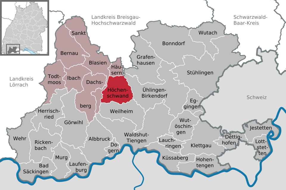
About Höchenschwand
Perched on a sunny ridge, this Black Forest village is the go-to retreat for panoramic Alpine views and restorative high-altitude air.
Highlights
- Panoramic ridge walks
- Climatic health spa
- Southern forest views
- Traditional sun terraces
Key Facts
- Altitude: 955m
- Top lift: 995m
- Ski pistes: 0.3km
- Ski lifts: 1
- Lakes nearby: 9
- MTB trails: 286.7km
- Mountain huts: 1
Ski Area
Weather and 10-day forecast for Höchenschwand
- Today: 8 to 17 °C, overcast, 2 h of sunshine
- Freezing level today: about 3665 m (3450 to 3890 m)
| Day | Min / max | Sky | Precipitation | Sunshine |
|---|---|---|---|---|
| jue, 24 sept | 8 / 17 °C | overcast | dry | 2 h sun |
| vie, 25 sept | 5 / 18 °C | partly cloudy | dry | 8 h sun |
| sáb, 26 sept | 9 / 24 °C | clear sky | dry | 12 h sun |
| dom, 27 sept | 11 / 25 °C | clear sky | dry | 12 h sun |
| lun, 28 sept | 13 / 26 °C | clear sky | dry | 12 h sun |
| mar, 29 sept | 12 / 26 °C | clear sky | dry | 11 h sun |
| mié, 30 sept | 14 / 25 °C | partly cloudy | dry | 5 h sun |
| jue, 1 oct | 12 / 23 °C | clear sky | dry | 9 h sun |
| vie, 2 oct | 11 / 17 °C | drizzle | dry | 3 h sun |
| sáb, 3 oct | 10 / 18 °C | partly cloudy | dry | 5 h sun |
Things to do in Höchenschwand
Hikes nearby — Höchenschwand (20)
20+ curated hiking trails around Höchenschwand, sourced from OpenStreetMap and enriched with distance, elevation gain and difficulty.
-
Mittelweg (westliche Variante)
Lenzkirch - Schluchsee - Häusern - Waldshut
-
Mittelweg (östliche Variante)
Lenzkirch - Rothaus - Mettmatal - Waldshut
-
Albsteig Schwarzwald
Albbruck - Görwihl - Häusern - St. Blasien - Menzenschwand - Feldberg-Passhöhe - Bernau - St. Blasien
-
Wolfssteig
-
Schluchtensteig Etappe 5 [St. Blasien - Todtmoos]
Narrow paths cross the open Hotzwald landscape of mountain meadows, with views stretching as far as the Alps, before the route plunges into the Hohwehraschlucht gorge.
-
Schluchtensteig Etappe 4 [Fischbach - St. Blasien]
-
Bergbaurundweg
-
Domsteig
Premiumwanderweg Genießerpfad
-
Hans-Thoma-Weg - Heuberg
-
Sandboden - Windberghof
-
Todtmoos - Sankt Blasien
blaue Raute Todtmoos, Lindau, Unteribach, Ibacher Kluse, St. Blasien
-
Hans-Thoma-Weg - St. Blasien Ehem. Schwimmbad
-
Dachsweg
Kindererlebnispfad
-
Weidelehrpfad
-
Eselshütte - Muchenland Parkplatz
-
blaue Raute Hornberg - Langewald
-
blaue Raute Schluchsee - Heidenmühle
-
Berauer Wuhr
-
7-Moore-Weg
-
blaue Raute Stühlingen - Rothaus
Mountain biking near Höchenschwand
- Gipfeltrail Hochschwarzwald
- MTB X-Ing SÄK-DS
- Moosweg
- Haagsträssle
- Eschhuettenweg
- Mittlerer Hangweg
Getting to Höchenschwand
Door-to-door travel times as used by the MR. ALPS ranking.
- Nearest airport: Zürich Airport (ZRH), 42 km away, about 1h02 by road
- Basel: 1h02 by car, 70 km
- Zürich: 1h07 by car, 71 km
- Luzern: 1h37 by car, 106 km
- Biel/Bienne: 1h50 by car, 139 km
- Bern: 1h51 by car, 141 km
- Strasbourg: 2h02 by car, 149 km
Where to stay in Höchenschwand
193 places to stay for a night on 2026-09-25, from 112 EUR per night, median 246 EUR. Prices are direct with hotels and destinations, compared live on the Höchenschwand page.