Valmorel
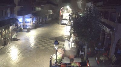
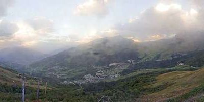
Webcam en directo
Remontes abiertos: 0/43
Parte de nieve
- Últimas 24h: 0 cm
- Últimas 72h: 0 cm
- Últimos 7 días: 0 cm
- Últimos 7 días: Valle 0cm · Media montaña 0cm · Cumbre 0cm
- Acumulado de temporada: 1.4 cm
Estaciones de esquí abiertas ahora · Parte de nieve
About Valmorel
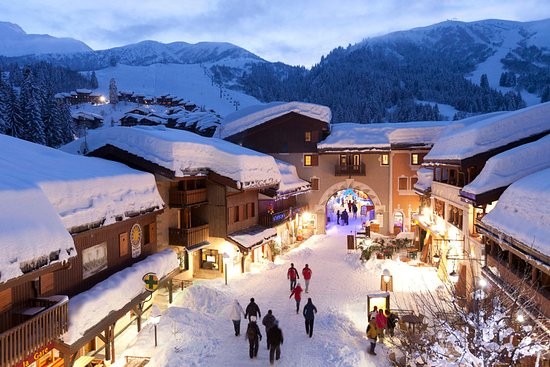
A purpose-built pedestrian sanctuary where slate-roofed chalets and stone facades preserve the soul of a traditional Savoyard hamlet.
Highlights
- Pedestrianized village center
- Traditional stone architecture
- Family-friendly atmosphere
- Slated-roof chalets
Key Facts
- Altitude: 1354m
- Top lift: 2403m
- Ski pistes: 165km
- Ski lifts: 47
- Population: 778
- Lakes nearby: 8
- MTB trails: 296.3km
- Mountain huts: 13
Ski Area
Le Grand Domaine – Valmorel/Doucy/Celliers/St François Longchamp
Weather and 10-day forecast for Valmorel
- Today: 11 to 19 °C, partly cloudy, 5 h of sunshine
- Freezing level today: about 4093 m (3930 to 4230 m)
| Day | Min / max | Sky | Precipitation | Sunshine |
|---|---|---|---|---|
| jue, 24 sept | 11 / 19 °C | partly cloudy | dry | 5 h sun |
| vie, 25 sept | 11 / 20 °C | partly cloudy | dry | 6 h sun |
| sáb, 26 sept | 11 / 21 °C | clear sky | dry | 12 h sun |
| dom, 27 sept | 12 / 22 °C | clear sky | dry | 11 h sun |
| lun, 28 sept | 12 / 22 °C | clear sky | dry | 12 h sun |
| mar, 29 sept | 15 / 23 °C | clear sky | dry | 12 h sun |
| mié, 30 sept | 15 / 21 °C | overcast | dry | 3 h sun |
| jue, 1 oct | 14 / 24 °C | drizzle | 1 mm rain | 11 h sun |
| vie, 2 oct | 9 / 15 °C | rain showers | 25 mm rain | 10 h sun |
| sáb, 3 oct | 6 / 14 °C | drizzle | 1 mm rain | 11 h sun |
Things to do in Valmorel
Hikes nearby — Valmorel (15)
15 curated hiking trails around Valmorel, sourced from OpenStreetMap and enriched with distance, elevation gain and difficulty.
-
Sentier balcon du Nielard
-
Boucle de la Maison Blanche
A steep climb rewards you with a plateau where Tarine cows graze and let you pass among them, before the trail drops back down through the woods toward Valmorel — with fine views from the top.
-
Boucle de la Belle Balade
-
Boucle de Crève-Tête
A cross-marked summit at 2,342m rewards the climb with a 360° panorama spanning Mont Blanc, the Vanoise glaciers, the Lauzière massif, and the Belleville Valley. The route threads through forest and alpine pasture, passing a chalet restaurant at Priarond and a Saint-Roch oratory before a final steep push along the ridge to the top.
-
Col de la Madeleine
-
L'Avancheraine
Half of the route threads through shaded forest, the other half crossing sun-drenched flowery meadows, before opening onto a panoramic view of the Morel Valley and the Lauzière Massif at Plan Parc (1425m). Along the way, the trail passes through the traditional villages and hamlets of the Avanchers, beginning at 1340m beside the Morel river.
-
Boucle de la Sauge
-
Boucle du Moulin de Cornet
-
Montagne de Tête
-
Boucle des cascades
-
Les Balcons du Morel
-
Boucle de Ronchat
-
La Glaizette
-
Boucle des Pissus
-
Boucle de Feissons
Mountain biking near Valmorel
- Sur les traces de l'hydroélectricité à la Coche
- Tonton Crampons
- La Vertingoule
- La Meuh
- Valmo Airline
- La Croué
- Valmortel
- Tournée Générale
Getting to Valmorel
Door-to-door travel times as used by the MR. ALPS ranking.
- Nearest airport: Lyon Saint-Exupéry Airport (LYS), 110 km away, about 1h54 by road
- Chambéry: 1h10 by car, 86 km
- Grenoble: 1h34 by car, 117 km
- Annecy: 1h34 by car, 82 km
- Genève: 2h08 by car, 126 km
- Lyon: 2h20 by car, 183 km
- Lausanne: 2h48 by car, 188 km
Where to stay in Valmorel
57 places to stay for a night on 2026-09-25, from 50 EUR per night, median 108 EUR. Prices are direct with hotels and destinations, compared live on the Valmorel page.