Pichl (Gsies)
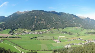
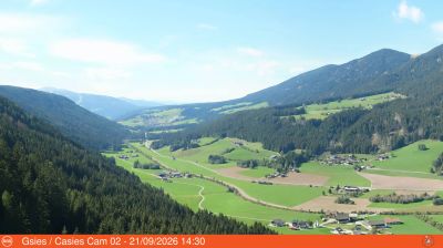
Webcam en directo

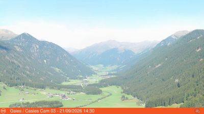
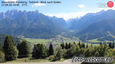
Remontes abiertos: 0%
Parte de nieve
- Últimas 24h: 0 cm
- Últimas 72h: 0 cm
- Últimos 7 días: 0 cm
- Últimos 7 días: Valle 0cm · Media montaña 0cm · Cumbre 0cm
- Acumulado de temporada: 0 cm
Estaciones de esquí abiertas ahora · Parte de nieve
About Pichl (Gsies)
A quiet South Tyrolean retreat where farm-to-table traditions and vast cross-country trails define a slower pace of Alpine life.
Highlights
- Cross-country skiing hub
- Traditional farmstead inns
- Quiet valley atmosphere
- Ladin culinary heritage
Key Facts
- Altitude: 1227m
- Top lift: 1397m
- Ski pistes: 1km
- Ski lifts: 1
- Population: 2,256
- Lakes nearby: 6
- MTB trails: 178.4km
- Mountain huts: 8
Ski Area
Weather and 10-day forecast for Pichl (Gsies)
- Today: 3 to 15 °C, clear sky, 13 h of sunshine
- Freezing level today: about 3368 m (2730 to 3630 m)
| Day | Min / max | Sky | Precipitation | Sunshine |
|---|---|---|---|---|
| mié, 23 sept | 3 / 15 °C | clear sky | dry | 13 h sun |
| jue, 24 sept | 5 / 17 °C | rain showers | dry | 1 h sun |
| vie, 25 sept | 3 / 15 °C | clear sky | dry | 12 h sun |
| sáb, 26 sept | 6 / 19 °C | clear sky | dry | 12 h sun |
| dom, 27 sept | 8 / 19 °C | clear sky | dry | 11 h sun |
| lun, 28 sept | 9 / 23 °C | clear sky | dry | 11 h sun |
| mar, 29 sept | 12 / 22 °C | clear sky | dry | 8 h sun |
| mié, 30 sept | 13 / 20 °C | partly cloudy | dry | 5 h sun |
| jue, 1 oct | 10 / 18 °C | partly cloudy | dry | 4 h sun |
| vie, 2 oct | 10 / 15 °C | overcast | dry | 1 h sun |
Things to do in Pichl (Gsies)
Hikes nearby — Pichl (Gsies) (20)
20+ curated hiking trails around Pichl (Gsies), sourced from OpenStreetMap and enriched with distance, elevation gain and difficulty.
-
Römerweg - Via Romana
-
Lottersteig
-
Via Alpina Red R29
Rifugio Biella - St. Martin in Gsies
-
Via Alpina Red R30
St. Martin in Gsies / S. Martino in Casies - Antholz-Mittertal / Anterselva di Mezzo
-
Gsieser Talblickweg
The Talblickweg threads through the full length of the Gsies Valley, passing farmsteads, meadows, and forest while delivering valley views from multiple vantage points rather than just one. A shorter loop near St. Magdalena winds along the Gsieser Bach, crosses small bridges, and passes a series of contemplation stops before entering deciduous woodland to the south.
-
Lanerweg
-
Lang-Erl-Weg
-
Themenweg Niederdorf
-
Moosweg
-
Maistattweg
-
Dolomitenblicksteig
The Dolomitenblicksteig runs high above the Gsies Valley (Gsieser Tal), offering unbroken views into the Dolomites along the entire route. The terrain is varied — dense forest alternates with open ground — and the panorama extends down over the Puster Valley as well.
-
Große Schlossrunde
This easy loop out of Welsberg passes Schloss Welsperg — a castle dating to the 12th century at the entrance to the Gsieser Tal — and includes a detour to the ruins of Thurn, following old paths through the valley.
-
Über die Jöcher
-
Besinnungsweg
-
Toblacher Höhenweg
-
Dolomitenpanoramaweg
-
Almweg 2000
-
Almweg 2000
-
Dolomitenblickrunde
-
Biotopweg - Via del Biotopo
Mountain biking near Pichl (Gsies)
- Haselsberg - Costa Nosellari
- Talerweg
Getting to Pichl (Gsies)
Door-to-door travel times as used by the MR. ALPS ranking.
- Nearest airport: Bolzano Airport (BZO), 75 km away, about 1h34 by road
- Bolzano - Bozen: 1h29 by car, 98 km
- Innsbruck: 1h58 by car, 131 km
- Trento: 2h by car, 154 km
- Verona: 2h58 by car, 249 km
- Padova: 3h by car, 232 km
- Brescia: 3h28 by car, 285 km
Where to stay in Pichl (Gsies)
200 places to stay for a night on 2026-09-25, from 132 EUR per night, median 359 EUR. Prices are direct with hotels and destinations, compared live on the Pichl (Gsies) page.