La Giettaz
Webcam en directo


Remontes abiertos: 0/20
Parte de nieve
- Últimas 24h: 0 cm
- Últimas 72h: 0 cm
- Últimos 7 días: 0 cm
- Últimos 7 días: Valle 0cm · Media montaña 0cm · Cumbre 0cm
- Acumulado de temporada: 0 cm
Estaciones de esquí abiertas ahora · Parte de nieve
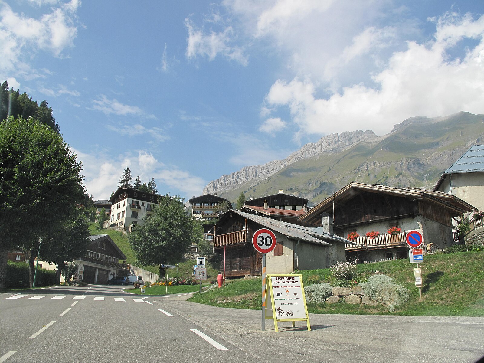
About La Giettaz
A secluded Aravis hideaway where quiet pine forests and rustic farmsteads offer a soulful alternative to the nearby glitter of Megève.
Highlights
- Secret powder stashes
- Traditional Reblochon farms
- Unspoiled mountain views
- Low-key atmosphere
Key Facts
- Altitude: 1095m
- Top lift: 1835m
- Ski pistes: 85km
- Ski lifts: 23
- Population: 379
- Lakes nearby: 12
- MTB trails: 183.4km
- Mountain huts: 19
Ski Area
Les Portes du Mont Blanc – Combloux/Megève le Jaillet/La Giettaz/Cordon
Incluido en estos pases de temporada
Weather and 10-day forecast for La Giettaz
- Today: 8 to 19 °C, clear sky, 9 h of sunshine
- Freezing level today: about 4235 m (3940 to 4430 m)
| Day | Min / max | Sky | Precipitation | Sunshine |
|---|---|---|---|---|
| vie, 25 sept | 8 / 19 °C | clear sky | dry | 9 h sun |
| sáb, 26 sept | 8 / 20 °C | clear sky | dry | 11 h sun |
| dom, 27 sept | 11 / 22 °C | clear sky | dry | 12 h sun |
| lun, 28 sept | 11 / 22 °C | clear sky | dry | 12 h sun |
| mar, 29 sept | 12 / 23 °C | overcast | dry | 2 h sun |
| mié, 30 sept | 10 / 18 °C | overcast | dry | 1 h sun |
| jue, 1 oct | 10 / 20 °C | clear sky | dry | 12 h sun |
| vie, 2 oct | 8 / 12 °C | rain showers | dry | 0 h sun |
| sáb, 3 oct | 5 / 17 °C | partly cloudy | dry | 6 h sun |
| dom, 4 oct | 6 / 18 °C | clear sky | dry | 11 h sun |
Things to do in La Giettaz
Hikes nearby — La Giettaz (5)
5 curated hiking trails around La Giettaz, sourced from OpenStreetMap and enriched with distance, elevation gain and difficulty.
-
Porte des Aravis par la Combe Creuse
Hemmed in by the cliffs of Aiguille Verte and Les Parrossaz, the Combe de la Creuse funnels you upward through a physically demanding ascent marked by cairns, delivering you at last to the Porte des Aravis — a col at 2400 m, unmistakable between its twin rock walls and commanding one of the finest panoramas in Haute-Savoie.
-
Massif de Tournette-Aravis
A strenuous loop through the Bornes massif, this route climbs from the hamlet of Montmin to the summit of La Tournette at 2,351 metres, where the effort is rewarded with a fine view of Mont Blanc. The early kilometres follow a stony path with a steep descent before the long push to the top.
-
KV de Manigod
-
Boucle des Bénés
-
Balade panoramique du Haut-Combloux
Mountain biking near La Giettaz
- Le Tour de la Tête du Torraz
- Les Chalets de Pétetruy
- La route des Montagnes (Route de la soif)
- Treffléannaise
- Descente du Torraz
- DH du Loup
- Enduro des Tétras
- VTT Enduro des Encarnes N°15
Getting to La Giettaz
Door-to-door travel times as used by the MR. ALPS ranking.
- Nearest airport: Geneva International Airport (GVA), 51 km away, about 1h37 by road
- Annecy: 57 min by car, 45 km
- Chambéry: 1h04 by car, 81 km
- Genève: 1h07 by car, 64 km
- Grenoble: 1h27 by car, 112 km
- Lausanne: 1h52 by car, 125 km
- Lyon: 2h14 by car, 178 km
Where to stay in La Giettaz
135 places to stay for a night on 2026-09-25, from 68 EUR per night, median 178 EUR. Prices are direct with hotels and destinations, compared live on the La Giettaz page.