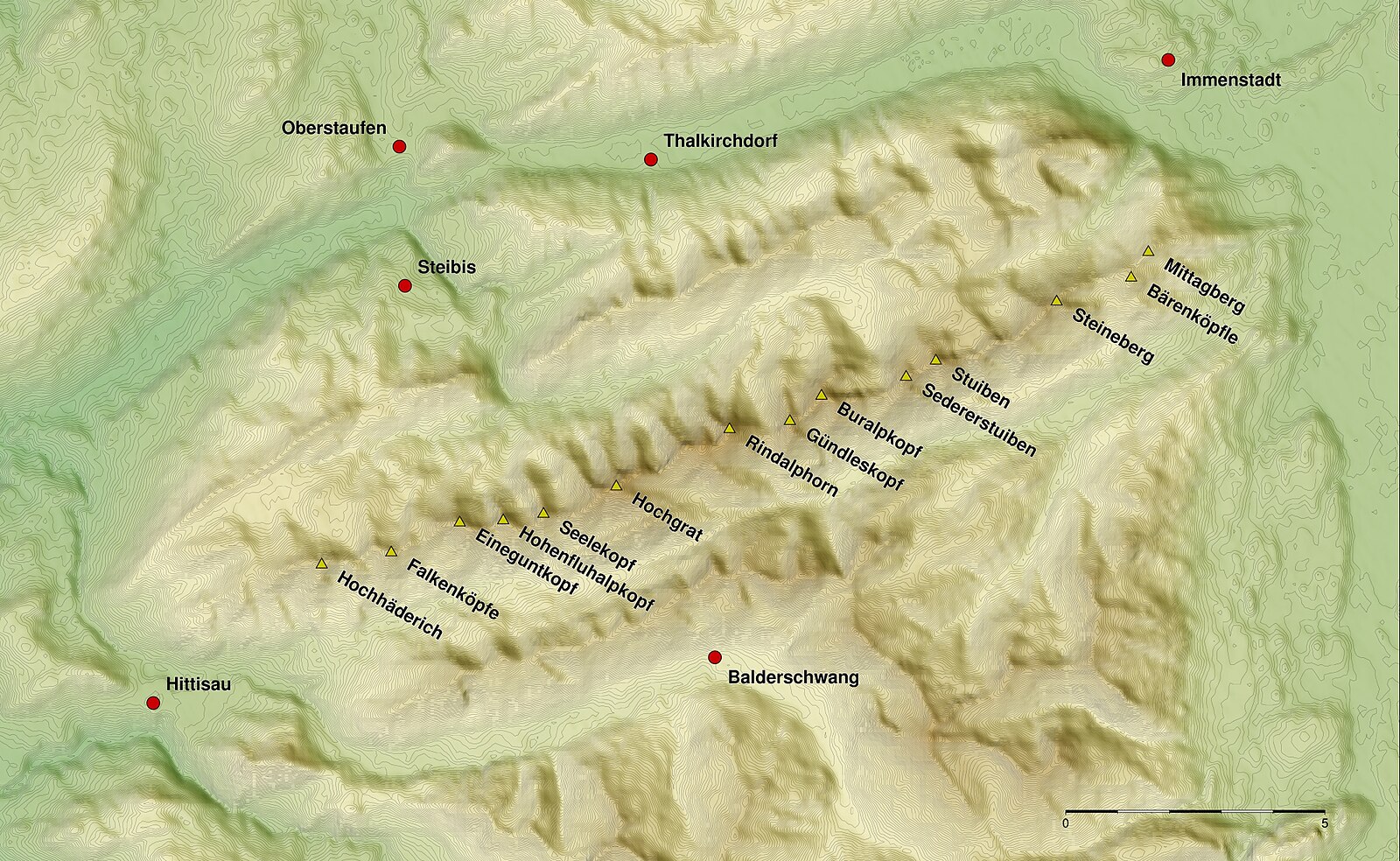
Hochhäderich – Hittisau
Webcam en directo


Remontes abiertos: 0/5
Parte de nieve
- Últimas 24h: 0 cm
- Últimas 72h: 0 cm
- Últimos 7 días: 0 cm
- Últimos 7 días: Valle 0cm · Media montaña 0cm · Cumbre 0cm
- Acumulado de temporada: 0 cm
Estaciones de esquí abiertas ahora · Parte de nieve
About Hochhäderich – Hittisau
A family-oriented plateau in the Bregenzerwald where cross-country trails meet traditional wooden architecture and low-key charm.
Highlights
- Gentle plateau slopes
- Bregenzerwald woodcraft
- Nordic skiing hub
- Family-run guesthouses
Key Facts
- Altitude: 1498m
- Top lift: 1600m
- Ski pistes: 10km
- Ski lifts: 5
- Population: 2,032
- Lakes nearby: 9
- MTB trails: 89.9km
- Mountain huts: 21
Ski Area
Incluido en estos pases de temporada
Weather and 10-day forecast for Hochhäderich – Hittisau
- Today: 4 to 13 °C, clear sky, 12 h of sunshine
- Freezing level today: about 3875 m (2980 to 4180 m)
| Day | Min / max | Sky | Precipitation | Sunshine |
|---|---|---|---|---|
| vie, 25 sept | 4 / 13 °C | clear sky | dry | 12 h sun |
| sáb, 26 sept | 8 / 17 °C | clear sky | dry | 11 h sun |
| dom, 27 sept | 8 / 19 °C | clear sky | dry | 12 h sun |
| lun, 28 sept | 10 / 21 °C | clear sky | dry | 12 h sun |
| mar, 29 sept | 10 / 20 °C | clear sky | dry | 12 h sun |
| mié, 30 sept | 8 / 19 °C | clear sky | dry | 12 h sun |
| jue, 1 oct | 7 / 18 °C | clear sky | dry | 10 h sun |
| vie, 2 oct | 8 / 10 °C | rain showers | dry | 0 h sun |
| sáb, 3 oct | 6 / 14 °C | clear sky | dry | 11 h sun |
| dom, 4 oct | 7 / 15 °C | clear sky | dry | 11 h sun |
Things to do in Hochhäderich – Hittisau
Hikes nearby — Hochhäderich – Hittisau (12)
12 curated hiking trails around Hochhäderich – Hittisau, sourced from OpenStreetMap and enriched with distance, elevation gain and difficulty.
-
Nord Süd Trail, Abschnitt Weiler im Allgäu - Ofterschwang
-
Wasserwanderweg Hittisau
-
Premiumwanderweg Alpin Luftiger Grat
-
Alperlebnispfad am Imberg
-
Premiumwanderweg Nagelfluhschleife Alpenfreiheit
-
Wandergebiet Oberstaufen
-
Premiumwanderweg Wildes Wasser
-
Rund um den Staufen
-
Wandertrilogie Etappe 36 Oberstaufen-Oberreute
Oberstaufen - Kapf - Hinterreute - Oberreute
-
Grenzer Pfad
-
Wandertrilogie Etappe 37 Oberreute-Weiler
Oberreute - Martinshöhe - Wildrosenmoos - Vorderschweinhöf - Hausbachklamm - Weiler im Allgäu
-
Lausbubenweg
Mountain biking near Hochhäderich – Hittisau
- Hittisau-Lecknertal-Alpe Scheidwang
- Amagmach
Getting to Hochhäderich – Hittisau
Door-to-door travel times as used by the MR. ALPS ranking.
- Nearest airport: Sankt Gallen Altenrhein Airport (ACH), 33 km away, about 1h29 by road
- Zürich: 2h36 by car, 154 km
- München: 3h01 by car, 189 km
- Luzern: 3h12 by car, 206 km
- Innsbruck: 3h21 by car, 214 km
- Stuttgart: 3h25 by car, 253 km
- Basel: 3h30 by car, 234 km
Where to stay in Hochhäderich – Hittisau
200 places to stay for a night on 2026-09-25, from 130 EUR per night, median 329 EUR. Prices are direct with hotels and destinations, compared live on the Hochhäderich – Hittisau page.