Haut-de-Caux
Webcam en directo
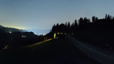

Remontes abiertos: 0%
Parte de nieve
- Últimas 24h: 0 cm
- Últimas 72h: 0 cm
- Últimos 7 días: 0 cm
- Últimos 7 días: Valle 0cm · Media montaña 0cm · Cumbre 0cm
- Acumulado de temporada: 0 cm
Estaciones de esquí abiertas ahora · Parte de nieve
About Haut-de-Caux
A secluded balcony above Montreux where Belle Époque architecture meets panoramic views of Lake Geneva and the French Alps.
Highlights
- Belle Époque architecture
- Panoramic lake views
- Quiet mountain escapism
- Historic cogwheel access
Key Facts
- Altitude: 1169m
- Top lift: 1166m
- Ski lifts: 1
- Population: 1,342
- Lakes nearby: 8
- MTB trails: 116.8km
- Mountain huts: 13
Ski Area
Weather and 10-day forecast for Haut-de-Caux
- Today: 11 to 17 °C, clear sky, 10 h of sunshine
- Freezing level today: about 4147 m (3880 to 4340 m)
| Day | Min / max | Sky | Precipitation | Sunshine |
|---|---|---|---|---|
| vie, 25 sept | 11 / 17 °C | clear sky | dry | 10 h sun |
| sáb, 26 sept | 13 / 19 °C | clear sky | dry | 12 h sun |
| dom, 27 sept | 15 / 24 °C | clear sky | dry | 12 h sun |
| lun, 28 sept | 15 / 24 °C | clear sky | dry | 12 h sun |
| mar, 29 sept | 15 / 24 °C | clear sky | dry | 10 h sun |
| mié, 30 sept | 13 / 21 °C | overcast | dry | 2 h sun |
| jue, 1 oct | 13 / 21 °C | clear sky | dry | 10 h sun |
| vie, 2 oct | 11 / 14 °C | drizzle | dry | 0 h sun |
| sáb, 3 oct | 9 / 14 °C | clear sky | dry | 8 h sun |
| dom, 4 oct | 8 / 17 °C | clear sky | dry | 8 h sun |
Things to do in Haut-de-Caux
Hikes nearby — Haut-de-Caux (19)
19 curated hiking trails around Haut-de-Caux, sourced from OpenStreetMap and enriched with distance, elevation gain and difficulty.
-
Via Alpina
The trail climbs from the shores of Lake Geneva up to the summit of Rochers de Naye, passing through the Gruyère Pays-d'Enhaut Regional Nature Park. It forms the final stage (Stage 20) of the Swiss Via Alpina, a long-distance route crossing the Alps.
-
Chemin panorama alpin
-
Via Alpina
From the summit of Rochers de Naye, the route traces the southwestern ridge dropping toward Lake Geneva before threading a narrow passage between two rock faces at Sautodoz, then winds through forested slopes past the peaks of Les Dentaux to reach Haut-de-Caux. The final stretch delivers an unexpected landmark: the Caux Palace, a grand hotel built in 1902 that defined the Belle Époque character of the area.
-
Chemin des Narcisses
Thousands of daffodils blanket the hills above Montreux each spring, turning the pastures into what looks like a white sea of flowers. The trail winds through those pastures and forests with Lake Geneva spread out below.
-
Tour des Alpes Vaudoises Étape 2
-
Tour des Alpes Vaudoises Étape 3
-
Luan-Ai
-
Prafandaz - fixme
-
Prafandaz - fixme
-
Miex-Lac de Taney (via Prélagine)
-
Via Alpina: Rochers de Naye - Montreux
-
ViaFrancigena: Vevey Marché - Aigle
-
Alpenpanorama-Weg: Les Paccots - Corseaux
-
Via Alpina: Rossinière, gare - Rochers de Naye
-
Le Grand Tour des Vanils
-
Tour des Alpes Vaudoises: Leysin-Feydey, gare - Col des Mosses
-
Sentier panoramique des Paccots
-
Sentier des trois tours de Leysin
-
L’Intyamon de Montbovon à la Brâ
Mountain biking near Haut-de-Caux
- Alpine Bike
- Panorama Bike - Étape 14
- Alpes de la Région du Léman Bike (Stage 1, Leysin - Les Diablerets)
- Montreux Panorama Bike
- Route de Soladier
Getting to Haut-de-Caux
Door-to-door travel times as used by the MR. ALPS ranking.
- Nearest airport: Bern Airport (BRN), 68 km away, about 1h29 by road
- Lausanne: 41 min by car, 38 km
- Bern: 1h18 by car, 95 km
- Genève: 1h20 by car, 101 km
- Biel/Bienne: 1h45 by car, 135 km
- Annecy: 1h53 by car, 142 km
- Chambéry: 2h18 by car, 186 km
Where to stay in Haut-de-Caux
200 places to stay for a night on 2026-10-02, from 175 EUR per night, median 570 EUR. Prices are direct with hotels and destinations, compared live on the Haut-de-Caux page.