Gröllerkopf – Übersaxen
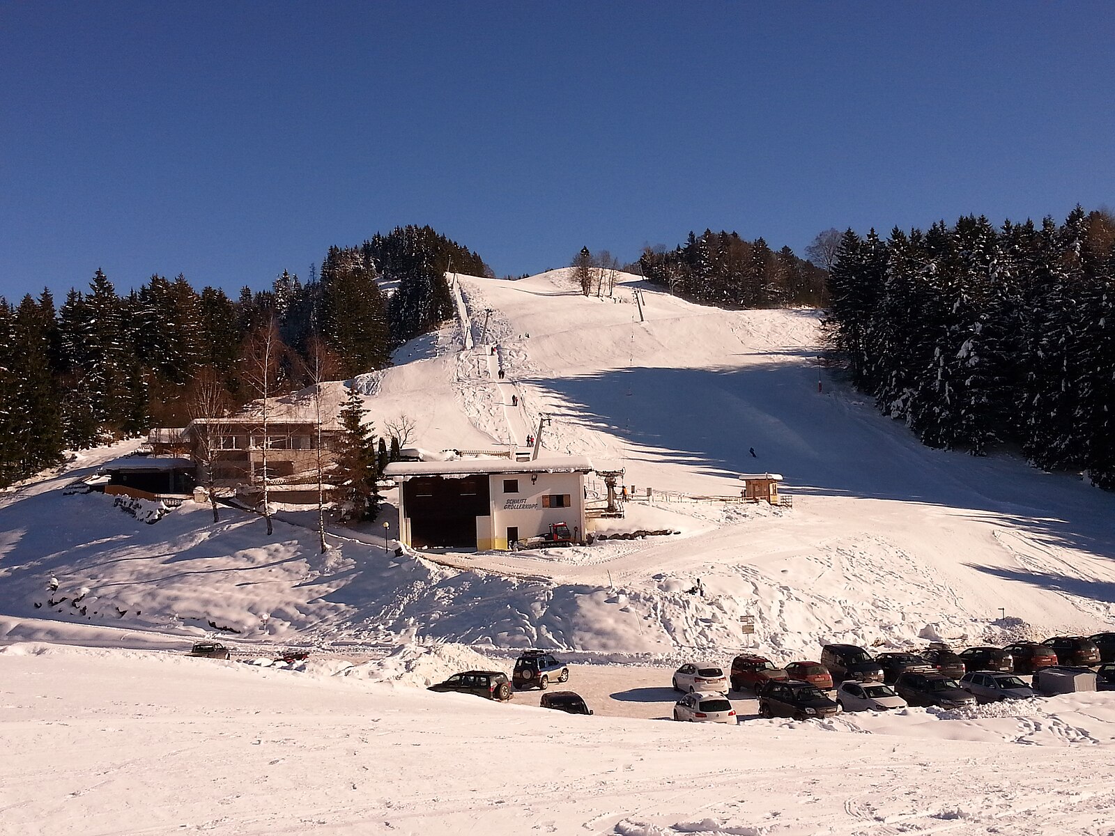
Webcam en directo
Remontes abiertos: 0/2
Parte de nieve
- Últimas 24h: 0 cm
- Últimas 72h: 0 cm
- Últimos 7 días: 0 cm
- Últimos 7 días: Valle 0cm · Media montaña 0cm · Cumbre 0cm
- Acumulado de temporada: 0 cm
Estaciones de esquí abiertas ahora · Parte de nieve
About Gröllerkopf – Übersaxen
A quiet Vorarlberg balcony offering low-key local vibes and sweeping views over the Rhine Valley toward Lake Constance.
Highlights
- Rhine Valley vistas
- Family-run character
- Sun-drenched plateaus
- Intimate winter hiking
Key Facts
- Altitude: 900m
- Top lift: 1200m
- Ski pistes: 3km
- Ski lifts: 2
- Population: 622
- Lakes nearby: 18
- MTB trails: 98.1km
- Mountain huts: 15
Ski Area
Incluido en estos pases de temporada
Weather and 10-day forecast for Gröllerkopf – Übersaxen
- Today: 10 to 17 °C, overcast, 2 h of sunshine
- Freezing level today: about 3323 m (2750 to 3850 m)
| Day | Min / max | Sky | Precipitation | Sunshine |
|---|---|---|---|---|
| jue, 24 sept | 10 / 17 °C | overcast | dry | 2 h sun |
| vie, 25 sept | 7 / 16 °C | clear sky | dry | 11 h sun |
| sáb, 26 sept | 10 / 21 °C | clear sky | dry | 12 h sun |
| dom, 27 sept | 12 / 23 °C | clear sky | dry | 12 h sun |
| lun, 28 sept | 13 / 23 °C | clear sky | dry | 12 h sun |
| mar, 29 sept | 11 / 22 °C | clear sky | dry | 12 h sun |
| mié, 30 sept | 8 / 22 °C | clear sky | dry | 12 h sun |
| jue, 1 oct | 8 / 20 °C | partly cloudy | dry | 4 h sun |
| vie, 2 oct | 9 / 15 °C | overcast | dry | 2 h sun |
| sáb, 3 oct | 5 / 17 °C | partly cloudy | dry | 5 h sun |
Things to do in Gröllerkopf – Übersaxen
Hikes nearby — Gröllerkopf – Übersaxen (19)
19 curated hiking trails around Gröllerkopf – Übersaxen, sourced from OpenStreetMap and enriched with distance, elevation gain and difficulty.
-
Appenzellerweg
-
Via Alpina Red R55
St. Gerold - Feldkirch
-
Alter Weg
The trail climbs from the Seilbahn Schnifis bergstation across open alpine meadows and through shady forest, passing twelve wooden story-boards illustrating local legends — among them the Geigenmännlein, the Goppakatz, and the Vernellaschimmel. At the Alpe Älpele, a working summer alp, the views stretch to the Swiss mountains, the Rätikon, and the Silvretta.
-
Walgauweg
-
Rheintal-Höhenweg
-
Rund ums Dorf Übersaxen
-
Via Alpina Stage 56: Feldkirch - Gafadurahütte
-
Rundweg Tschütsch
-
Schaanwald Zoll - Tisis (A)
-
Hinterer Schellenberg - Tostner Wald - Mittlerer Schellenberg
-
Bio-Lehrpfad Götzis
-
Hinterer Schellenberg - Gantenstein - Mittlerer Schellenberg
-
Mauren - St. Corneli (A)
-
Mauren - Tisis (A)
-
Paulahuette - Schaanwald
-
Liechtensteiner Panoramaweg: Gafadurahütte - Ruggell
-
Eschnerberg-Höhenweg
-
Appenzeller Weg: Rankweil - Appenzell
-
Rheintaler Höhenweg: Altstätten Stadt - Sennwald
Mountain biking near Gröllerkopf – Übersaxen
- Tufers-Übersaxen-Dünser Älpele
- Satteins-Übersaxen
- Netschelweg
- Oberer Kristweg
- Krist
- Holzbodenweg
Getting to Gröllerkopf – Übersaxen
Door-to-door travel times as used by the MR. ALPS ranking.
- Nearest airport: Sankt Gallen Altenrhein Airport (ACH), 27 km away, about 37 min by road
- Zürich: 1h45 by car, 141 km
- Luzern: 2h09 by car, 167 km
- Innsbruck: 2h12 by car, 168 km
- München: 2h24 by car, 221 km
- Basel: 2h39 by car, 221 km
- Stuttgart: 2h45 by car, 259 km
Where to stay in Gröllerkopf – Übersaxen
135 places to stay for a night on 2026-09-25, from 112 EUR per night, median 190 EUR. Prices are direct with hotels and destinations, compared live on the Gröllerkopf – Übersaxen page.