Gais
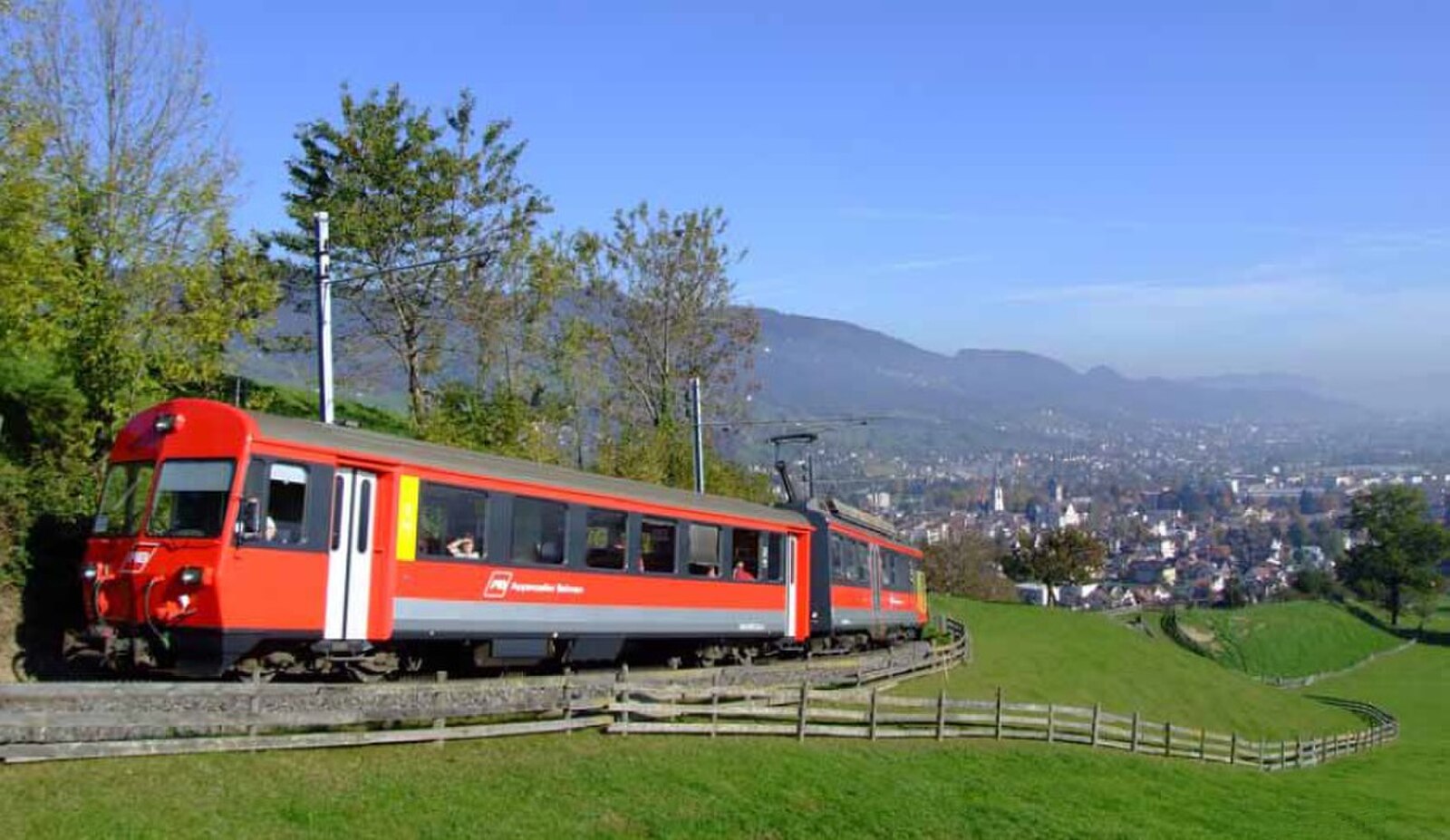
About Gais
A pastoral retreat defined by its wooden architecture and rolling hills, embodying the quiet charm of the Appenzell countryside.
Highlights
- Traditional timber facades
- Rolling pasture landscapes
- Wellness tourism heritage
- Authentic Swiss folkways
Key Facts
- Altitude: 937m
- Top lift: 1025m
- Ski pistes: 1km
- Ski lifts: 1
- Population: 3,086
- Lakes nearby: 19
- MTB trails: 447.4km
- Mountain huts: 23
Ski Area
Weather and 10-day forecast for Gais
- Today: 10 to 17 °C, overcast, 2 h of sunshine
- Freezing level today: about 3376 m (2740 to 3810 m)
| Day | Min / max | Sky | Precipitation | Sunshine |
|---|---|---|---|---|
| jue, 24 sept | 10 / 17 °C | overcast | dry | 2 h sun |
| vie, 25 sept | 8 / 18 °C | clear sky | dry | 12 h sun |
| sáb, 26 sept | 12 / 22 °C | clear sky | dry | 11 h sun |
| dom, 27 sept | 12 / 23 °C | clear sky | dry | 12 h sun |
| lun, 28 sept | 14 / 23 °C | clear sky | dry | 12 h sun |
| mar, 29 sept | 10 / 23 °C | clear sky | dry | 12 h sun |
| mié, 30 sept | 8 / 22 °C | clear sky | dry | 12 h sun |
| jue, 1 oct | 7 / 20 °C | clear sky | dry | 12 h sun |
| vie, 2 oct | 11 / 14 °C | drizzle | dry | 0 h sun |
| sáb, 3 oct | 9 / 17 °C | partly cloudy | dry | 8 h sun |
Things to do in Gais
Hikes nearby — Gais (20)
20+ curated hiking trails around Gais, sourced from OpenStreetMap and enriched with distance, elevation gain and difficulty.
-
Pfeff ond Lischt Weg
Thirteen interactive stations punctuate this family trail through the Appenzeller hill country, where walkers balance seesaws, roll balls through a Chügelibahn, hurl pine cones, and coax sound from a giant xylophone and resonating pipes. The route also reveals the region's characteristic Nagelfluh ridge landscape and opens onto views across the Appenzeller hills toward the Alpstein.
-
Appenzeller Rundweg
-
Alpenpanorama-Weg
-
Alpenpanorama-Weg
-
Appenzeller Weg
-
Eggerstanden - Eggli
-
Aussichtsweg "obedöri"
-
Rund um Speicher
-
ViaJacobi
-
Kulturspur Appenzellerland
NONE (Los extractos proporcionados describen el sendero Kulturspur Appenzellerland que atraviesa Appenzell Ausserrhoden entre Urnäsch/Rehetobel y Walzenhausen — no un sendero en Wiesen–Gruob en Graubünden. Ningún extracto contiene información sobre un sendero que coincida con la ubicación especificada.)
-
Rheintaler Höhenweg
-
Barfussweg
-
Ebenalp Nord
-
Wasserlehrpfad Hundwil
-
Chlus - ?
-
Alpenpanorama-Weg: Trogen Landsgemeindeplatz - Tourist Information
-
Appenzeller Kapellenweg
-
Lauras Lieblingsplätze
-
Kulturspur Appenzellerland: Teufen - Trogen
-
Kulturspur Appenzellerland: Trogen - Heiden Kirchplatz
Mountain biking near Gais
- Wildmannli Bike
- Appenzeller Vorderland-Route
- Hoher Hirschberg-Route
- Appenzell Rheintal Bike
- Appenzeller Mittelland-Route
- Panorama Bike - Etappe 2
- Leimensteigstrasse
- Widenbachtobel
Getting to Gais
Door-to-door travel times as used by the MR. ALPS ranking.
- Nearest airport: Sankt Gallen Altenrhein Airport (ACH), 16 km away, about 33 min by road
- Zürich: 1h17 by car, 98 km
- Luzern: 1h57 by car, 150 km
- Basel: 2h11 by car, 178 km
- Innsbruck: 2h28 by car, 187 km
- München: 2h29 by car, 222 km
- Biel/Bienne: 2h37 by car, 216 km
Where to stay in Gais
171 places to stay for a night on 2026-09-25, from 146 EUR per night, median 243 EUR. Prices are direct with hotels and destinations, compared live on the Gais page.