Breitenwang
About Breitenwang
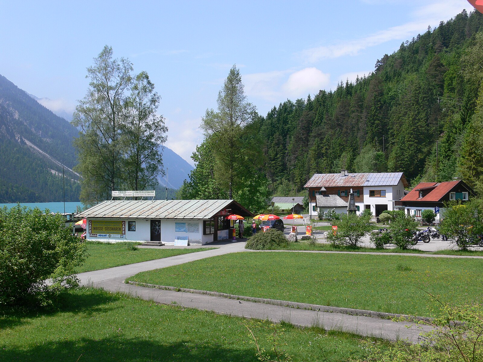
A quiet gateway to the Tyrolean high country, known for its deep-rooted folk traditions and proximity to the emerald Plansee waters.
Highlights
- Traditional Tyrolean architecture
- Alpine lake access
- Quiet mountain living
- Year-round hiking trails
Key Facts
- Altitude: 884m
- Top lift: 850m
- Ski lifts: 1
- Population: 1,440
- Lakes nearby: 25
- MTB trails: 159.4km
- Mountain huts: 27
Ski Area
Weather and 10-day forecast for Breitenwang
- Today: 6 to 18 °C, clear sky, 11 h of sunshine
- Freezing level today: about 3654 m (3230 to 3880 m)
| Day | Min / max | Sky | Precipitation | Sunshine |
|---|---|---|---|---|
| mié, 23 sept | 6 / 18 °C | clear sky | dry | 11 h sun |
| jue, 24 sept | 10 / 18 °C | overcast | dry | 2 h sun |
| vie, 25 sept | 7 / 17 °C | clear sky | dry | 11 h sun |
| sáb, 26 sept | 8 / 22 °C | clear sky | dry | 12 h sun |
| dom, 27 sept | 11 / 24 °C | clear sky | dry | 12 h sun |
| lun, 28 sept | 13 / 25 °C | clear sky | dry | 10 h sun |
| mar, 29 sept | 16 / 25 °C | clear sky | dry | 12 h sun |
| mié, 30 sept | 15 / 24 °C | clear sky | dry | 11 h sun |
| jue, 1 oct | 13 / 21 °C | rain showers | dry | 1 h sun |
| vie, 2 oct | 9 / 13 °C | drizzle | dry | 0 h sun |
Things to do in Breitenwang
Hikes nearby — Breitenwang (9)
9 curated hiking trails around Breitenwang, sourced from OpenStreetMap and enriched with distance, elevation gain and difficulty.
-
Lechweg
The Lechweg follows the Lech River from its source at Formarinsee lake through one of Europe's last wild river landscapes, passing Europe's largest ibex colony, swinging suspension bridges, and mysterious waterfalls framed by the Lechtal and Allgäu Alps. The route threads through river meadows and forests before arriving at views of the Bavarian royal castles of Neuschwanstein and Hohenschwangau near Füssen.
-
Dürrenbergweg
-
Via Alpina Purple A62
Kenzenhütte - Füssen
-
Jakobsweg Tirol - Allgäu
-
Alpsee-Rundweg
Rund um den Hopfensee
-
Naturpfad Ahornreitweg
Este sendero sigue la ruta trazada alrededor de 1850 por el rey Maximiliano II, quien lo utilizaba para ir a caballo hasta su pabellón de caza en el Tegelberg. Paneles informativos situados en puntos clave del recorrido narran la historia de las montañas y los bosques por los que pasa el sendero.
-
Schutzengelweg
-
23 Berwang - Rastkopf - Sattelkopf - Hönig
-
18 Brand - Rinnen
Mountain biking near Breitenwang
- Melkalpe-Kuhklause-Plansee
- Klausenwald
- Frauensee - Feuerköpfle
- Zum Hohen Schloss
- Dürrenbergalpe
- Fort Claudia
- Pflach - Urisee
- Dreiwässerweg
Getting to Breitenwang
Door-to-door travel times as used by the MR. ALPS ranking.
- Nearest airport: Innsbruck Airport (INN), 52 km away, about 1h15 by road
- Innsbruck: 1h23 by car, 96 km
- München: 1h44 by car, 121 km
- Stuttgart: 2h39 by car, 236 km
- Bolzano - Bozen: 2h47 by car, 208 km
- Zürich: 3h11 by car, 246 km
- Trento: 3h18 by car, 264 km
Where to stay in Breitenwang
194 places to stay for a night on 2026-09-25, from 148 EUR per night, median 259 EUR. Prices are direct with hotels and destinations, compared live on the Breitenwang page.