Pod Wangiem
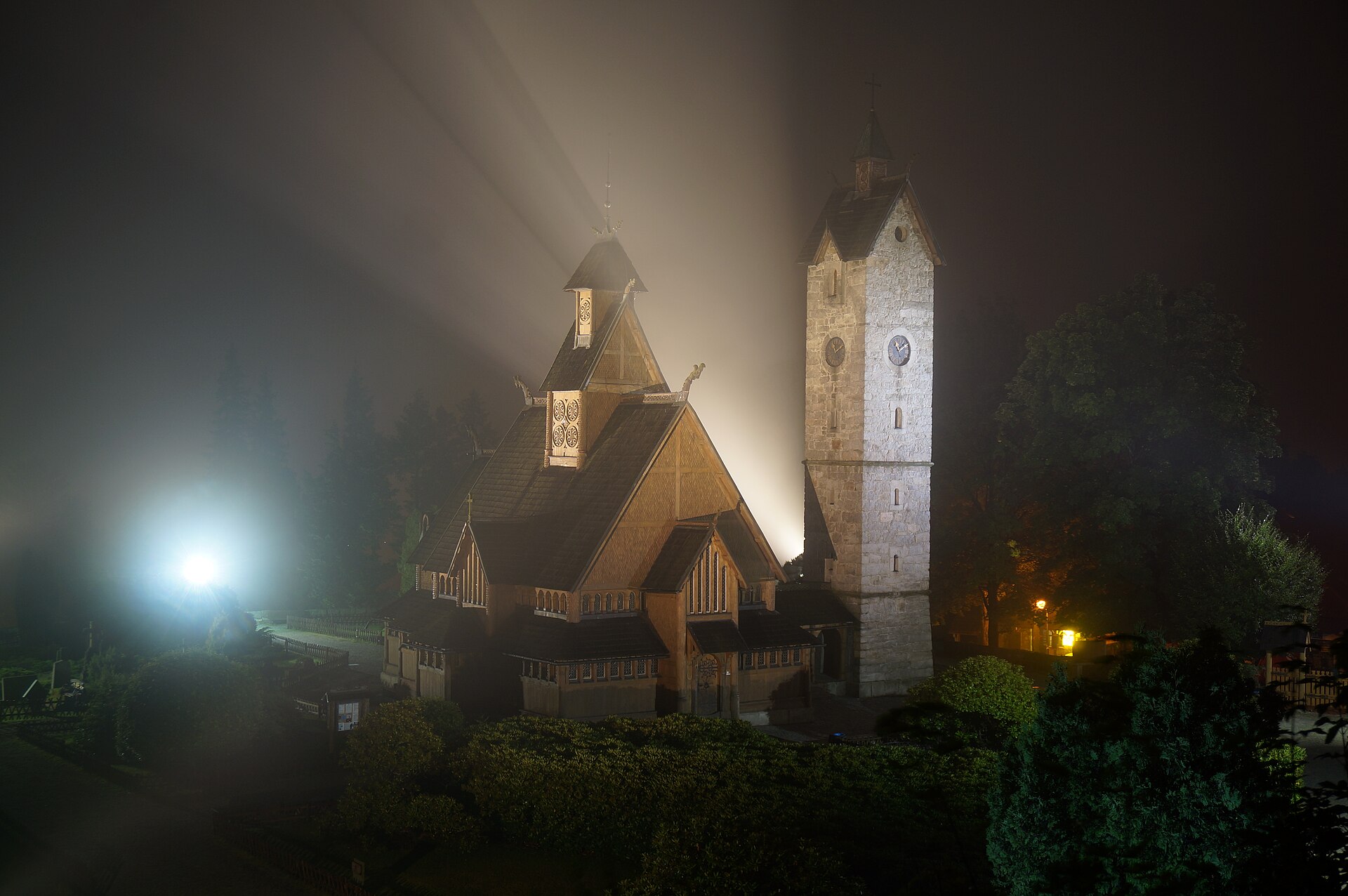
About Pod Wangiem
A gateway to the Karkonosze wilderness, this neighborhood blends historic wooden architecture with a quiet, forest-bound retreat.
Highlights
- Scandinavian architecture
- Pine forest trails
- Mountain views
- Quiet retreat
Key Facts
- Altitude: 817m
- Lakes nearby: 5
- MTB trails: 146.5km
- Mountain huts: 50
Ski Area
Weather and 10-day forecast for Pod Wangiem
- Today: 7 to 10 °C, rain showers, 1 h of sunshine
- Freezing level today: about 2333 m (1920 to 2910 m)
| Day | Min / max | Sky | Precipitation | Sunshine |
|---|---|---|---|---|
| Thu, Sep 24 | 7 / 10 °C | rain showers | dry | 1 h sun |
| Fri, Sep 25 | 7 / 11 °C | partly cloudy | dry | 3 h sun |
| Sat, Sep 26 | 8 / 17 °C | clear sky | dry | 10 h sun |
| Sun, Sep 27 | 12 / 18 °C | overcast | dry | 2 h sun |
| Mon, Sep 28 | 14 / 20 °C | clear sky | dry | 11 h sun |
| Tue, Sep 29 | 13 / 19 °C | clear sky | dry | 12 h sun |
| Wed, Sep 30 | 12 / 19 °C | clear sky | dry | 9 h sun |
| Thu, Oct 1 | 13 / 18 °C | clear sky | dry | 12 h sun |
| Fri, Oct 2 | 10 / 17 °C | clear sky | dry | 12 h sun |
| Sat, Oct 3 | 8 / 17 °C | clear sky | dry | 11 h sun |
Things to do in Pod Wangiem
Hikes nearby — Pod Wangiem (15)
15 curated hiking trails around Pod Wangiem, sourced from OpenStreetMap and enriched with distance, elevation gain and difficulty.
-
Cieplicki szlak spacerowy
-
Cieplicki szlak spacerowy Zielony
-
Via Czechia - Severní (7. Krkonoše)
-
Karpacz Biały Jar - Kocioł Białego Jaru
-
Karpacz Biały Jar - Śnieżka
-
Karpacz - Rozdroże koło Spalonej Strażnicy
-
Droga Bronka Czecha
-
Cesta česko-polského přátelství
The Polish–Czech Friendship Trail is a public walking path in the Giant Mountains. The path runs on both sides of the Czech–Polish border, along the main ridge and crosses or traverses all its summits. The maintenance of the trail is performed by the staff of both adjacent national parks: the Polish Karkonosze National Park and the Czech Krkonoše National Park. The start point is located on Szreni
-
Dřevařská cesta
-
Karpacz - Słonecznik
-
Karpacz PKP - Schronisko PTTK nad Łomniczką
-
Rozdroże Izerskie - Pielgrzymy
-
Podgórzyn Górny - Przełęcz Karkonoska
-
Pec pod Sněžkou
-
Pec pod Sněžkou
Mountain biking near Pod Wangiem
- Pasmo rowerowe Olbrzymy - Singletrack
- Pętla Podgórzyńska
- Trasa rowerowa Jedlinki - Lubuszanin
Getting to Pod Wangiem
Door-to-door travel times as used by the MR. ALPS ranking.
- Nearest airport: Copernicus Wrocław Airport (WRO), 89 km away, about 2h03 by road
- Berlin: 4h09 by car, 315 km
- Wien: 5h41 by car, 398 km
- Nürnberg: 5h43 by car, 469 km
- München: 6h37 by car, 558 km
- Frankfurt am Main: 7h21 by car, 660 km
- Stuttgart: 7h36 by car, 659 km
Where to stay in Pod Wangiem
200 places to stay for a night on 2026-09-25, from 59 EUR per night, median 309 EUR. Prices are direct with hotels and destinations, compared live on the Pod Wangiem page.