Saas-Almagell
Alps › Pennine Alps › Mischabel and Weissmies Alps
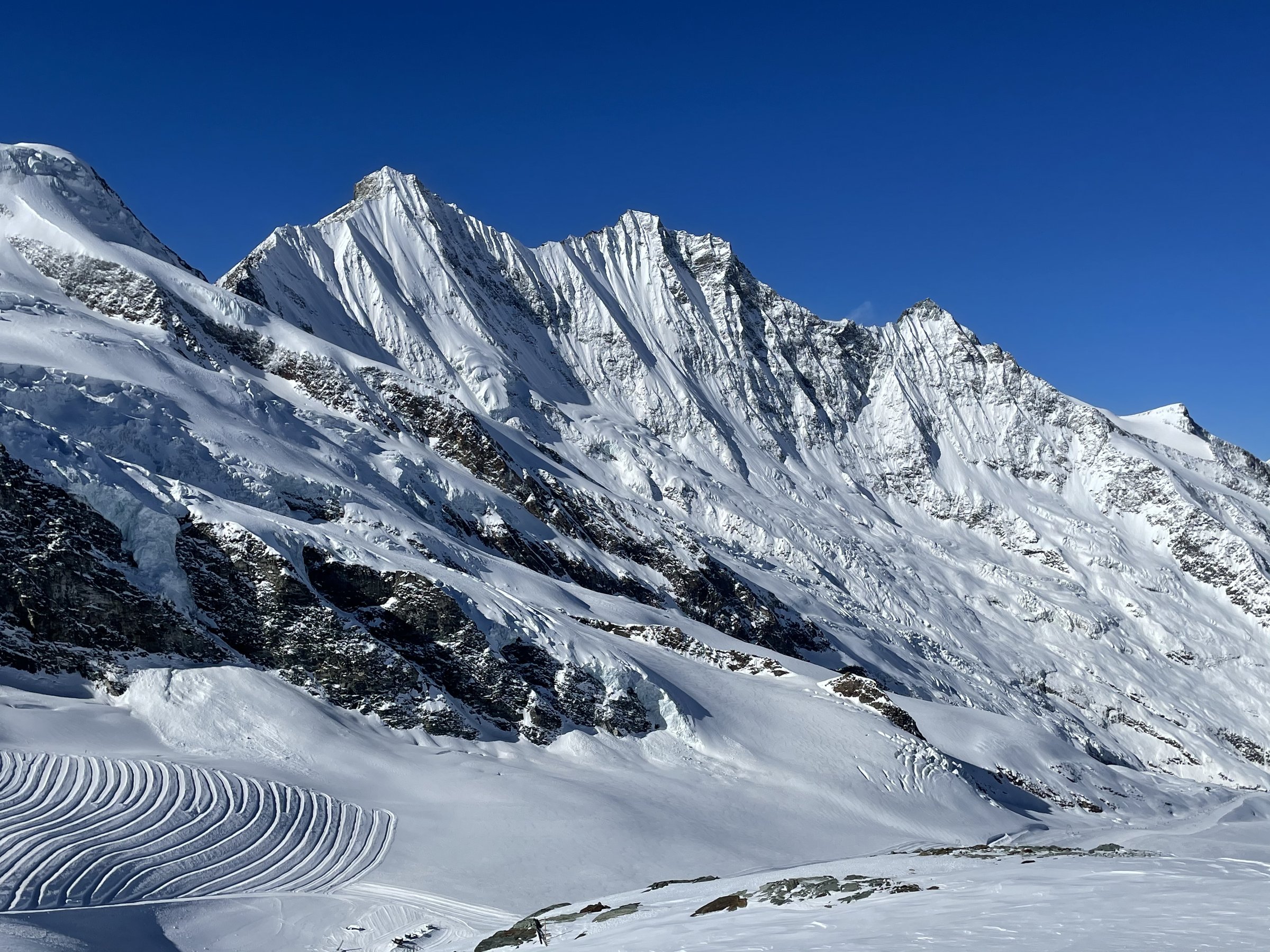
Live webcam


Lifts open: 4/23
Snow report
- Last 24h (2008 m): 2 cm
- Last 72h (2008 m): 10 cm
- Last 7 days: Top (2346 m) 24cm · Mid-mountain (2008 m) 20cm · Valley (1670 m) 7cm
- Season total (2008 m): 11 cm
Ski resorts open now · Snow report
About Saas-Almagell
A historic high-altitude settlement situated at 1,670m within the Saas-Fee/Saastal region. During the shoulder season, the village maintains a quiet character while providing access to the 144km piste network via the Magic Pass.
Highlights
- Rustic Valais charm
- Family-oriented slopes
- Sun-drenched valley floor
- Authentic village atmosphere
Key Facts
- Altitude: 1670m
- Top lift: 2346m
- Ski pistes: 10km
- Ski lifts: 38
- Population: 385
- 4000m+ peaks nearby: 19
- Lakes nearby: 19
- MTB trails: 24.5km
- Mountain huts: 18
Ski Area
Included in these season passes
Weather and 10-day forecast for Saas-Almagell
- Today: -3 to 0 °C, snow showers, 0 h of sunshine
- Freezing level today: about 2100 m (1890 to 2600 m)
- Snowfall in the last 7 days: 24 cm
| Day | Min / max | Sky | Precipitation | Sunshine |
|---|---|---|---|---|
| Sun, Nov 22 | -3 / 0 °C | snow showers | dry | 0 h sun |
| Mon, Nov 23 | -6 / -1 °C | snow showers | dry | 3 h sun |
| Tue, Nov 24 | -6 / -4 °C | overcast | dry | 1 h sun |
| Wed, Nov 25 | -5 / -2 °C | snow | dry | 0 h sun |
| Thu, Nov 26 | -5 / -1 °C | clear sky | dry | 7 h sun |
| Fri, Nov 27 | -8 / -4 °C | clear sky | dry | 9 h sun |
| Sat, Nov 28 | -5 / 2 °C | overcast | dry | 2 h sun |
| Sun, Nov 29 | -10 / -2 °C | overcast | dry | 3 h sun |
| Mon, Nov 30 | -10 / -2 °C | clear sky | dry | 8 h sun |
| Tue, Dec 1 | -11 / -3 °C | overcast | dry | 2 h sun |
Things to do in Saas-Almagell
Hikes nearby - Saas-Almagell (20)
20+ curated hiking trails around Saas-Almagell, sourced from OpenStreetMap and enriched with distance, elevation gain and difficulty.
-
Vie Storiche Monte Moro Saas Almagell
The trail departs from the massive Mattmark dam and climbs to the Monte Moro Pass on Roman-era stone slabs, following a route that has served as a mountain crossing for millennia.
-
19-Alpenpässe-Weg
-
20-Alpenpässse-Weg
The route traverses the steep western flank of the Saas Valley along an exposed high-altitude path — some sections secured with wire cables — delivering constant panoramas of the Mischabel group, the Fletschhorn, the Weissmies, and the Matterhorn, with vertiginous views straight down into the valley below. The terrain shifts from open larch forest through boulder fields and across several avalanche chutes before arriving at the sunny terrace of Grächen.
-
Zenlauinen - Saas-Almagell
-
Saas-Fee - Saas-Almagell
This loop trail passes the Mattmark Dam and reservoir, where hikers can walk around the lake and stop for lunch. The route runs through the Saas Valley, a region encircled by more than a dozen four-thousand-metre peaks.
-
Saas-Almagell - Berghaus Plattjen
-
Höhenweg Almagelleralp
The route traverses the flanks of the Saas Valley at around 2400–2550 metres, delivering views of the glaciated Mischabel massif and the Dom (4545 m), the highest peak lying entirely on Swiss soil. Two suspension bridges up to 60 metres long punctuate the path, and at the ridge crossing of the Triftgrätji the entire valley opens up — from the Mattmark reservoir all the way down to Stalden.
-
Saas-Almagell - Almagelleralp
-
Saas-Fee - Plattjen
-
Plattjen - Egginerjoch
This trail threads through the arena of several 4,000-metre peaks surrounding the Saas Fee valley basin, passing through Egginerjoch and Morenia on its circuit around the basin.
-
Saas-Grund - Saas-Fee
The route descends from Saas-Fee through forest and along the Saaser-Vispa river, climbing through Zermeiggern and Chapfwald to the lunch stop at Furggstalden, before returning via a panoramic ridge path through Spisswald and Zum Moss down to Saas-Grund.
-
Alpenblumen Promenade
Botanists from Horace Bénédict de Saussure to the Prior of the Great St. Bernard once roamed these slopes, and the trail from Kreuzboden still threads through one of the finest alpine flower regions in the Swiss Alps, high above the Saastal. The route descends from a gondola station ringed by four-thousand-metre peaks toward Saas-Grund, tracing an easy path through what the sources call a nearly forgotten paradise of alpine blooms.
-
Alpenblick - Gletschergrotte
The trail leads from the village of Saas-Fee through open, green landscape to a crystal-blue glacier lake at 1904 m, then continues past the Bergrestaurant Gletschergrotte at 1997 m, which serves local food and drinks with a mountain panorama.
-
Gemsweg Saas-Fee
-
Bärenfalle - Hannig
-
Gletschergrotte - Längfluh
-
Antronpass - Heitbodme
-
Alpenpässe-Weg: Gspon - Saas-Fee
-
Alpenpässe-Weg: Saas-Fee - Grächen
-
Swiss Tour Monte Rosa: Saas-Fee - Grächen
Mountain biking near Saas-Almagell
- Trift flowtrail
- Gsponer Höhenweg
- MTB Freeride
- Kreuzbodenweg
- Plattjenweg
- Brunnenweg
Getting to Saas-Almagell
Door-to-door travel times as used by the MR. ALPS ranking.
- Nearest airport: Milan Malpensa International Airport (MXP), 79 km away, about 2h52 by road
- Lausanne: 2h09 by car, 165 km
- Bern: 2h31 by train, 123 km
- Biel/Bienne: 2h45 by train, 157 km
- Genève: 2h48 by car, 227 km
- Luzern: 3h by car, 185 km
- Zürich: 3h13 by train, 240 km
Where to stay in Saas-Almagell
362 places to stay for a night on 2026-11-27, from 101 EUR per night, median 250 EUR. Prices are direct with hotels and destinations, compared live on the Saas-Almagell page.