Alpe del Nevegal
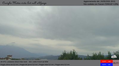
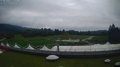
Live webcam

Snow report
- Last 24h (1367 m): 0 cm
- Last 72h (1367 m): 0 cm
- Last 7 days: Top (1675 m) 0cm · Mid-mountain (1367 m) 0cm · Valley (1058 m) 0cm
- Season total (1367 m): 0 cm
Ski resorts open now · Snow report
About Alpe del Nevegal
Known as the balcony over the Dolomites, this retro escape offers panoramic views and a nostalgic, unhurried Italian mountain experience.
Highlights
- Panoramic ridge views
- Vintage mountain charm
- Family-run trattorias
- Gentle forested slopes
Key Facts
- Altitude: 1058m
- Top lift: 1675m
- Ski pistes: 13.2km
- Ski lifts: 3
- Lakes nearby: 6
- MTB trails: 102.7km
- Mountain huts: 10
Ski Area
Weather and 10-day forecast for Alpe del Nevegal
- Today: 1 to 6 °C, overcast, 1 h of sunshine
- Freezing level today: about 2599 m (2190 to 3060 m)
| Day | Min / max | Sky | Precipitation | Sunshine |
|---|---|---|---|---|
| Tue, Nov 17 | 1 / 6 °C | overcast | dry | 1 h sun |
| Wed, Nov 18 | 4 / 7 °C | clear sky | dry | 7 h sun |
| Thu, Nov 19 | 2 / 5 °C | rain | dry | 0 h sun |
| Fri, Nov 20 | 1 / 6 °C | clear sky | dry | 7 h sun |
| Sat, Nov 21 | 1 / 8 °C | partly cloudy | dry | 5 h sun |
| Sun, Nov 22 | -1 / 2 °C | overcast | dry | 1 h sun |
| Mon, Nov 23 | -1 / 3 °C | partly cloudy | dry | 6 h sun |
| Tue, Nov 24 | -4 / 4 °C | overcast | dry | 3 h sun |
| Wed, Nov 25 | -3 / 5 °C | clear sky | dry | 8 h sun |
| Thu, Nov 26 | -3 / 3 °C | rain showers | dry | 0 h sun |
Things to do in Alpe del Nevegal
Hikes nearby - Alpe del Nevegal (18)
18 curated hiking trails around Alpe del Nevegal, sourced from OpenStreetMap and enriched with distance, elevation gain and difficulty.
-
Cammino delle Dolomiti - Tappa 27
-
Tag 24 V2 Traumpfad München Venedig
-
Cammino delle Dolomiti - Tappa 28
-
Alta via n. 6 delle Dolomiti - XI tappa
L'Alta via n. 6, conosciuta anche con il nome di Alta via dei Silenzi, è un'alta via alpina lungo le montagne dolomitiche, attraverso le regioni Friuli-Venezia Giulia e Veneto, in Italia. L'itinerario ha inizio dalle sorgenti del fiume Piave, nel comune di Sappada, in provincia di Udine, e termina nel comune di Vittorio Veneto, nella provincia di Treviso. Il percorso è segnalato da triangoli blu a
-
2004
-
2005
-
2000creste
-
Troi de Medo
-
Sentiero del Lago Morto
-
Troi de la Montagna
-
sentiero per il Nordic Walking
-
Sentiero Naturalistico H3
-
Sentiero dell'Ardo
-
Sentiero naturalistico E1
black "E1" on orange background
-
Sentiero naturalistico F - Strada del Taffarel
black "F" on orange background
-
Anello del Cansiglio
-
Anello del Monte Boral
-
La Velenosetta
Mountain biking near Alpe del Nevegal
- 1: Nevegal - Costa Legner - Nevegal
- 3: Nevegal - Col de Gou - Nevegal
- Sentiero 1 La Grava - Costa Legnèr
- Via Malvan
- Sentiero 13 delle Creste
- Sentiero 6 del Toront
- Sentiero 8 Costa del Sol
Getting to Alpe del Nevegal
Door-to-door travel times as used by the MR. ALPS ranking.
- Nearest airport: Venice Marco Polo Airport (VCE), 66 km away, about 1h11 by road
- Padova: 1h33 by car, 133 km
- Trento: 2h03 by car, 120 km
- Verona: 2h21 by car, 215 km
- Bolzano - Bozen: 2h31 by car, 125 km
- Bologna: 2h42 by car, 247 km
- Brescia: 2h57 by car, 275 km