Pitztaler Gletscher
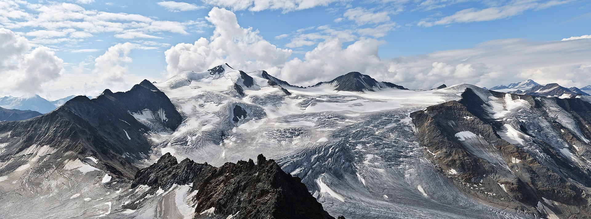
About Pitztaler Gletscher
Austria’s highest sanctuary for purists, defined by high-altitude solitude and the architectural drama of its summit café.
Highlights
- High-altitude solitude
- Architectural summit café
- Glacier terrain
- Extended season
Key Facts
- Altitude: 1723m
- Top lift: 3427m
- Ski pistes: 29.6km
- Ski lifts: 7
- Lakes nearby: 12
- MTB trails: 144.2km
- Mountain huts: 31
Ski Area
Zahrnuto v těchto sezonních permanentkách
Weather and 10-day forecast for Pitztaler Gletscher
- Today: 0 to 9 °C, clear sky, 12 h of sunshine
- Freezing level today: about 3244 m (2560 to 4080 m)
| Day | Min / max | Sky | Precipitation | Sunshine |
|---|---|---|---|---|
| pá 25. 9. | 0 / 9 °C | clear sky | dry | 12 h sun |
| so 26. 9. | 5 / 13 °C | clear sky | dry | 12 h sun |
| ne 27. 9. | 7 / 15 °C | clear sky | dry | 12 h sun |
| po 28. 9. | 7 / 15 °C | partly cloudy | dry | 6 h sun |
| út 29. 9. | 8 / 16 °C | clear sky | dry | 11 h sun |
| st 30. 9. | 9 / 15 °C | clear sky | dry | 11 h sun |
| čt 1. 10. | 8 / 14 °C | clear sky | dry | 11 h sun |
| pá 2. 10. | 2 / 8 °C | drizzle | dry | 0 h sun |
| so 3. 10. | -1 / 7 °C | drizzle | dry | 1 h sun |
| ne 4. 10. | -2 / 8 °C | clear sky | dry | 8 h sun |
Things to do in Pitztaler Gletscher
Hikes nearby — Pitztaler Gletscher (20)
20+ curated hiking trails around Pitztaler Gletscher, sourced from OpenStreetMap and enriched with distance, elevation gain and difficulty.
-
Via Alpina Yellow B33
Vent - Zwieselstein
-
Ötztal Trek Etappe 17
Breslauer Hütte → Braunschweiger Hütte
-
Ötztal Trek Etappe 16
Vernagthütte → Breslauer Hütte
-
Ötztal Trek Etappe 11
Ramolhaus → Martin-Busch-Hütte
-
Sonnberg-Höhenweg
-
Venter Höhenweg
-
Via Alpina Yellow B34
Zwieselstein - Braunschweiger Hütte
-
Wanderweg 925
-
Wanderweg 924
-
Ötztal Trek Etappe 18
Braunschweiger Hütte → Rüsselsheimer Hütte
-
Wanderweg 927
-
Wanderweg 926
-
Wanderweg 917
-
Wanderweg 928
-
Ötztal Trek Etappe 19
Rüsselsheimer Hütte → Hauerseehütte
-
Fuldaer Höhenweg
-
Mainzer Höhenweg
Der Mainzer Höhenweg ist ein hochalpiner, anspruchsvoller Höhenweg in den Ötztaler Alpen in Tirol.
-
Offenbacher Höhenweg
-
Cottbuser Höhenweg
-
Panoramaweg
Mountain biking near Pitztaler Gletscher
- Ollweite Line
- Fernar Trail
- Fernar Trail (6041) / 28b
- Mittelbergweg
- 34 A
- Ollweite Line (6010)
Getting to Pitztaler Gletscher
Door-to-door travel times as used by the MR. ALPS ranking.
- Nearest airport: Innsbruck Airport (INN), 52 km away, about 1h28 by road
- Innsbruck: 1h44 by car, 94 km
- München: 3h04 by car, 185 km
- Bolzano - Bozen: 3h07 by car, 206 km
- Trento: 3h38 by car, 262 km
- Zürich: 3h56 by car, 275 km
- Luzern: 4h17 by car, 291 km
Where to stay in Pitztaler Gletscher
70 places to stay for a night on 2026-09-25, from 142 EUR per night, median 307 EUR. Prices are direct with hotels and destinations, compared live on the Pitztaler Gletscher page.