Pany (Luzein)
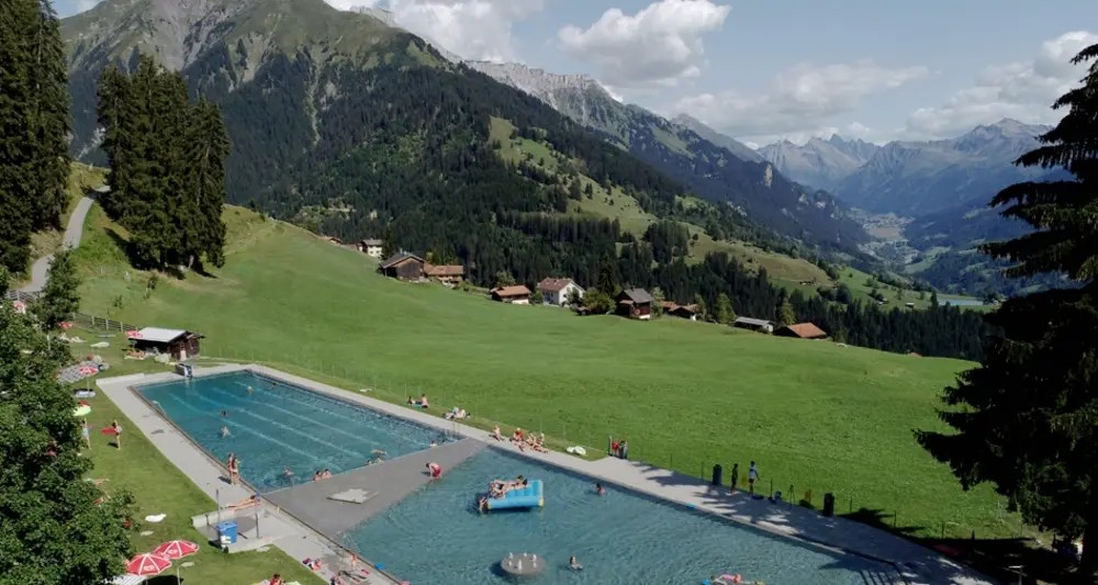
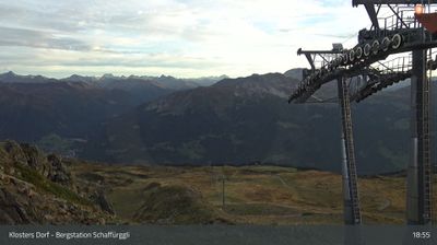
Živá webkamera
Otevřené vleky: 0%
Sněhová zpráva
- Posledních 24h: 0 cm
- Posledních 72h: 0 cm
- Posledních 7 dní: 0 cm
- Posledních 7 dní: Údolí 0cm · Střední část 0cm · Vrchol 0cm
- Sezónní úhrn: 4.5 cm
Lyžařská střediska otevřená právě teď · Sněhová zpráva
About Pany (Luzein)
A quiet sun-trap in the Prättigau known for its family-run charm, panoramic terraces, and a slower pace of mountain life.
Highlights
- Solar-heated pool
- Pristine winter hiking
- Family-friendly slopes
- Authentic Walser culture
Key Facts
- Altitude: 1263m
- Top lift: 1550m
- Ski pistes: 5km
- Ski lifts: 2
- Population: 1,596
- Lakes nearby: 13
- MTB trails: 336.5km
- Mountain huts: 11
Ski Area
Weather and 10-day forecast for Pany (Luzein)
- Today: 8 to 19 °C, clear sky, 12 h of sunshine
- Freezing level today: about 4050 m (3980 to 4160 m)
| Day | Min / max | Sky | Precipitation | Sunshine |
|---|---|---|---|---|
| so 26. 9. | 8 / 19 °C | clear sky | dry | 12 h sun |
| ne 27. 9. | 11 / 21 °C | clear sky | dry | 12 h sun |
| po 28. 9. | 12 / 22 °C | clear sky | dry | 10 h sun |
| út 29. 9. | 12 / 22 °C | clear sky | dry | 11 h sun |
| st 30. 9. | 10 / 20 °C | partly cloudy | dry | 5 h sun |
| čt 1. 10. | 9 / 20 °C | partly cloudy | dry | 8 h sun |
| pá 2. 10. | 9 / 12 °C | rain | dry | 0 h sun |
| so 3. 10. | 8 / 17 °C | drizzle | dry | 7 h sun |
| ne 4. 10. | 8 / 13 °C | drizzle | dry | 2 h sun |
| po 5. 10. | 5 / 16 °C | clear sky | dry | 11 h sun |
Things to do in Pany (Luzein)
Hikes nearby — Pany (Luzein) (20)
20+ curated hiking trails around Pany (Luzein), sourced from OpenStreetMap and enriched with distance, elevation gain and difficulty.
-
Prättigauer Höhenweg - Etappe 4
The route follows the Alpbach stream past scattered farmsteads up to the Jägglisch Horn at 2,257 m, where views open across the Rätikon and the full sweep of the Prättigauer Höhenweg. A long traverse of the hillside then passes the Erlebnispark Madrisa-Land and the Madrisabahn mountain station before descending through the Schlappintobel gorge to Klosters.
-
Küblis - Fideris
-
Küblis -
This trail threads through beautiful old alleys connecting the Prättigau villages of Pany, Luzein, and Küblis, dropping steeply in places along paths that are now part of the official hiking trail network. At the end, the postbus whisks walkers back to the starting point.
-
Saas Station - Küblis
-
Fideris - Jenaz
-
Walki - Saas
The trail winds through quiet forest before opening to views toward Serneus and Klosters, with the imposing Sunnibergbrücke bridge visible in the distance.
-
Bahnhof Furna - Schiers
-
Schiers - Überlandquart
-
Grüsch - Schiers
-
Walserweg - Etappe 17
-
Schanfigger Höhenweg - Etappe 2
-
Schanfigger Höhenweg - Etappe 3
-
Klosters Platz - Grossrüti
-
Gotschnagrat - Parsennhütte
-
Gotschnagrat - Schwarzseealp
-
Panyer Rundweg
-
Prättigauer Höhenweg: St. Antönien Platz - Klosters Bahnhof
-
Walserweg: Klosters Dorf Bahnhof - St. Antönien Platz
-
Walserweg: Langwies Dorf - Klosters Dorf Bahnhof
-
Furner Rundweg
Mountain biking near Pany (Luzein)
- Fideriser Heuberge
- Schmuggler Tour
- Madrisa-Saas Trail
Getting to Pany (Luzein)
Door-to-door travel times as used by the MR. ALPS ranking.
- Nearest airport: Sankt Gallen Altenrhein Airport (ACH), 64 km away, about 1h14 by road
- Zürich: 1h39 by car, 126 km
- Luzern: 1h59 by car, 149 km
- Basel: 2h37 by car, 209 km
- Innsbruck: 2h58 by car, 204 km
- Biel/Bienne: 3h02 by car, 247 km
- Bern: 3h03 by car, 248 km
Where to stay in Pany (Luzein)
53 places to stay for a night on 2026-10-02, from 126 EUR per night, median 277 EUR. Prices are direct with hotels and destinations, compared live on the Pany (Luzein) page.