Ollomont
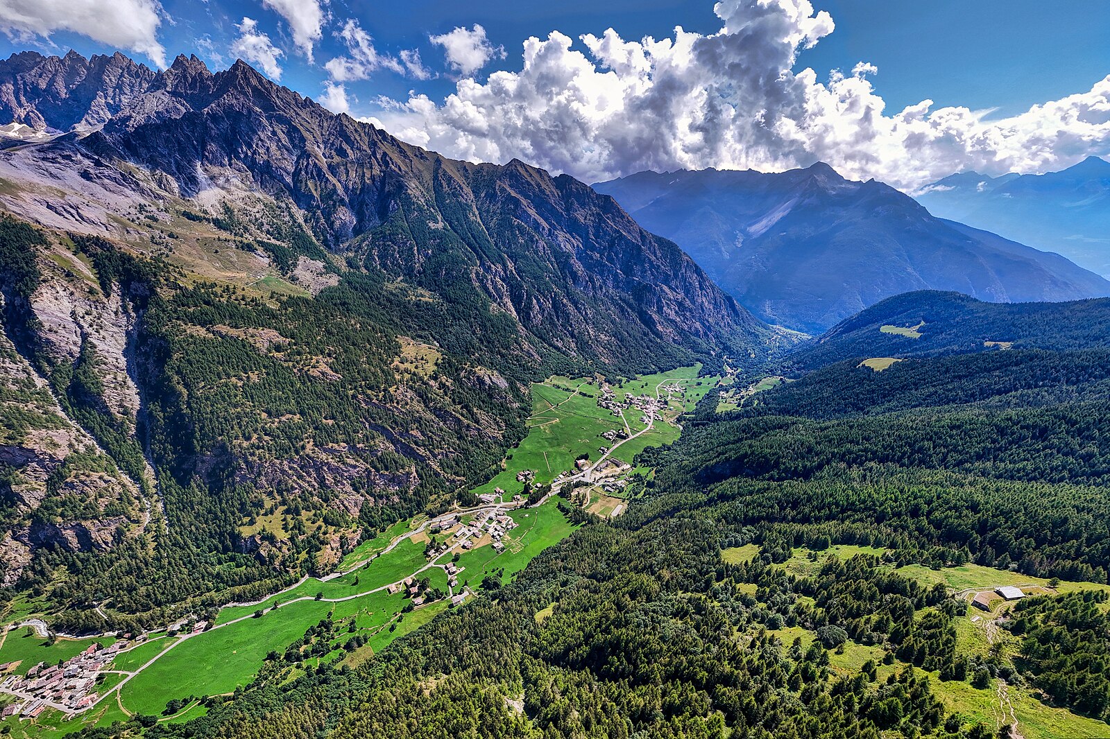
About Ollomont
A secluded Aosta Valley sanctuary where silent, untamed peaks offer a rare escape from the commercialized ski circuit.
Highlights
- Untouched wilderness
- Traditional stone hamlets
- Ski mountaineering routes
- Slow-paced atmosphere
Key Facts
- Altitude: 1370m
- Top lift: 1474m
- Ski pistes: 1km
- Ski lifts: 1
- Population: 170
- 4000m+ peaks nearby: 3
- Lakes nearby: 14
- MTB trails: 71.5km
- Mountain huts: 11
Ski Area
Zahrnuto v těchto sezonních permanentkách
Weather and 10-day forecast for Ollomont
- Today: 11 to 22 °C, partly cloudy, 3 h of sunshine
- Freezing level today: about 3991 m (3730 to 4200 m)
| Day | Min / max | Sky | Precipitation | Sunshine |
|---|---|---|---|---|
| čt 24. 9. | 11 / 22 °C | partly cloudy | dry | 3 h sun |
| pá 25. 9. | 12 / 18 °C | overcast | dry | 4 h sun |
| so 26. 9. | 10 / 21 °C | clear sky | dry | 12 h sun |
| ne 27. 9. | 11 / 22 °C | clear sky | dry | 12 h sun |
| po 28. 9. | 12 / 22 °C | clear sky | dry | 12 h sun |
| út 29. 9. | 11 / 22 °C | clear sky | dry | 12 h sun |
| st 30. 9. | 8 / 19 °C | overcast | dry | 1 h sun |
| čt 1. 10. | 9 / 20 °C | clear sky | dry | 11 h sun |
| pá 2. 10. | 9 / 16 °C | drizzle | dry | 5 h sun |
| so 3. 10. | 7 / 18 °C | clear sky | dry | 9 h sun |
Things to do in Ollomont
Hikes nearby — Ollomont (20)
20+ curated hiking trails around Ollomont, sourced from OpenStreetMap and enriched with distance, elevation gain and difficulty.
-
Ru de By
The Ru de By traces an ancient irrigation channel through high alpine terrain where sheer rock faces, glaciers, and abandoned stone barns line the route, with the Grand Combin looming over the scene. For roughly a quarter of its length, the water still runs in its natural bed, and the path bursts with extraordinary wildflowers before reaching the intake works at 2200 m.
-
Alta Via n. 1 della Valle d'Aosta - Tappa 13
Tappa n. 13 - Rey (Ollomont) (1.393 mt.) - Rifugio Létey-Champillon (2.465 mt.)
-
Alta Via n. 1 della Valle d'Aosta - Tappa 12
Tappa n. 12 - Oyace (1397 mt.) - Rey (Ollomont) (1.393 mt.)
-
Tour des Combins - Stage 6 - CABANE CHANRION – CABANE LETEY À CHAMPILLON
-
Alta Via n. 1 della Valle d'Aosta - Tappa 14
Tappa n. 14 - Rifugio Létey-Champillon (2.465 mt.) - Saint-Rhémy-en-Bosses (1.600 mt.)
-
Tour des Combins - Stage 7 -CABANE LETEY À CHAMPILLON – SAINT-RHÉMY
-
Ru du Mont: da Vaud a Chatelair (Doues)
-
Oyace - Valpelline
-
Tournalin
-
Via Francigena - 01 Valle d'Aosta
La Via Francigena, Francisca o Romea, è parte di un fascio di percorsi, detti vie romee, che dall'Europa occidentale, in particolare dalla Francia, conducevano nel Sud Europa fino a Roma proseguendo poi verso la Puglia, dove vi erano i porti d'imbarco per la Terrasanta, meta di pellegrini e di crociati.
-
Via Alpina Red R116
Bourg-St-Pierre - Col du Grand-Saint-Bernard
-
33-Chemin des cols alpins
-
Alta Via n. 1 della Valle d'Aosta - Tappa 11
Tappa n. 11 - Rifugio Cunéy (2652 mt.) - Oyace (1397 mt.)
-
Tour du Mont Fallère - Première étape - 3h30/4h / Tour du Mont Fallère - Prima tappa - 3h30/4h
-
Tour du Mont Fallère - Étape trois - 4h/5h30 / Tour du Mont Fallère - Terza tappa - 4h/5h30
-
ViaFrancigena: Bourg-St-Pierre - 5169
-
Alpenpässe-Weg: Bourg-St-Pierre - Col du Grd-St-Bernard
-
Pont Avisod - Chacotteyes - Tsa de Metz - Pointe Chaligne
-
Mont Mary
-
Fonteil - Becca d'Aveille
Getting to Ollomont
Door-to-door travel times as used by the MR. ALPS ranking.
- Nearest airport: Turin Airport (TRN), 77 km away, about 1h42 by road
- Torino: 1h46 by car, 131 km
- Genève: 2h15 by car, 151 km
- Lausanne: 2h18 by car, 151 km
- Annecy: 2h24 by car, 163 km
- Milano: 2h29 by car, 199 km
- Chambéry: 2h49 by car, 207 km
Where to stay in Ollomont
69 places to stay for a night on 2026-10-02, from 95 EUR per night, median 146 EUR. Prices are direct with hotels and destinations, compared live on the Ollomont page.