Chandolin
Živá webkamera
Otevřené vleky: 0/15
Sněhová zpráva
- Posledních 24h: 0 cm
- Posledních 72h: 0 cm
- Posledních 7 dní: 0 cm
- Posledních 7 dní: Údolí 0cm · Střední část 0cm · Vrchol 0cm
- Sezónní úhrn: 5.1 cm
Lyžařská střediska otevřená právě teď · Sněhová zpráva
About Chandolin
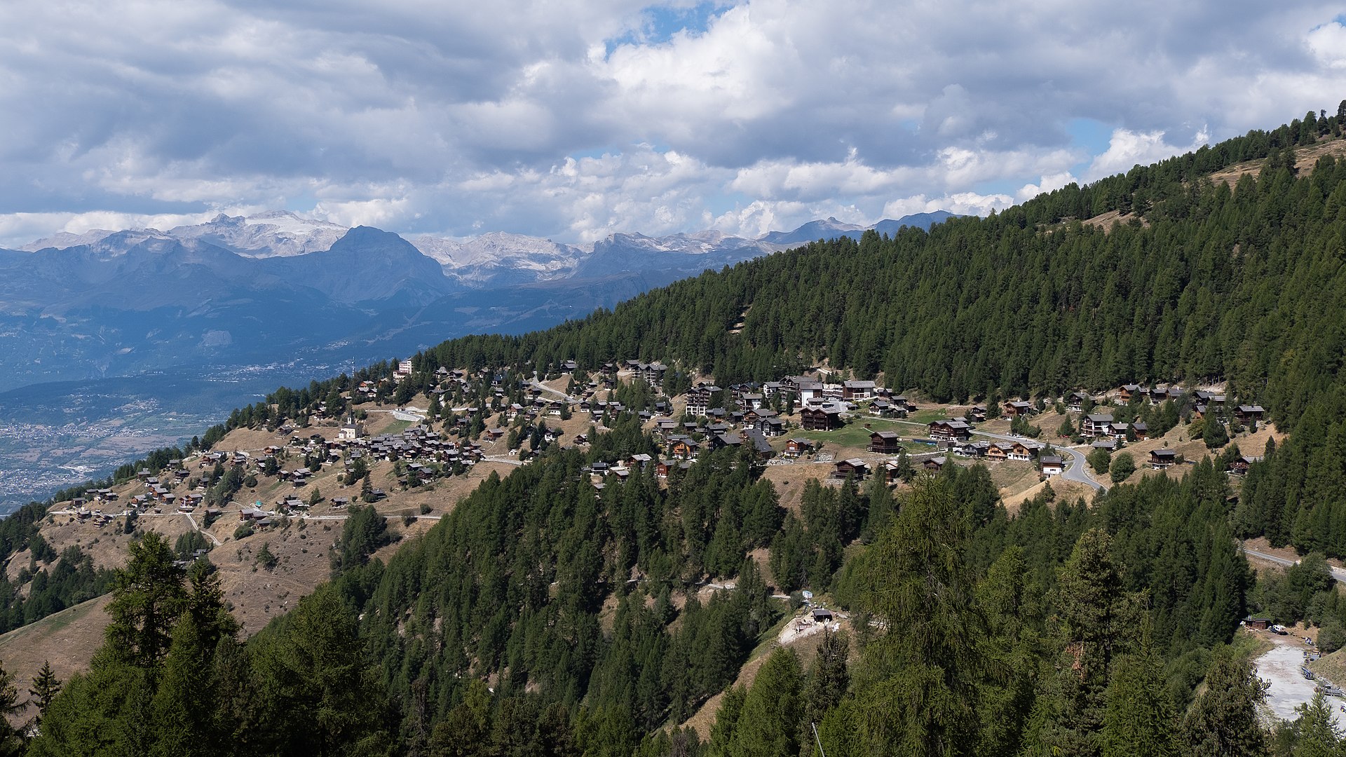
Perched on a sun-drenched balcony, this high-altitude haunt offers a quiet, intellectual retreat with raw views of the Imperial Crown.
Highlights
- Untamed mountain vistas
- Sun-soaked wooden chalets
- High-altitude serenity
- Traditional Valaisan charm
Key Facts
- Altitude: 1939m
- Top lift: 2976m
- Ski pistes: 60km
- Ski lifts: 15
- Population: 394
- 4000m+ peaks nearby: 2
- Lakes nearby: 26
- MTB trails: 116.6km
- Mountain huts: 8
Ski Area
Zahrnuto v těchto sezonních permanentkách
Weather and 10-day forecast for Chandolin
- Today: 6 to 12 °C, clear sky, 12 h of sunshine
- Freezing level today: about 3969 m (3740 to 4240 m)
| Day | Min / max | Sky | Precipitation | Sunshine |
|---|---|---|---|---|
| st 23. 9. | 6 / 12 °C | clear sky | dry | 12 h sun |
| čt 24. 9. | 6 / 12 °C | partly cloudy | dry | 5 h sun |
| pá 25. 9. | 6 / 14 °C | partly cloudy | dry | 8 h sun |
| so 26. 9. | 8 / 16 °C | clear sky | dry | 12 h sun |
| ne 27. 9. | 9 / 17 °C | clear sky | dry | 12 h sun |
| po 28. 9. | 9 / 17 °C | clear sky | dry | 10 h sun |
| út 29. 9. | 9 / 17 °C | clear sky | dry | 12 h sun |
| st 30. 9. | 9 / 16 °C | partly cloudy | dry | 8 h sun |
| čt 1. 10. | 5 / 13 °C | overcast | dry | 1 h sun |
| pá 2. 10. | 4 / 13 °C | drizzle | dry | 1 h sun |
Things to do in Chandolin
Hikes nearby — Chandolin (20)
20+ curated hiking trails around Chandolin, sourced from OpenStreetMap and enriched with distance, elevation gain and difficulty.
-
07-Chemin des Bisses
-
Chandolin-St Luc
The route threads through historic hamlets and wooded slopes above the Val d'Anniviers, passing through Chandolin — one of the highest year-round inhabited villages in Europe at 1956 m, where a former church holds an exhibition dedicated to pioneer photographer and writer Ella Maillart — before descending along a panoramic path to St-Luc.
-
Tignousa-Le Tsapé
-
Chemin des Planètes
-
Grand Bisse de St-Jean
-
Walliser Sonnenweg Etappe 1
-
03-Chemin du Vignoble
-
Mayens de Réchy-Brie
-
22-Alpenpässe-Weg
-
23-Chemin des cols alpins
-
24-Chemin des cols alpins
-
06-Chemin des Bisses
-
05-Tour pédestre du Val d'Hérens
-
Meidpass-Toûno
-
Sentier des Marmottes
-
Chemin des Bisses: Vercorin - Grimentz
-
Alpenpässe-Weg: Gruben Meiden - Hôtel Weisshorn
-
Chemin des Bisses: Nax - Vercorin
-
Chemin du vignoble: Venthône - Leuk SBB / Susten
-
Über die Raspille
Mountain biking near Chandolin
- meretschytrail
- Route du Ban
Getting to Chandolin
Door-to-door travel times as used by the MR. ALPS ranking.
- Nearest airport: Geneva International Airport (GVA), 115 km away, about 2h31 by road
- Lausanne: 1h48 by car, 136 km
- Bern: 2h25 by car, 193 km
- Genève: 2h27 by car, 198 km
- Biel/Bienne: 2h53 by car, 232 km
- Annecy: 2h59 by car, 205 km
- Chambéry: 3h23 by car, 249 km
Where to stay in Chandolin
155 places to stay for a night on 2026-09-25, from 155 EUR per night, median 219 EUR. Prices are direct with hotels and destinations, compared live on the Chandolin page.