Barmsee (Krün)
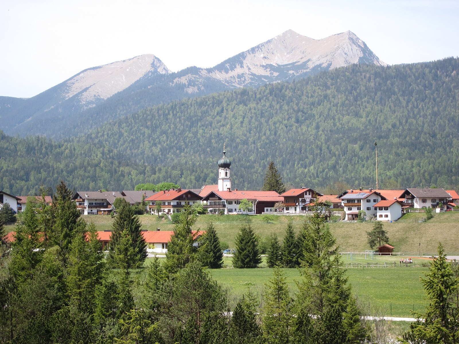
Živá webkamera
Otevřené vleky: 0%
Sněhová zpráva
- Posledních 24h: 0 cm
- Posledních 72h: 0 cm
- Posledních 7 dní: 0 cm
- Posledních 7 dní: Údolí 0cm · Střední část 0cm · Vrchol 0cm
- Sezónní úhrn: 0 cm
Lyžařská střediska otevřená právě teď · Sněhová zpráva
About Barmsee (Krün)
A tranquil Bavarian retreat where crystalline waters mirror the Karwendel peaks, embodying the quiet soul of Alpine forest life.
Highlights
- Pristine lake swimming
- Traditional Karwendel architecture
- Quiet forest trails
- Panoramic peak reflections
Key Facts
- Altitude: 894m
- Top lift: 950m
- Ski lifts: 1
- Population: 50
- Lakes nearby: 18
- MTB trails: 125km
- Mountain huts: 19
Ski Area
Weather and 10-day forecast for Barmsee (Krün)
- Today: 6 to 20 °C, clear sky, 11 h of sunshine
- Freezing level today: about 3958 m (3870 to 4040 m)
| Day | Min / max | Sky | Precipitation | Sunshine |
|---|---|---|---|---|
| so 26. 9. | 6 / 20 °C | clear sky | dry | 11 h sun |
| ne 27. 9. | 7 / 22 °C | clear sky | dry | 12 h sun |
| po 28. 9. | 8 / 22 °C | partly cloudy | dry | 9 h sun |
| út 29. 9. | 12 / 23 °C | clear sky | dry | 11 h sun |
| st 30. 9. | 12 / 22 °C | clear sky | dry | 11 h sun |
| čt 1. 10. | 12 / 22 °C | clear sky | dry | 11 h sun |
| pá 2. 10. | 11 / 13 °C | rain | dry | 0 h sun |
| so 3. 10. | 10 / 18 °C | partly cloudy | dry | 5 h sun |
| ne 4. 10. | 7 / 18 °C | clear sky | dry | 11 h sun |
| po 5. 10. | 8 / 18 °C | clear sky | dry | 9 h sun |
Things to do in Barmsee (Krün)
Hikes nearby — Barmsee (Krün) (16)
16 curated hiking trails around Barmsee (Krün), sourced from OpenStreetMap and enriched with distance, elevation gain and difficulty.
-
Jakobsweg Isar - Loisach - Leutascher Ache - Inn
This Jakobsweg stage threads through a remarkable sequence of landscapes: ancient *Buckelwiesen* (hummocky meadows with a long history), transition bogs, glacier-polished rock, and pine forests, before reaching the historic Porta Claudia fortification at the Leutascher Schanz. The route also passes the dramatic Leutaschklamm gorge and the gravel banks of an Alpine river system.
-
Wanderweg 405 (blau)
-
Wanderweg 406 (grün)
-
Wanderweg 407 (grün)
The trail circles the Barmsee, a 30-metre-deep glacial lake with shallow, reed-fringed shores, passing through open meadows and Bannwald before reaching the north bank where the Karwendel mountains reflect in the often mirror-still water.
-
Wanderweg 310
-
Wanderweg 415 (blau)
-
Wanderweg 451 (blau)
-
Wanderweg 301
-
Wanderweg 355
-
Wanderweg 417 (Magdalena Neuner Panoramaweg, grün)
-
Wanderweg 810 (blau)
-
Via Alpina Purple A59
Weilheimer Hütte - Garmisch-Partenkirchen
-
Via Alpina Purple A58
Herzogstand - Weilheimer Hütte
-
Wanderweg 453
-
Wanderweg 450 (blau)
-
AV Weg 820 (grün)
Mountain biking near Barmsee (Krün)
- Mitterkopfrunde
- Fischbachalm
- Gerold - Wallgau
- Jägersteig
Getting to Barmsee (Krün)
Door-to-door travel times as used by the MR. ALPS ranking.
- Nearest airport: Innsbruck Airport (INN), 27 km away, about 36 min by road
- Innsbruck: 44 min by car, 49 km
- München: 1h16 by car, 101 km
- Bolzano - Bozen: 2h08 by car, 162 km
- Trento: 2h39 by car, 217 km
- Nürnberg: 3h01 by car, 279 km
- Stuttgart: 3h27 by car, 316 km
Where to stay in Barmsee (Krün)
200 places to stay for a night on 2026-10-02, from 127 EUR per night, median 324 EUR. Prices are direct with hotels and destinations, compared live on the Barmsee (Krün) page.