Andiast
Živá webkamera



Otevřené vleky: 0/10
Sněhová zpráva
- Posledních 24h: 0 cm
- Posledních 72h: 0 cm
- Posledních 7 dní: 0 cm
- Posledních 7 dní: Údolí 0cm · Střední část 0cm · Vrchol 0cm
- Sezónní úhrn: 9.9 cm
Lyžařská střediska otevřená právě teď · Sněhová zpráva
About Andiast
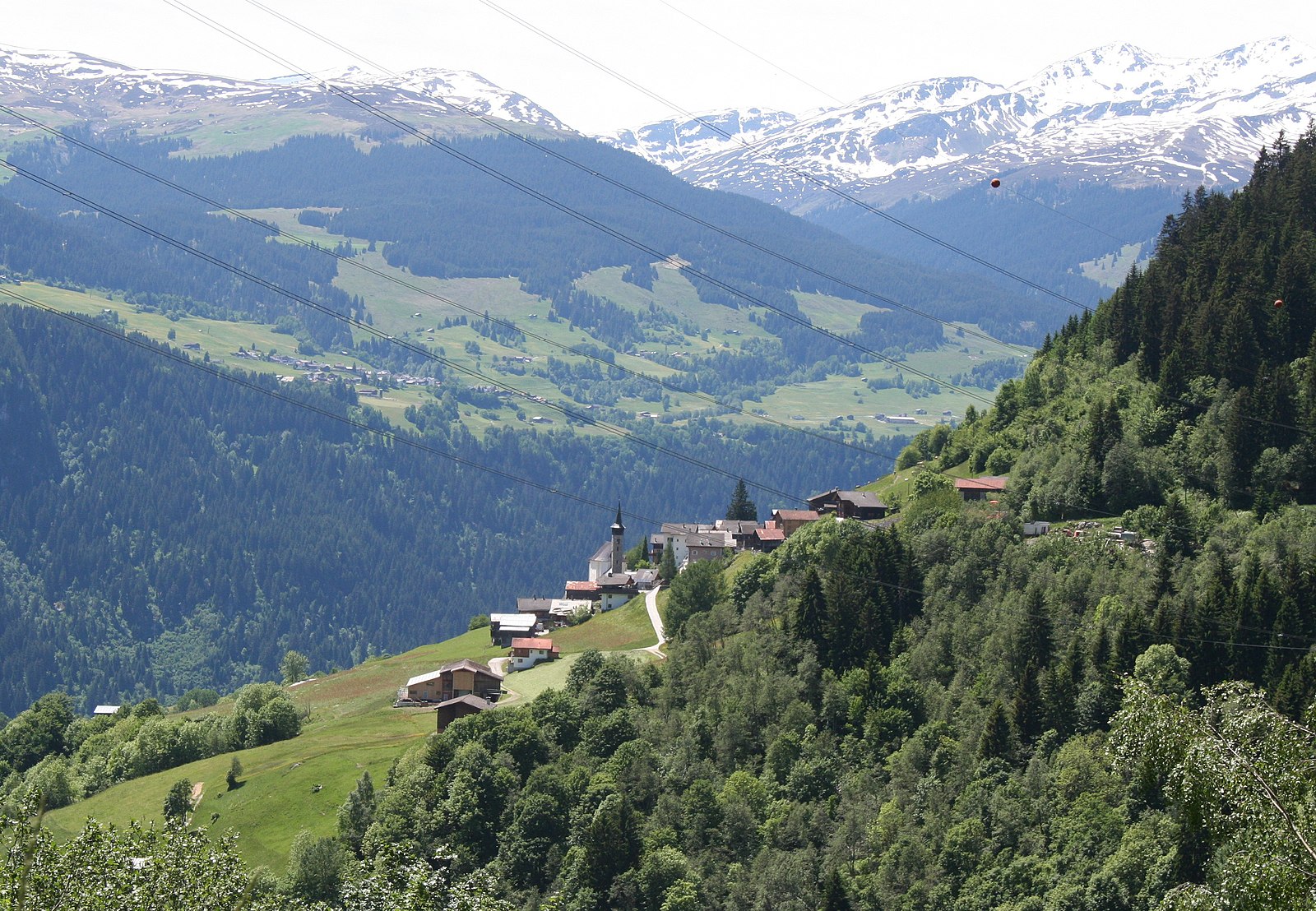
A quiet Romansh enclave on a sun-drenched terrace, where traditional farming life still dictates the pace above the Surselva valley.
Highlights
- Romansh cultural heritage
- Terraced sun-trap slopes
- Quiet mountain solitude
- Authentic farmhouse architecture
Key Facts
- Altitude: 1259m
- Top lift: 2418m
- Ski pistes: 40km
- Ski lifts: 10
- Population: 1,706
- Lakes nearby: 9
- MTB trails: 216.8km
- Mountain huts: 11
Ski Area
Zahrnuto v těchto sezonních permanentkách
Weather and 10-day forecast for Andiast
- Today: 4 to 15 °C, clear sky, 12 h of sunshine
- Freezing level today: about 3861 m (3760 to 4020 m)
| Day | Min / max | Sky | Precipitation | Sunshine |
|---|---|---|---|---|
| st 23. 9. | 4 / 15 °C | clear sky | dry | 12 h sun |
| čt 24. 9. | 6 / 13 °C | partly cloudy | dry | 6 h sun |
| pá 25. 9. | 4 / 17 °C | clear sky | dry | 10 h sun |
| so 26. 9. | 8 / 19 °C | clear sky | dry | 12 h sun |
| ne 27. 9. | 10 / 21 °C | clear sky | dry | 12 h sun |
| po 28. 9. | 9 / 20 °C | clear sky | dry | 12 h sun |
| út 29. 9. | 8 / 20 °C | clear sky | dry | 12 h sun |
| st 30. 9. | 9 / 18 °C | clear sky | dry | 12 h sun |
| čt 1. 10. | 5 / 13 °C | drizzle | dry | 0 h sun |
| pá 2. 10. | 2 / 4 °C | snow showers | dry | 0 h sun |
Things to do in Andiast
Hikes nearby — Andiast (20)
20+ curated hiking trails around Andiast, sourced from OpenStreetMap and enriched with distance, elevation gain and difficulty.
-
Via son Giachen
-
Via son Giachen
-
Walserweg Gottardo - Etappe 14
From the hamlet of Val, the route drops to a bridge over the Rein da Sumvitg before climbing 700 steep metres through forest, over pastures and Maiensässe (seasonal alpine meadows). Two wild ravines must be crossed before the path delivers you into the Walser settlement of St. Martin — the final destination of the roughly 200-kilometre Walserweg Gottardo.
-
Senda Sursilvana
The fifth and final segment of the Senda Sursilvana, this point-to-point route runs from Laax to Chur, passing through forests on a 105 km trail that traverses the sunny terraces of the Surselva high above the Vorderrhein.
-
Hochtal Val Frisal
The trail traverses the high plateau of Val Frisal — one of the Alps' most beautiful high valleys — revealing a sweeping panoramic view of the valley floor with its broad alluvial plain and dense network of waterways. A further highlight is the ancient spruce forest of Scatlé.
-
Kistenpass
-
Alp Sezner Obersaxen
-
Obersaxen Bündner Rigi
-
Triel Meierhof
-
Tavanasa Cumpadials
-
Via Glaralpina
-
Via Glaralpina
-
ViaSuworow
-
Via Glaralpina
-
Via Glaralpina
-
ViaSuworow: Elm Station - Pigniu/Panix
-
Jakobsweg Graubünden: Falera - Andiast Vitg
-
Senda Sursilvana: Breil/Brigels - Laax Murschetg
-
ViaSuworow: Pigniu/Panix - Ilanz/Glion Bahnhof
-
Via Alpina: Elm Station - Linthal
Mountain biking near Andiast
- Via Dalisch
- Via Munsaus
- Via Priel
- Walserweg
- Senda Cuolms da Nadels
Getting to Andiast
Door-to-door travel times as used by the MR. ALPS ranking.
- Nearest airport: Bodensee Airport Friedrichshafen (FDH), 106 km away, about 2h26 by road
- Zürich: 2h08 by car, 161 km
- Luzern: 2h13 by car, 137 km
- Basel: 3h06 by car, 243 km
- Milano: 3h16 by car, 218 km
- Biel/Bienne: 3h26 by car, 244 km
- Bern: 3h27 by car, 245 km
Where to stay in Andiast
49 places to stay for a night on 2026-09-25, from 135 EUR per night, median 292 EUR. Prices are direct with hotels and destinations, compared live on the Andiast page.